Guildford No. 3 / Gildeford / Guldforde
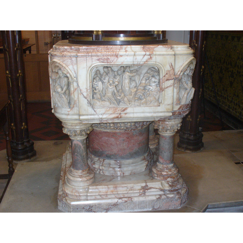
Image copyright © Colin Smith, 2010
Standing permission
Results: 9 records
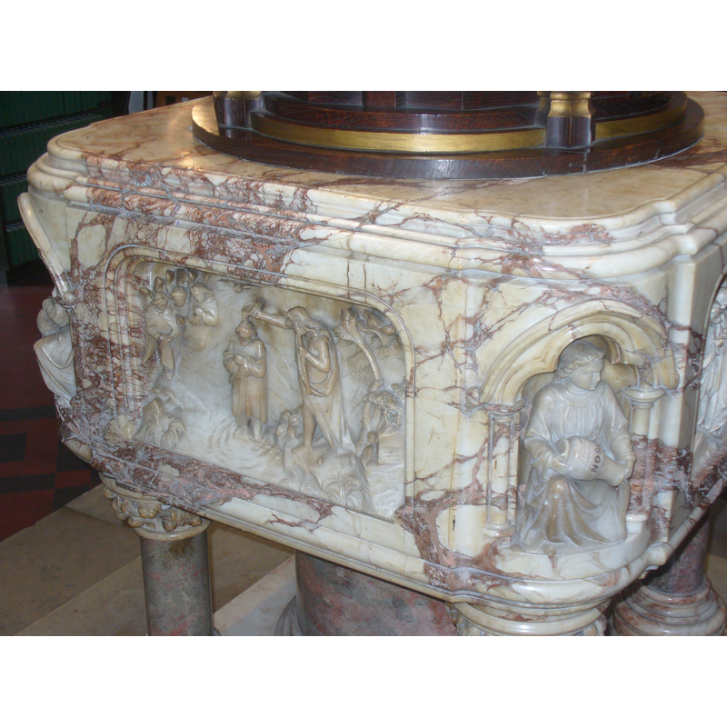
view of font
Scene Description: on the basin side: Moses parts the waters
Copyright Statement: Image copyright © Colin Smith, 2010
Image Source: digital photograph taken 22 December 2010 by Colin Smith
Copyright Instructions: Standing permission
view of basin
Scene Description: on the basin side: the Baptism of Christ; at the angle, one of the symbols of the four rivers of Paradise
Copyright Statement: Image copyright © Colin Smith, 2010
Image Source: digital photograph taken 22 December 2010 by Colin Smith
Copyright Instructions: Standing permission
view of basin
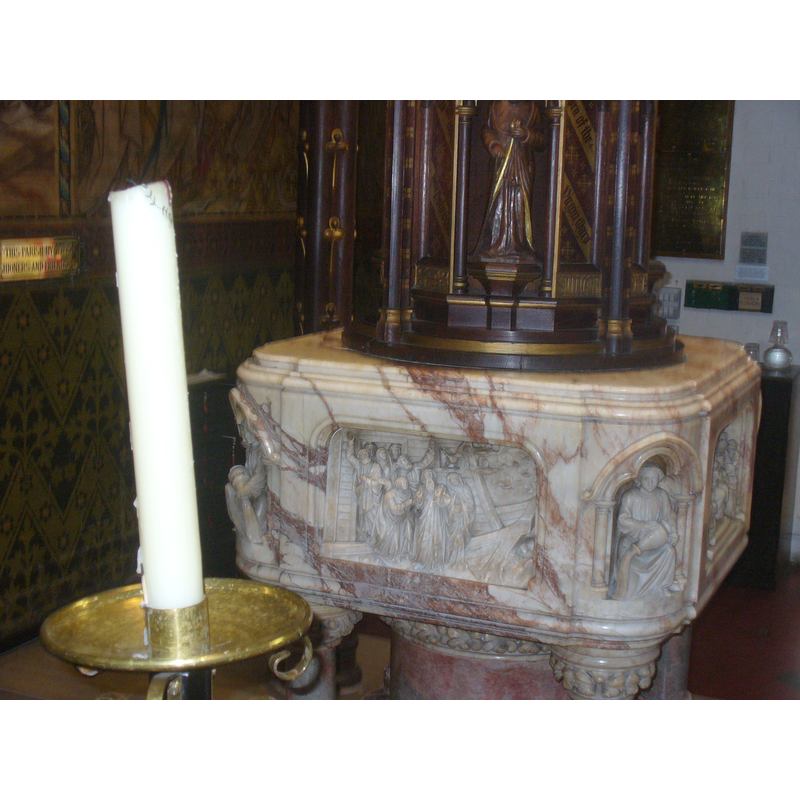
Scene Description: on the basin side: Noah and his family
Copyright Statement: Image copyright © Colin Smith, 2010
Image Source: digital photograph taken 22 December 2010 by Colin Smith
Copyright Instructions: Standing permission
view of basin
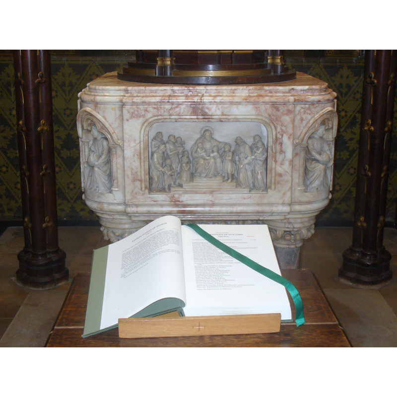
Scene Description: on the basin side: Christ blesses the children
Copyright Statement: Image copyright © Colin Smith, 2010
Image Source: digital photograph taken 22 December 2010 by Colin Smith
Copyright Instructions: Standing permission
view of church exterior - southeast view
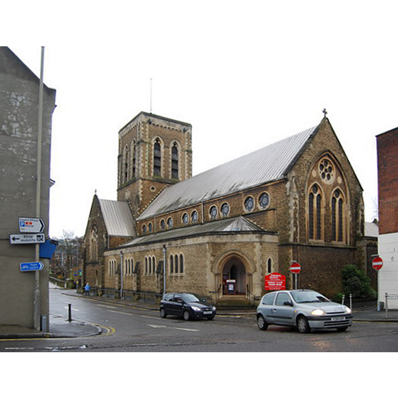
Scene Description: Source caption: "St Nicolas's Church, Guildford. St Nicolas' is an Anglican parish church in the centre of Guildford. It is one of the three ancient parishes of Guildford borough (the other two being Holy Trinity and St Mary’s). The current church building, built in 1876, is at least the third church on the site. The previous building was built in 1836. The Loseley Chapel, which contains memorials to the More-Molyneux family whose residence is the nearby Loseley Park, is all that remains of the medieval building."
Copyright Statement: Image copyright © N Chadwick, 2009
Image Source: digital photograph taken 25 January 2009 by N Chadwick [www.geograph.org.uk/photo/1135033] [accessed 22 August 2015]
Copyright Instructions: CC-BY-SA-2.0
view of church exterior - northeast view
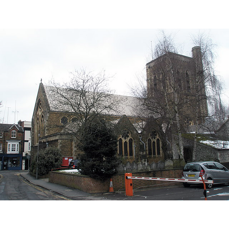
Copyright Statement: Image copyright © Basher Eyre, 2009
Image Source: digital photograph taken 7 February 2009 by Basher Eyre [www.geograph.org.uk/photo/1159866] [accessed 22 August 2015]
Copyright Instructions: CC-BY-SA-2.0
view of font and cover - detail
Scene Description: the modern font and cover
Copyright Statement: Image copyright © Colin Smith, 2023
Image Source: digital photograph 12 September 2022 by Colin Smith
Copyright Instructions: Image and permission received from the author (e-mail of 5 February 2023)
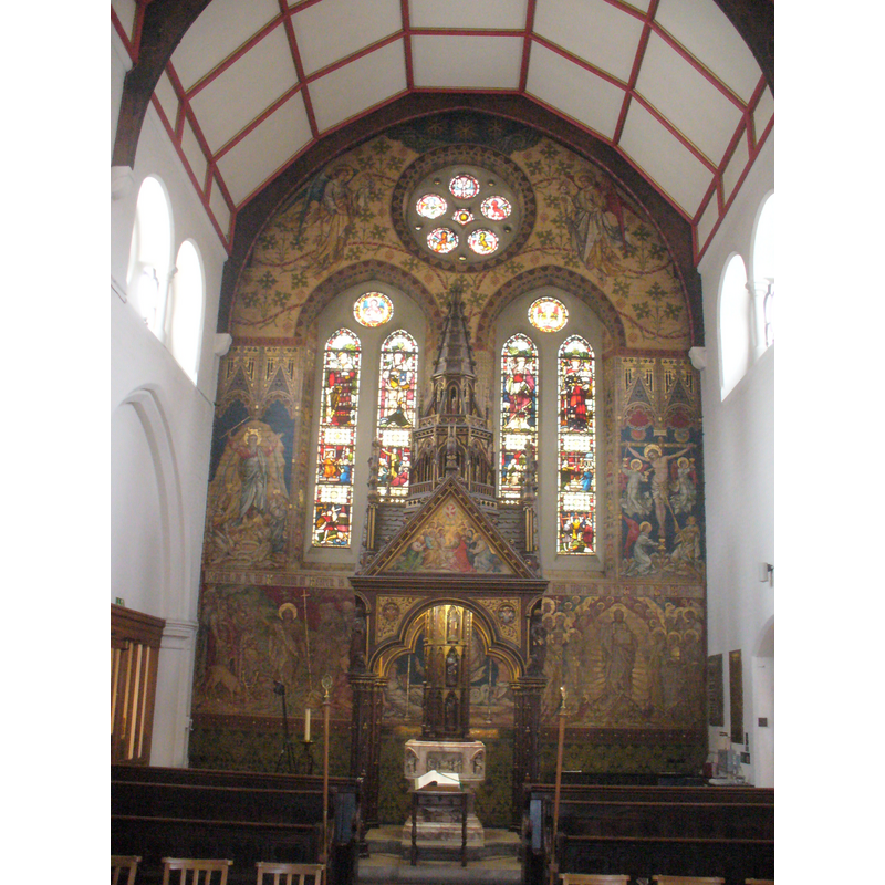
view of church interior - looking east
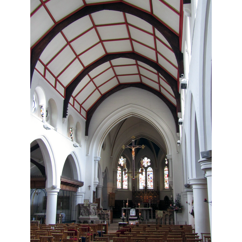
Copyright Statement: Image copyright © Colin Smith, 2023
Image Source: digital photograph 12 September 2022 by Colin Smith
Copyright Instructions: Image and permission received from the author (e-mail of 5 February 2023)
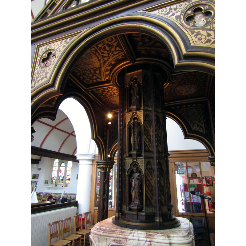
view of font and canopy, baldachin - canopy
Scene Description: the 19th-century font and canopy
Copyright Statement: Image copyright © Colin Smith, 2010
Image Source: digital photograph taken 22 December 2010 by Colin Smith
Copyright Instructions: Standing permission
INFORMATION
Font ID: 17192GUI
Object Type: Baptismal Font1?
Font Century and Period/Style: 14th century, Medieval
Church / Chapel Name: Parish Church of St. Nicholas
Church Patron Saint(s): St. Nicholas of Myra
Church Notes: original church here 13thC or earlier; the present building, the third on this site, is Victorian.
Church Address: Bury Street, Guildford, Surrey, GU2 4AW
Site Location: Surrey, South East, England, United Kingdom
Directions to Site: Located on High Street, at the lower end, at Bury St.
Ecclesiastic Region: Diocese of Guildford
Historical Region: Hundred of Woking [in Domesday] -- [NB: the rural part of the parish was in the Hundred of Godalming]
Additional Comments: disappeared font? (the one from the 13thC (?) original church here)
Font Notes:
Click to view
There are seven entries for Guildford [variant spelling] in the Domesday survey [http://opendomesday.org/place/SU9949/guildford/] [accessed 22 August 2015], none of which mentions cleric or church in it. The Victoria County History (Surrey, vol. 3, 1911) notes: "The original building was on a lower level, and was often damaged by floods. It had been much repaired, but was entirely rebuilt in 1836–7 in churchwardens' Gothic. [...] In the churchyard is a 13th-century capital of a pillar, much perished, from the first church. [...] The registers begin in 1562; the first book contains baptisms, marriages, and burials from that year to 1681"; no font mentioned in the VCH entry for this church. English Heritage [Listing NGR: SU9942049348] (1953) notes: "Marble and alabaster font by Thomas Earp with pillared base and carved panel reliefs on sides depicting sermons. Magnificent font in west end of nave under tall canopy carved by Earp and designed by Woodyer. Large bowl on central pillar flanked by smaller pillars at angles on moulded plinths and with foliated caps. Each side of the font is carved in deep relief with baptism and Old Testament scenes; at the corners are figures emptying jars. Five stage towering canopy above, the main structure square with cusped arches on pillars of 4 coupled shafts, at the corners are statues of four evangelists. Crocketed gables above surmounted with carved pelicans and painted on sides. Quatrefoil recesses in spandrels with angles, and from the centre of this stage rises an octagonal base and lantern above with pinnacled flying buttresses. Smaller lantern above and crocketed spirit crowning. The central wooden drum cover is drawn up by means of a pulley and chain into the canopy and is carved with the twelve apostles." The present [Dec. 2010] font is from the Victorian re-building of this church, and is located ar the west end of the church, beneath a tall and very ornate canopy; within the canopy is a carved wooden font cover that can be raised to provide access to the inner well of the font. [NB: we have no information on the fonts of the earlier buildings -- we have no information on whether the Chapel of St. Catherine's, in Artington, in this parish, ever had a font; the ruins of the building show a fabric of the 14th century]
Credit and Acknowledgements: We are grateful to Colin Smith for his photograph of the modern font
COORDINATES
UTM: 30U 669088 5678611
Latitude & Longitude (Decimal): 51.233791, -0.577945
Latitude & Longitude (DMS): 51° 14′ 1.65″ N, 0° 34′ 40.6″ W
LID INFORMATION
Date: 19th-century?
Material: wood
Apparatus: yes
Notes: [cf. FontNotes]
REFERENCES
- Victoria County History [online], University of London, 1993-. URL: https://www.british-history.ac.uk.