Fleet Marston / Marston Fleet / Merstone / Flettemerstone
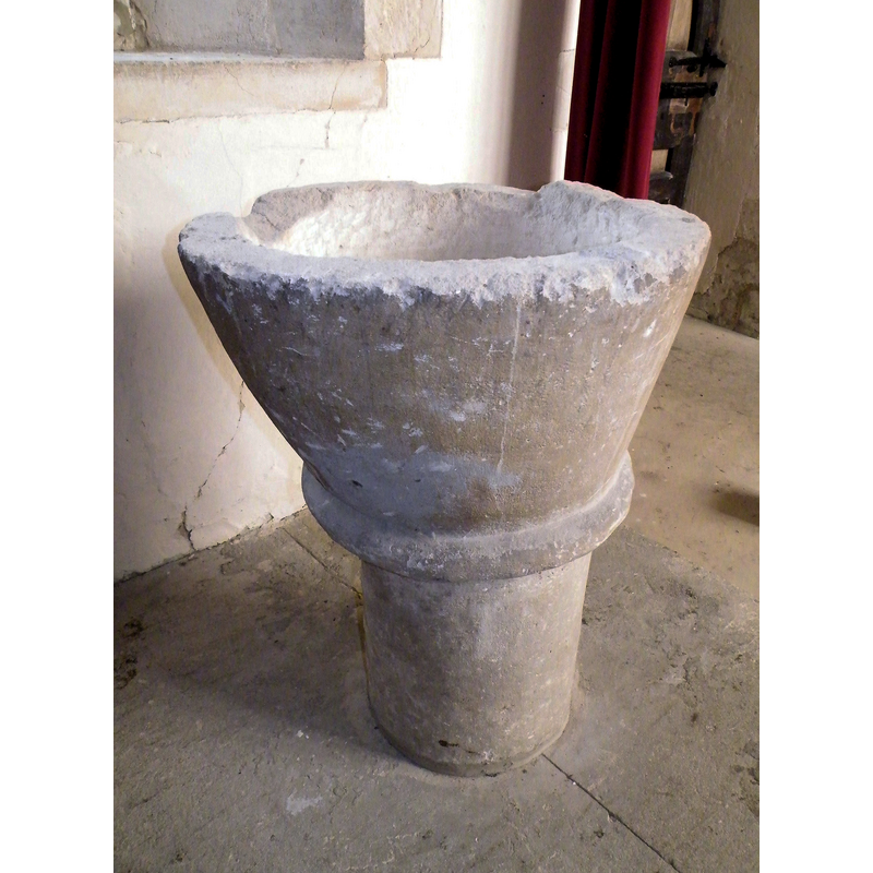
Image copyright © R-P-M, 2009
CC-BY-SA-3.0
Results: 4 records
view of font
Copyright Statement: Image copyright © R-P-M, 2009
Image Source: digital photograph taken 18 March 2009 by R-P-M [http://www.flickr.com/photos/rpmarks/3366151404/in/photostream/]
Copyright Instructions: CC-BY-SA-3.0
design element - motifs - roll moulding
Copyright Statement: Image copyright © R-P-M, 2009
Image Source: digital photograph taken 18 March 2009 by R-P-M [http://www.flickr.com/photos/rpmarks/3366151404/in/photostream/]
Copyright Instructions: CC-BY-SA-3.0
view of church exterior - southwest view
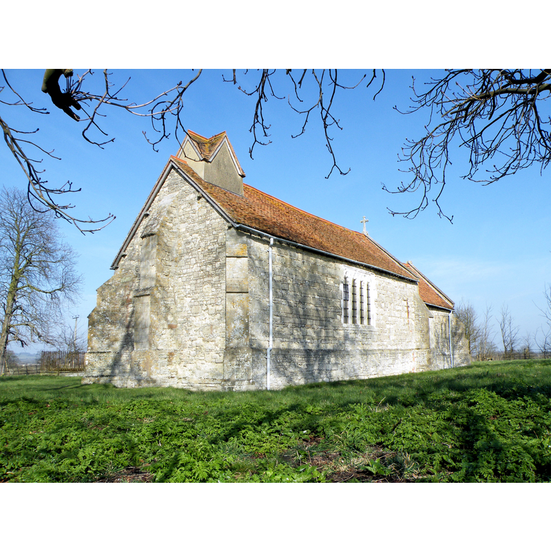
Copyright Statement: Image copyright © R-P-M, 2009
Image Source: digital photograph taken 18 March 2009 by R-P-M [http://www.flickr.com/photos/rpmarks/3366151404/in/photostream/]
Copyright Instructions: CC-BY-SA-3.0
view of church interior - nave - looking east
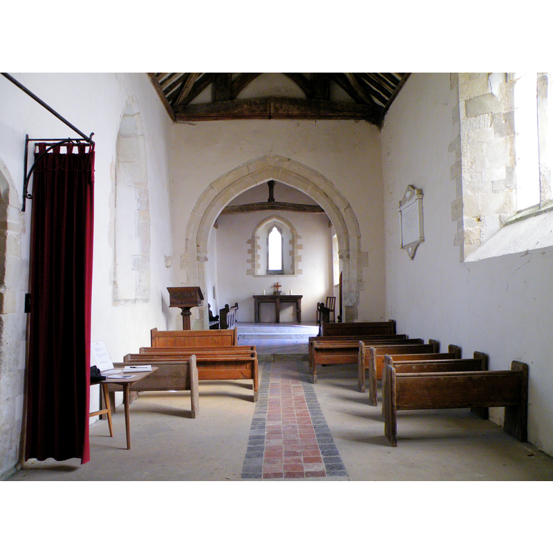
Copyright Statement: Image copyright © R-P-M, 2009
Image Source: digital photograph taken 18 March 2009 by R-P-M [http://www.flickr.com/photos/rpmarks/3366151404/in/photostream/]
Copyright Instructions: CC-BY-SA-3.0
INFORMATION
Font ID: 17172MAR
Object Type: Baptismal Font1
Font Century and Period/Style: 13th century [re-cut], Early English [altered]
Church / Chapel Name: Parish Church of St. Mary the Virgin [redundant]
Font Location in Church: Inside the church
Church Patron Saint(s): St. Mary the Virgin
Church Notes: church out of regular use since 1973; now redundant and in the care of the Churches Conservation Trust.
Church Address: Fleet Marston, Buckinghamshire HP18 0PU
Site Location: Buckinghamshire, South East, England, United Kingdom
Directions to Site: Located 4 km WNW of Aylesbury
Ecclesiastic Region: Diocese of Oxford
Historical Region: Hundred of Waddesdon [in Domesday] -- Hundred of Ashendon
Additional Comments: altered font / re-cut font
Font Notes:
Click to view
There is an entry for [Fleet] Marston [variant spelling] in the Domesday survey [http://opendomesday.org/place/SP7715/fleet-marston/] [accessed 4 December 2015], but it mentions neither cleric nor church in it. Lipscomb (1831- ) writes: "The font is ancient, columnar, and plain." In Sheahan (1862): "The font is ancient, plain, and circular". Described in the RCAHM (Buckinghamshire, 1912): "Font: roughly made, uneven bowl with tapering sides and lower edge roll, plain cylindrical stem, probably 13th-century, re-cut." The Victoria County History (Buckingham, vol. 4, 1927) notes: "The church seems to have been considerably altered during the 14th century, and the earliest existing details are of that period, but traces of two small windows in the chancel, now blocked, indicate that the fabric was built at an earlier date. The church was restored in 1868–9 [...] The font, which probably dates from the 13th century, though since retooled, has a rough tapering bowl with an edge-roll at the bottom, and a plain round stem." The bucket-shaped basin is very badly damaged at the upper rim, with much of it now missing.
COORDINATES
UTM: 30U 646769 5745044
Latitude & Longitude (Decimal): 51.8369, -0.8697
Latitude & Longitude (DMS): 51° 50′ 12.84″ N, 0° 52′ 10.92″ W
MEDIUM AND MEASUREMENTS
Material: stone
Font Shape: round, mounted
Basin Interior Shape: round
Basin Exterior Shape: round
REFERENCES
- Victoria County History [online], University of London, 1993-. URL: https://www.british-history.ac.uk.
- Great Britain. Royal Commission on Historical Monuments (England), An inventory of the historical monuments in Buckinghamshire, London: H.M. Stationary Office, 1912-, vol. 1: 158
- Lipscomb, George, The History and Antiquities of the County of Buckingham, London: J.B. Nichols, 1831-1843, vol. 1: 332
- Sheahan, James Joseph, History and topography of Buckinghamshire, comprising a general survey of the county, preceded by an epitome of the early history of Great Britain, London; Pontefract: Longman, Green, Longman, and Roberts; William Edward Bonas [...], 1862, p. 402