Newton North
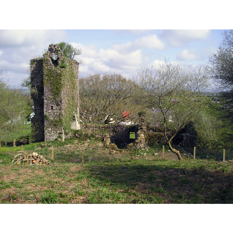
Image copyright © Chris Andrews, 2010
CC-BY-SA-2.0
Results: 3 records
view of church exterior in context - south view
Scene Description: the ruins of Newton North church
Copyright Statement: Image copyright © Chris Andrews, 2010
Image Source: digital photograph taken 3 May 2010 by Chris Andrews [www.geograph.org.uk/photo/1885862] [accessed 20 August 2019]
Copyright Instructions: CC-BY-SA-2.0
view of church exterior in context
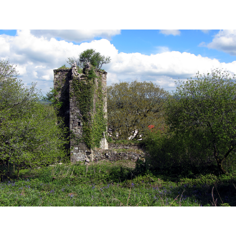
Scene Description: Source caption: "Remains of Newton North church"
Copyright Statement: Image copyright © Gareth James, 2013
Image Source: digital photograph taken 19 March 2013 by Gareth James [www.geograph.org.uk/photo/3468579] [accessed 20 August 2019]
Copyright Instructions: CC-BY-SA-2.0
view of church interior - looking east
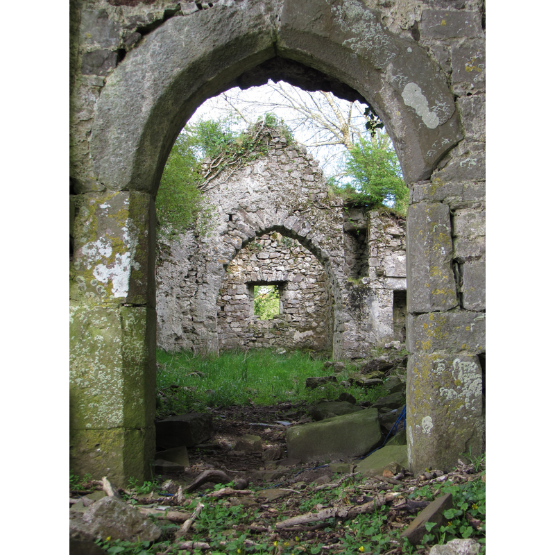
Scene Description: Source caption: "View into the derelict Newton North church"
Copyright Statement: Image copyright © Gareth James, 2013
Image Source: digital photograph taken 19 March 2013 by Gareth James [www.geograph.org.uk/photo/3468571] [accessed 20 August 2019]
Copyright Instructions: CC-BY-SA-2.0
INFORMATION
Font ID: 17165NEW
Object Type: Baptismal Font1?
Font Century and Period/Style: 12th century, Late Norman
Church / Chapel Name: Parish Church [in ruins -- cf. FontNotes]
Font Location in Church: [cf. FontNotes]
Church Wikidata: https://www.wikidata.org/wiki/Q29485367
Site Location: Pembrokeshire, Wales, United Kingdom
Directions to Site: Newton North is located 1 km W of Newhouse Farm, in the community of Martletwy, 5 km WSW of Narbeth
Additional Comments: disused font? (the one from the 12thC church here)
Font Notes:
Click to view
No entry found for Newton North in the Domesday survey. A Norman font in this church is reported in the RCAHMW (Pembroke, 1925). An entry by J. Wiles dated 20 March 2002 in the COFLEIN database of the RCAHMW [http://www.coflein.gov.uk/en/site/300429/details/NEWTON+NORTH+CHURCH/] [accessed 8 December 2010] reads: "The former parish church of Newton North, comprising a 12th-13th century nave and a 13th-14th century nave, is now a roofless ruin." The entry for this church in British Listed Buildings [https://britishlistedbuildings.co.uk/300006088-newton-north-church-martletwy] [accessed 20 August 2019] notes: "The Chancel arch may be C12, and the W doorway is probably C14. The church was redundant in the C19; it is marked on the 1887 map as 'remains of ...'. Now very much overgrown and derelict, although the tower and stairs survive to parapet level. [...] Interior devoid of all fittings. The building having long been roofless, the floor is buried and inaccessible. [...] The S transept was perhaps only a tomb-recess. There is a recess for a stoup in the E side. [...] There are no monuments or font and no glazing. [NB: we have no information on the whereabouts of this font; it might still be within the ruins].
COORDINATES
Latitude & Longitude (Decimal): 51.785, -4.8056
Latitude & Longitude (DMS): 51° 47' 6" N, 4° 48' 20" W
MEDIUM AND MEASUREMENTS
Material: stone
REFERENCES
- Great Britain. Royal Commission on Ancient Monuments and Constructions in Wales and Monmouthshire, An inventory of the ancient and historical monuments of the County of Pembroke, London: H.M. Stationary Office, 1925, no. 830