Chesham / Cæstæleshamm / Caestreham / Cestreham
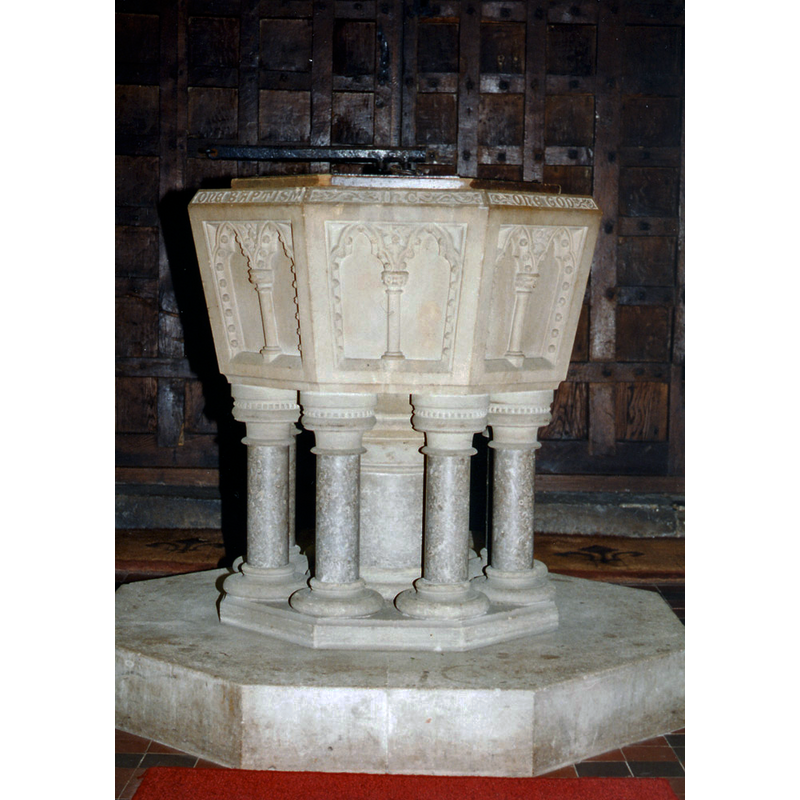
Image copyright © John Salmon, 2012
CC-BY-SA-2.0
Results: 3 records
view of font and cover
Scene Description: the modern font [cf. FontNotes]
Copyright Statement: Image copyright © John Salmon, 2012
Image Source: photograph taken June 1994 by John Salmon [www.geograph.org.uk/photo/3267125] [accessed 27 October 2015]
Copyright Instructions: CC-BY-SA-2.0
view of church exterior - southeast view
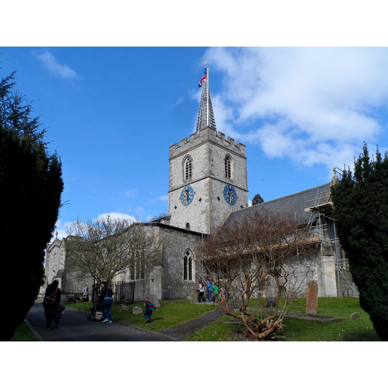
Scene Description: Source caption: "St Mary's, Chesham. The earliest part of the church are C12. The nave and aisles are C13 and the tower C14. The church was restored Giles Gilbert Scott 1868-9."
Copyright Statement: Image copyright © Bikeboy, 2015
Image Source: digital photograph taken 22 March 2015 by Bikeboy [www.geograph.org.uk/photo/4398395] [accessed 27 October 2015]
Copyright Instructions: CC-BY-SA-2.0
view of church interior - nave - looking east
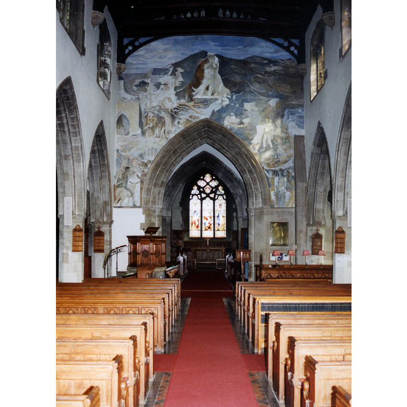
Copyright Statement: Image copyright © John Salmon, 2012
Image Source: photograph taken June 1994 by John Salmon [www.geograph.org.uk/photo/3267122] [accessed 27 October 2015]
Copyright Instructions: CC-BY-SA-2.0
INFORMATION
Font ID: 17153CHE
Object Type: Stoup
Font Date: ca. 1330?
Font Century and Period/Style: 14th century, Decorated
Church / Chapel Name: Parish Church of St. Mary
Font Location in Church: Inside the church, in the SW angle of the S transept
Church Patron Saint(s): St. Mary the Virgin
Church Address: 4 Bury Lane, Chesham, Buckinghamshire HP5 1JD
Site Location: Buckinghamshire, South East, England, United Kingdom
Directions to Site: Located 5 km N of Amersham, 18 km SE of Aylesbury
Ecclesiastic Region: Diocese of Oxford [formerly in the diocese of Lincoln]
Historical Region: Hundred of Burnham
Additional Comments: disappeared font? (the one from the 12thC church here)
Font Notes:
Click to view
There are five entries for Chesham [variant spelling] in the Domesday survey [http://opendomesday.org/place/SP9501/chesham/] [accessed 27 October 2015], none of which mentions cleric or church in it. Sheahan (1862) dates the "venerable cruciform structure" of this church to the 14th century, in the Perpendicular style, but does not mention the font in it. The Victoria County History (Buckingham, vol. 3, 1925) notes: "A large cruciform church existed here in the 12th century [...] The whole fabric was restored in 1868–9 by G. G. Scott [...] The font is modern". The RCAHM (Buckinghamshire, 1912) notes a holy-water stoup "on S.W. angle of S. transept" [NB: the transept itself is dated ca. 1330; the RCAHM (ibid.) notes some remains of the mid-12th century church here, as well as the re-buildings in the 13th and 14th centuries, but we have no information on the original baptismal font of the medieval church; the present font dates from the late-1860s renovation of the church]
COORDINATES
UTM: 30U 664660 5730805
Latitude & Longitude (Decimal): 51.704, -0.617
Latitude & Longitude (DMS): 51° 42′ 14.4″ N, 0° 37′ 1.2″ W
MEDIUM AND MEASUREMENTS
Material: stone
REFERENCES
- Victoria County History [online], University of London, 1993-. URL: https://www.british-history.ac.uk.
- Great Britain. Royal Commission on Historical Monuments (England), An inventory of the historical monuments in Buckinghamshire, London: H.M. Stationary Office, 1912-, p. 93, 94
- Sheahan, James Joseph, History and topography of Buckinghamshire, comprising a general survey of the county, preceded by an epitome of the early history of Great Britain, London; Pontefract: Longman, Green, Longman, and Roberts; William Edward Bonas [...], 1862, p. 841