Swanbourne / Soeneberno / Soenenbern / Suanaburna / Sueneberie / Sueneberne / Sueneborne / Sveneborne / Swanbourn
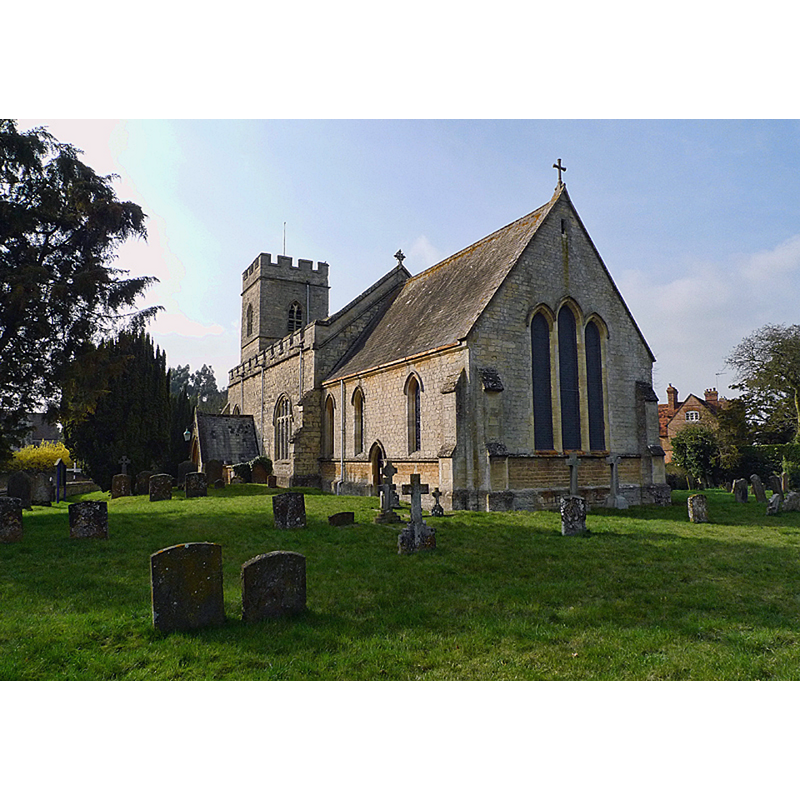
Image copyright © Cameraman, 2011
CC-BY-SA-2.0
Results: 3 records
view of church exterior - southeast end
Copyright Statement: Image copyright © Cameraman, 2011
Image Source: digital photograpjh taken 17 March 2011 by Cameraman [www.geograph.org.uk/photo/2311467] [accessed 23 November 2015]
Copyright Instructions: CC-BY-SA-2.0
view of font and cover

Copyright Statement: Image copyright © greentool2002, 2015
Image Source: digital photograph taken 3 April 2015 by greentool2002 [www.flickr.com/photos/greentool2002/16836428790] [accessed 23 November 2015]
Copyright Instructions: PERMISSION NOT AVAILABLE -- IMAGE NOT FOR PUBLIC USE
view of font and cover in context
Copyright Statement: Image copyright © Ewart White, 2007
Image Source: digital photograph taken 27 June 2007 by Ewart White [www.flickr.com/photos/john_field/3351813434/in/pool-1222982@N22/]
Copyright Instructions: PERMISSION NOT AVAILABLE -- IMAGE NOT FOR PUBLIC USE
INFORMATION
Font ID: 17121SWA
Object Type: Baptismal Font1
Font Century and Period/Style: 13th century [re-tooled], Early English [altered]
Church / Chapel Name: Parish Church of St. Swithun [aka St. Swithin's]
Font Location in Church: Inside the church, at the W end
Church Patron Saint(s): St. Swithun [aka Swithin]
Church Address: 10 Mursley Road, Swanbourne, Buckinghamshire MK17 0SH
Site Location: Buckinghamshire, South East, England, United Kingdom
Directions to Site: Located on the B4032, 3 km E of Winslow, 5 km W of Stewkley
Ecclesiastic Region: Diocese of Oxford
Historical Region: Hundred of Mursley [in Domesday] -- Hundred of Cottesloe
Additional Comments: altered font / re-tooled and repaired font (the present font) -- disappeared font? (the one from the church documented here in the 1140s [cf. FontNotes])
Font Notes:
Click to view
There are five entries for Swanbourne [variant spelling] in the Domesday survey [http://opendomesday.org/place/SP8027/swanbourne/] [accessed 23 November 2015], none of which mentions cleric or church in it. Sheahan (1862) writes: "The font is large, plain, and circular". Noted in the Victoria County History (Buckingham, vol. 3, 1925): "The church of Swanbourne formed part of the fee granted to Woburn Abbey by Hugh Malet [according to Regesta iii, 961, this grant took place in 1140-1143] [...] The [present] building dates from the first half of the 13th century [...] The font has a circular tapering bowl which has been re-tooled, but is probably of the 13th century." The basin is bucket-shaped, plain, with a moulded underbowl; on a plain circular pedestal and round lower base. The wooden cover is flat and round, with metal decoration and small cross handle/finial; appears modern. [NB: we have no informarion on the font of the mid-12th century church here].
COORDINATES
UTM: 30U 648729 5756324
Latitude & Longitude (Decimal): 51.937732, -0.836406
Latitude & Longitude (DMS): 51° 56′ 15.83″ N, 0° 50′ 11.06″ W
MEDIUM AND MEASUREMENTS
Material: stone
Font Shape: bucket-shaped, mounted
Basin Interior Shape: round
Basin Exterior Shape: round
LID INFORMATION
Date: modern
Material: wood, oak?
Apparatus: no
Notes: [cf. FontNotes]
REFERENCES
- Victoria County History [online], University of London, 1993-. URL: https://www.british-history.ac.uk.
- Sheahan, James Joseph, History and topography of Buckinghamshire, comprising a general survey of the county, preceded by an epitome of the early history of Great Britain, London; Pontefract: Longman, Green, Longman, and Roberts; William Edward Bonas [...], 1862, p. 758