Danby Wiske / Danby-upon-Wiske / Danebi
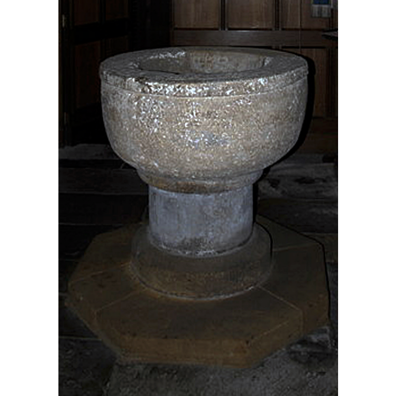
Image copyright © David Rogers, 2012
CC-BY-SA-2.0
Results: 6 records
view of font - east side
Copyright Statement: Image copyright © David Rogers, 2012
Image Source: edited detail of a digital photograph taken 30 May 2012 by David Rogers [www.geograph.org.uk/photo/2968875] [accessed 18 November 2019]
Copyright Instructions: CC-BY-SA-2.0
view of font in context - east side
![Source caption: "Norman Font, Danby Wiske Parish Church. "This simple but massive stone font is one of a very few in this area to survive from early times. Such symbols of the Roman Church were a popular target for destruction by extremists during both the Reformation and Cromwell's Protectorate. This font must have been carefully hidden away until the threat from iconoclasts had abated"." [NB: the quoted text in the caption may be from a local source].](/static-50478a99ec6f36a15d6234548c59f63da52304e5/compressed/1191118003_compressed.png)
Scene Description: Source caption: "Norman Font, Danby Wiske Parish Church. "This simple but massive stone font is one of a very few in this area to survive from early times. Such symbols of the Roman Church were a popular target for destruction by extremists during both the Reformation and Cromwell's Protectorate. This font must have been carefully hidden away until the threat from iconoclasts had abated"." [NB: the quoted text in the caption may be from a local source].
Copyright Statement: Image copyright © David Rogers, 2012
Image Source: digital photograph taken 30 May 2012 by David Rogers [www.geograph.org.uk/photo/2968875] [accessed 18 November 2019]
Copyright Instructions: CC-BY-SA-2.0
view of font
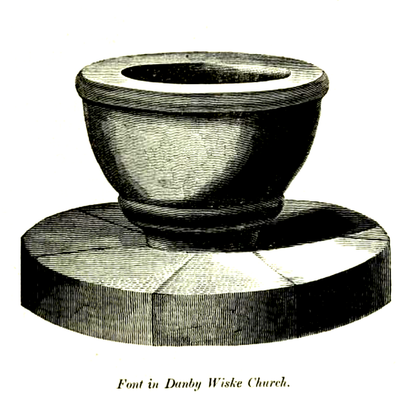
Copyright Statement: Image copyright © [in the public domain]
Image Source: digital image of an illustration in Whitaker (1823)
Copyright Instructions: PD
view of church exterior - south view
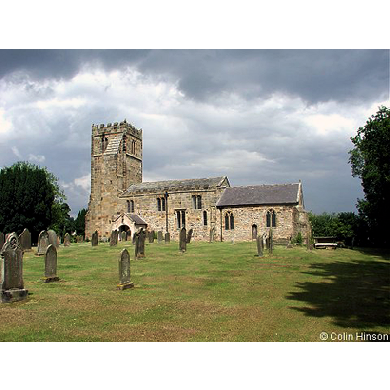
Copyright Statement: Image copyright © Colin Hinson, 2010
Image Source: digital photograph taken 29 June 2003 by Colin Hinson [www.yorkshireCDbooks.com]
Copyright Instructions: Standing permission
view of church interior - nave - looking east
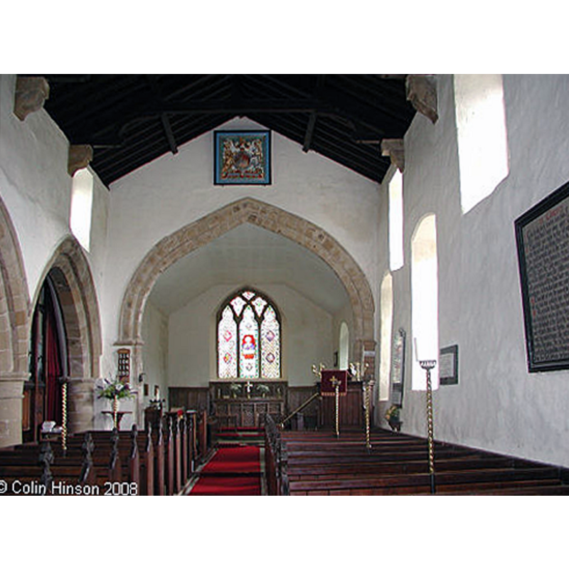
Copyright Statement: Image copyright © Colin Hinson, 2010
Image Source: digital photograph taken 29 June 2003 by Colin Hinson [www.yorkshireCDbooks.com]
Copyright Instructions: Standing permission
view of font in context - southeast side

Copyright Statement: Image copyright © jmc4, 2010
Image Source: digital photograph taken 7 October 2010 ny jmc4 [http://www.flickr.com/photos/52219527@N00/5065379216/in/pool-1222982@N22/]
Copyright Instructions: PERMISSION NOT AVAILABLE -- IMAGE NOT FOR PUBLIC USE
INFORMATION
Font ID: 17119DAN
Object Type: Baptismal Font1
Font Century and Period/Style: 12th century [basin only], Medieval [composite]
Church / Chapel Name: Danby Wiske Parish Church
Font Location in Church: Inside the church, at the W end of the nave
Church Address: Mountstrall Ln, Danby Wiske, Northallerton DL7 0LY, UK -- Tel.: +44 113 200 0540
Site Location: North Yorkshire, Yorkshire and the Humber, England, United Kingdom
Directions to Site: Located between the village of Streetlam (W) and the A167 (E), 6 km NNW of Northallerton
Ecclesiastic Region: Diocese of Leeds
Historical Region: Hundred of Land of Count Alan
Font Notes:
Click to view
There is an entry for Danby [Wiske] [variant spelling] in the Domesday survey [https://opendomesday.org/place/SE3398/danby-wiske/] [accessed 18 November 2019] but it mentions neither cleric nor church in it. The font is noted and illustrated in Whitaker (1823). The entry for this parish in the Victoria County History (York North Riding, vol. 1, 1914) notes: "The parish church of DANBY WISKE (invocation unknown) [...] The south door and the lower part of the south wall date from about the year 1100. The alterations made early in the 14th century, when the chancel was rebuilt and a north aisle added to the nave, gave the church very much the same plan that it has to day. The tower, however, was not added till 200 years later"; no font mentioned in it. The entry for this church in Historic England [Listing NGR: SE3380898336] notes: "Church. C12 south wall and doorway, C14 chancel and north aisle, later C15 tower and C18 porch"; no font mentioned in it. Large tub-shaped basin decorated with a flat moulding at the upper rim, and a thick roll moulding on the underbowl; raised of a plain cylindrical pedestal base, a circular lower base and an octagonal plinth; the whole of the base is probably of a later date, the stem appears modern. Flat and round wooden cover; plain and modern.
Credit and Acknowledgements: We are grateful to Colin Hinson, of www.yorkshireCDbooks.com, for the photographs of this church
COORDINATES
UTM: 30U 598721 6026911
Latitude & Longitude (Decimal): 54.3804, -1.48
Latitude & Longitude (DMS): 54° 22′ 49.44″ N, 1° 28′ 48″ W
MEDIUM AND MEASUREMENTS
Material: stone
Font Shape: tub-shaped, mounted
Basin Interior Shape: round
Basin Exterior Shape: round
LID INFORMATION
Date: modern
Material: wood
Apparatus: no
Notes: [cf. FontNotes]
REFERENCES
- Victoria County History [online], University of London, 1993-. URL: https://www.british-history.ac.uk.
- Whitaker, Thomas Dunham, An history of Richmondshire, in the North Riding of the County of York [...], with illustrations by J.M.W. Turner, London: [s.n.], 1823, vol. 1: 257