Newtown nr. Shrewsbury / Y Drenewydd
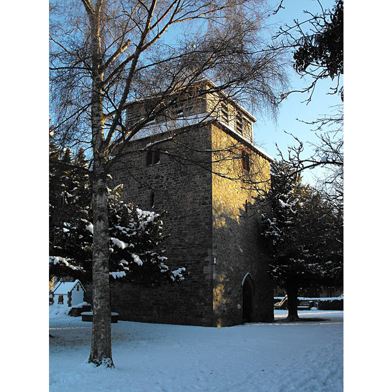
Image copyright © Penny Mayes, 2010
CC-BY-SA-2.0
Results: 2 records
view of church exterior - tower
Copyright Statement: Image copyright © Penny Mayes, 2010
Image Source: digital photograph taken 7 January 2010 by Penny Mayes [www.geograph.org.uk/photo/2194471] [accessed 22 August 2018
Copyright Instructions: CC-BY-SA-2.0
view of church exterior in context
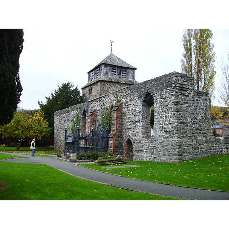
Scene Description: Source caption: "Church of St Mary, Newtown. The first record of this church dates from 1253 when it appears as the Chapelry of the Church of Llanwllchaiarn. In 1291 it became the parish church of the town which was then known as Llanfair-yng-nghedewain. The massive square stone tower with wooden belfry is typical of Montgomeryshire churches and may have been erected about a hundred years later. The church stands on the banks of the Severn and was abandoned for worship in 1856, after the building of St David's, as it had become too small for the congregation and, being subject to flooding, was in a bad state of repair."
Copyright Statement: Image copyright © Penny Mayes, 2007
Image Source: digital photograph taken 7 November 2007 by Penny Mayes [www.geograph.org.uk/photo/661993] [accessed 22 August 2018]
Copyright Instructions: CC-BY-SA-2.0
INFORMATION
Font ID: 17103NEW
Object Type: Baptismal Font1
Font Century and Period/Style: 15th century, Perpendicular
Church / Chapel Name: Parish Church of St. Mary
Font Location in Church: Inside the church [cf. FontNotes]
Church Patron Saint(s): St. Mary the Virgin
Church Address: Old Church Street, Powys, Wales, UK
Site Location: Powys, Wales, United Kingdom
Directions to Site: Located at the A483-A489 crossroads, 16 km from the English border, 40 km WSW of Shrewsbury
Historical Region: formerly Montgomeryshire
Font Notes:
Click to view
The RCAHM (Montgomery, 1911) records at the time of the visit to this church on 19 June 1909: "The rector [...] observes that 'the ancient font of the parish had been allowed to go out of the keeping of the church authorities, but was restored to the church a few years ago, and is now resting in the new church in company with two other fonts of modern date.' The font referred to is octagonal in shape, and of the Perpendicular period."
COORDINATES
UTM: 30U 478652 5818589
Latitude & Longitude (Decimal): 52.517, -3.3146
Latitude & Longitude (DMS): 52° 31′ 1.2″ N, 3° 18′ 52.56″ W
REFERENCES
- Great Britain. Royal Commission on Ancient Monuments and Constructions in Wales and Monmouthshire, An inventory of the ancient and historical monuments of the County of Montgomery, London: H.M. Stationary Office, 1911, vol. 1: 162