Nunkeeling / Chelinge / Chillingbe / Killing
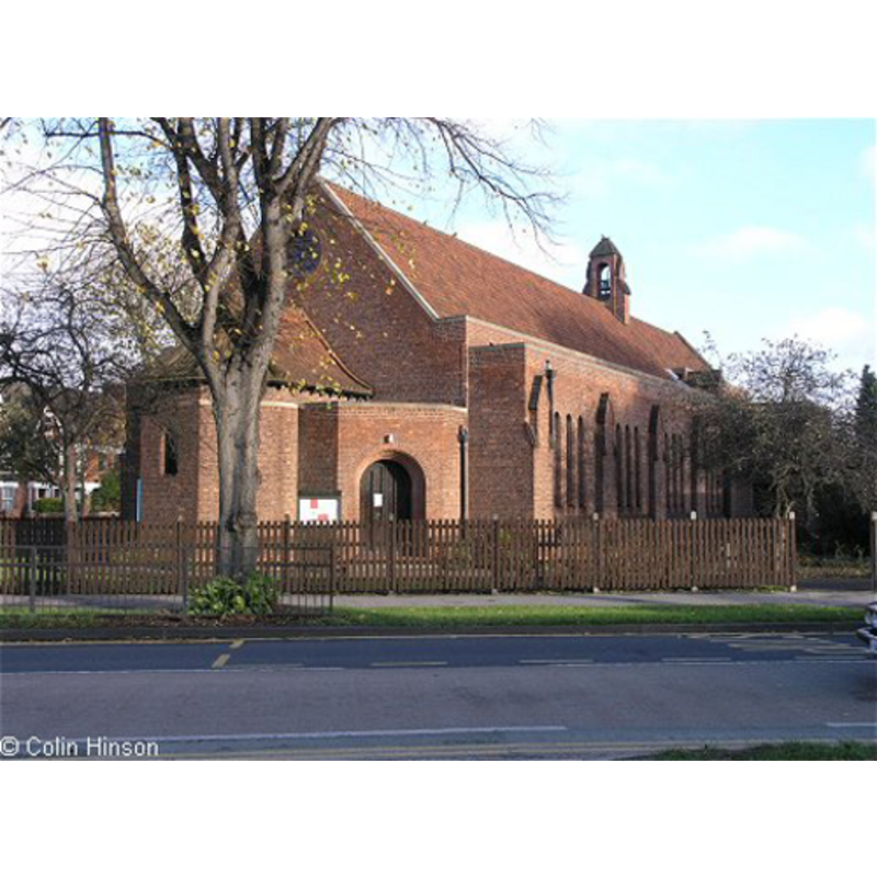
Image copyright © Colin Hinson, 2010
Standing permission
Results: 3 records
view of church exterior
Scene Description: the Church of St. Martin, in Hull
Copyright Statement: Image copyright © Colin Hinson, 2010
Image Source: digital photograph taken by Colin Hinson [www.yorkshireCDbooks.com]
Copyright Instructions: Standing permission
view of church exterior
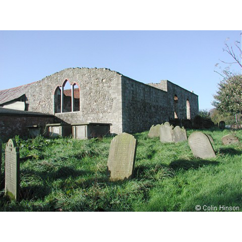
Scene Description: the ruins of the old church, Nunkeeling
Copyright Statement: Image copyright © Colin Hinson, 2010
Image Source: digital photograph taken by Colin Hinson [www.yorkshireCDbooks.com]
Copyright Instructions: Standing permission
view of church interior
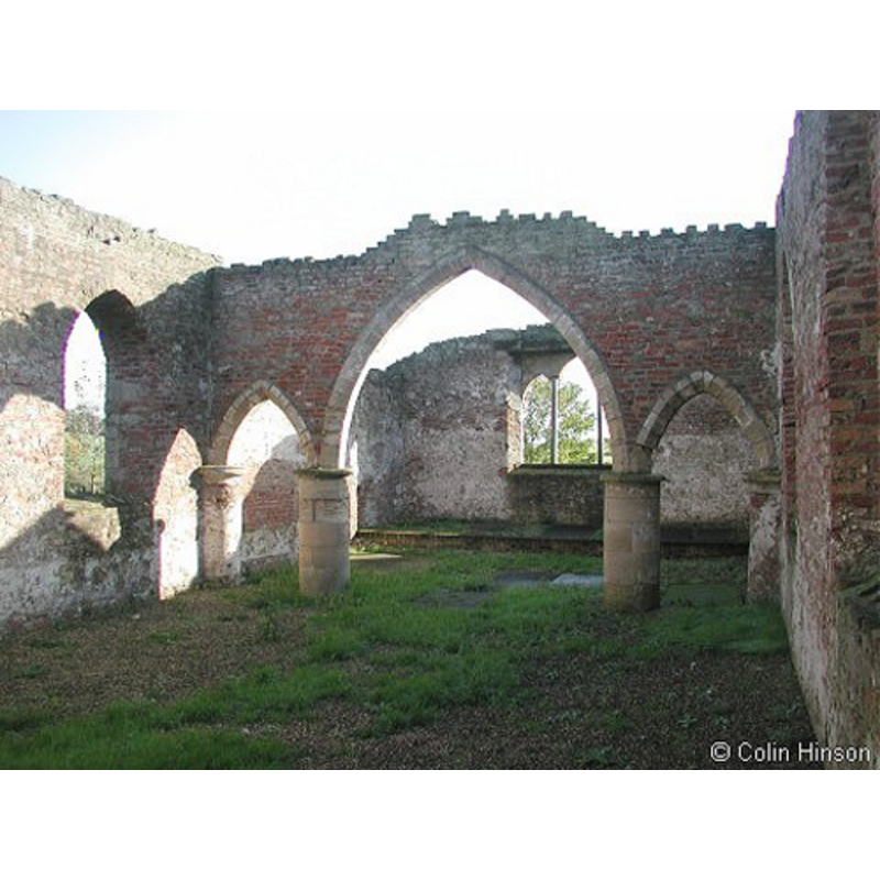
Scene Description: the ruins of the old church, Nunkeeling
Copyright Statement: Image copyright © Colin Hinson, 2010
Image Source: digital photograph taken by Colin Hinson [www.yorkshireCDbooks.com]
Copyright Instructions: Standing permission
INFORMATION
Font ID: 17013NUN
Object Type: Baptismal Font1
Font Century and Period/Style: 12th century (mid?), Norman
Church / Chapel Name: Parish Church of St. Mary [in ruins]
Font Location in Church: [cf. FontNotes]
Church Patron Saint(s): St. Mary the Virgin [earlier dedication: St. Mary Magdalene & St. Helen]
Church Notes: NB: problem with this church is: original parish church was given to, and later held by the Priory, which had its own monastic church; it was the monastic church that was later re-built as parish, but later still became ruinous
Church Address: Nunkeeling, Driffield YO25 8EH, UK
Site Location: East Riding of Yorkshire, Yorkshire and the Humber, England, United Kingdom
Directions to Site: Located E of the A165 [aka Bridlington Rd], 10 km NW of Hornsea, 22 km NNE of Hull [The Church of St. Martin is located on North Road, Hull]
Ecclesiastic Region: Diocese of York
Historical Region: North Hundred of Holderness
Additional Comments: moved font
Font Notes:
Click to view
There are two entries for [Nun]Keeling [variant spelling] in the Domesday survey [https://opendomesday.org/place/TA1450/nunkeeling/] [accessed 5 September 2019] one of which reports a priest, a church and "1.0 church lands" in it. There is no mention of a font here in Mouile (1837). It is noted as "ancient" in Sheahan & Whellan (1857). Described in Bulmer's directory of 1892 notes: "The font is circular and ancient, and rests on four piers." The National Archives holds the parish records of the Church of Hull St. Martin, among which, under reference PE21 is a: "Licence for removal of Norman font from Nunkeeling Church to St Martin's PE21/T58 1939", and a "Form of faculty in unopposed proceedings, removal of font, improvement of electrical lighting, removal of chairs from nave and installation of pews from St Nicholas' Church and installation of pulpit PE21/T65 1968". The Victoria County History (York East Riding, vol. 7, 2002) notes: "Agnes de Arches gave Nunkeeling church c. 1150 to the priory which she then founded there. The priory appropriated the church in 1409 [...] The parish church was evidently dedicated to St.. Mary Magdalene and St. Helen at the foundation of the priory c. 1150 [...] The church was rebuilt in 1810 [...] Some materials from the medieval building were reused, principally the north arcade which was rebuilt as a triple chancel arch. Nunkeeling church ceased to be used in 1928 and fell into disrepair; the walls of the unroofed building were consolidated by the parish council in 1987 [...] In 1992 it was unused [...] The medieval church evidently had a Norman font [...] The font was removed to a Hull church in 1939" [footnoted in the VCH: "B.I.H.R., Fac. Bk. 12, p. 165A."]. {NB: The Anlaby Road History web site [http://www.anlabyroad.com/history/anlaby-road-history-12.html] [accessed 7 November 2010] informs: "St Martin’s Church. The foundation stone of the new church was laid on St Martin’s Day (11th November) 1938 and the completed church was consecrated in 1939.[ ...] it contains a 12th Century font that was rescued from the ruined Benedictine Nunnery at Nunkeeling, and later installed in the local parish church there. When the Nunkeeling church closed in 1939 the font was donated to the new St Martin’s." The entry for the re-built church here in Historic England [Listing NGR: TA1454450150] notes: "Church. Probably founded mid C12; rebuilt 1810 using old materials. Brick with cladding of coursed squared rubble and cobbles. 2-bay nave, one-bay chancel. Nave: 2 pointed windows, the heads turned in brick with small keystones. West door of six raised and fielded panels in round-headed opening also turned in brick. Chancel: east window of three stepped lancets, now in ruins. Interior: triple stepped chancel arch. Pointed chamfered central arch on cylindrical piers flanked by similar, lower, arches on cylindrical responds with moulded abaci. Ruinous at time of re- survey."
Credit and Acknowledgements: We are grateful to Colin Hinson, of www.yorkshireCDbooks.com, for his photographs of the ruined church
COORDINATES
UTM: 30U 679756 5979348
Latitude & Longitude (Decimal): 53.931268, -0.261899
Latitude & Longitude (DMS): 53° 55′ 52.57″ N, 0° 15′ 42.83″ W
MEDIUM AND MEASUREMENTS
Material: stone
Font Shape: round, mounted
Basin Interior Shape: round
Basin Exterior Shape: round
REFERENCES
- Victoria County History [online], University of London, 1993-. URL: https://www.british-history.ac.uk.
- Victoria County History [online], University of London, 1993-. URL: https://www.british-history.ac.uk.
- Bulmer, T., History and Directory of East Yorkshire, 1892, [transcribed in http://www.genuki.org.uk/big/eng/YKS/ERY/Nunkeeling/Nunkeeling92.html [accessed 7 November 2010]]
- Sheahan, James Joseph, History and topography of the city of York; the East Riding of Yorkshire and a portion of the West Riding […], Beverley: printed for the publishers by John Green, Market Place, 1857, vol. 2: 426