Sigglesthorne / Siglestorne
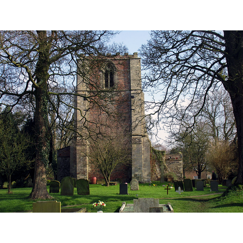
Image copyright © Jonathan Thacker, 2016
CC-BY-SA-2.0
Results: 5 records
view of church exterior - west view
Copyright Statement: Image copyright © Jonathan Thacker, 2016
Image Source: digital photograph taken 11 March 2016 by Jonathan Thacker [www.geograph.org.uk/photo/4865050] [accessed 7 November 2019]
Copyright Instructions: CC-BY-SA-2.0
view of church exterior - southeast view
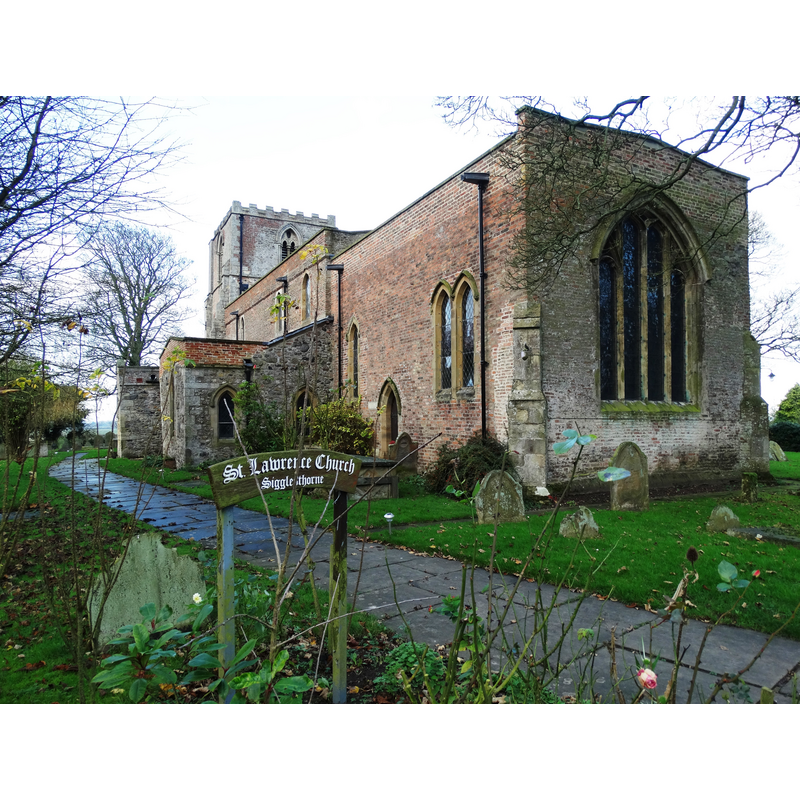
Scene Description: Source caption: "St Lawrence's Church, Sigglesthorne. The tower of this Grade II listed building was constructed during the thirteenth century. As building stone is not available in the local area, the walls are mostly composed of large beach stones from the nearby coastline. Several other old churches in the area used the same technique."
Copyright Statement: Image copyright © Neil Theasby, 2014
Image Source: digital photograph taken 3 December 2014 by Neil Theasby [www.geograph.org.uk/photo/4266921] [accessed 7 November 2019]
Copyright Instructions: CC-BY-SA-2.0
view of church exterior - south view
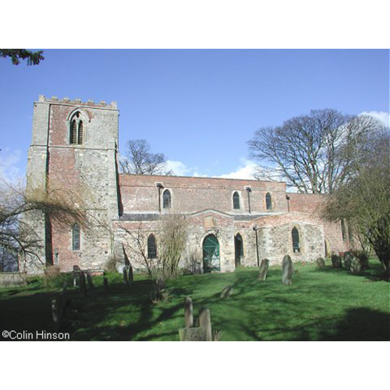
Copyright Statement: Image copyright © Colin Hinson, 2010
Image Source: digital photograph taken by Colin Hinson [www.yorkshireCDbooks.com]
Copyright Instructions: Standing permission
view of church interior - looking west
![the font is partially visible in the foreground, left [south] side, in the arch](/static-50478a99ec6f36a15d6234548c59f63da52304e5/compressed/1191108016_compressed.png)
Scene Description: the font is partially visible in the foreground, left [south] side, in the arch
Copyright Statement: Image copyright © Jonathan Thacker, 2016
Image Source: digital photograph taken 11 March 2016 by Jonathan Thacker [www.geograph.org.uk/photo/4865020] [accessed 7 November 2019]
Copyright Instructions: CC-BY-SA-2.0
view of church interior - looking east
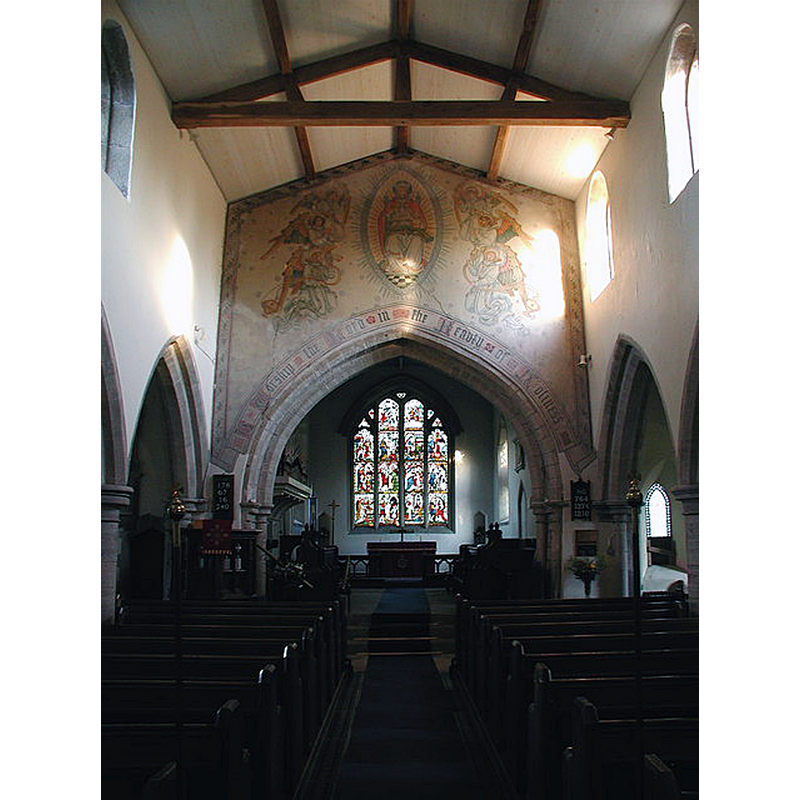
Scene Description: Source caption: "There was a church at Sigglesthorne in 1086 and it was dedicated to St. Lawrence by 1393. Built of boulders with ashlar dressings, much of the original building's fabric dates from the 13th century. Substantially repaired in brick, the decaying chancel was rebuilt in 1575 and the tower restored in 1676, 1763, 1842 and again in 1920."
Copyright Statement: Image copyright © Paul Glazzard, 2007
Image Source: digital photograph taken 12 November 2007 by Paul Glazzard [www.geograph.org.uk/photo/612331] [accessed 7 November 2019]
Copyright Instructions: CC-BY-SA-2.0
INFORMATION
Font ID: 17012SIG
Object Type: Baptismal Font1?
Font Century and Period/Style: 11th century, Pre-Conquest? / Norman
Church / Chapel Name: Parish Church of St. Lawrence
Church Patron Saint(s): St. Lawrence [aka Laurence]
Church Address: B1243, Sigglesthorne, Hull HU11 5QG, UK
Site Location: East Riding of Yorkshire, Yorkshire and the Humber, England, United Kingdom
Directions to Site: Located off the B1243, 6 km SW of Hornsea, 16 NE of Beverley, 18 km NNE of Hull
Ecclesiastic Region: Diocese of York
Historical Region: Hundred of Holderness [North Hundred]
Additional Comments: disappeared font? (the one from the Domesday-time church here) [NB: what was the font Moule reported ca. 1837 outside the church? where is it now?]
Font Notes:
Click to view
There is an entry for Sigglesthorne [variant spelling] in the Domesday survey [https://opendomesday.org/place/TA1545/sigglesthorne/] [accessed 7 November 2019]; it reports a priest and a church in it. Moule (1837) reported a disused font: "the ancient font is placed on the southern side of the chancel as a receptacle for the water from the roof". The entry for this parish in the Victoria County History (York East Riding, vol. 7, 2002) notes: "There was a church at Sigglesthorne in 1086 [...] Much of the fabric dates from the 13th century [...] The registers of baptisms, marriages, and burials begin in 1562 and are complete"; no mention of a font in it. The entry for this church in Historic England [Listing NGR: TA1544045666] notes: "Church. Early C13 west tower (restored 1616, 1763), C13 north and south nave arcades, north aisle and chancel of 1827. Restored by Pearson 1848"; no font mentioned in it either.
Credit and Acknowledgements: We are grateful to Colin Hinson, of www.yorkshireCDbooks.com, for the photograph of this church
COORDINATES
UTM: 30U 681019 5975266
Latitude & Longitude (Decimal): 53.89419, -0.2451
Latitude & Longitude (DMS): 53° 53′ 39.08″ N, 0° 14′ 42.36″ W
REFERENCES
- Victoria County History [online], University of London, 1993-. URL: https://www.british-history.ac.uk.
- Moule, Thomas, The English counties delineated; or, A topographical description of England [...], London: George Virtue, 1837 [vol. 2], vol. 2: 420