Chilworth No. 1 / Celeorde / Cheleworth / St. Martha / St. Martha and Holy Martyrs / St. Martha on the Hill / Marters Hill / Martyr's Hill / Martha Hill
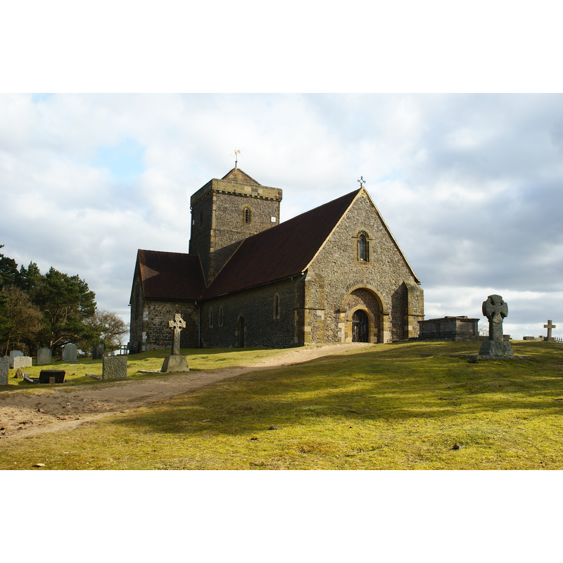
Image copyright © Peter Trimming, 2010
CC-BY-SA-2.0
Results: 2 records
view of church exterior - southwest view
Scene Description: Source caption: "The church, in a remote location on the Pilgrims' Way, sits at the top of St.Martha's Hill. This is the highest point within a three mile radius."
Copyright Statement: Image copyright © Peter Trimming, 2010
Image Source: digital photograph taken 11 February 2010 by Peter Trimming [www.geograph.org.uk/photo/1704133] [accessed 13 December 2015]
Copyright Instructions: CC-BY-SA-2.0
view of church exterior - northeast view
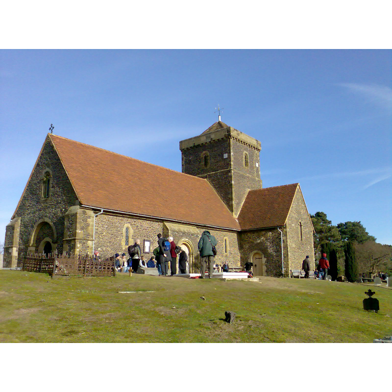
Copyright Statement: Image copyright © AJR, 2008
Image Source: digital photograph taken 2 February 2008 by AJR [https://commons.wikimedia.org/wiki/File:St_Martha-on-the-Hill.jpg] [accessed 13 December 2015]
Copyright Instructions: GFDL / CC-BY-SA
INFORMATION
Font ID: 16965CHI
Object Type: Baptismal Font1?
Font Century and Period/Style: 11th - 12th century, Norman
Cognate Fonts: [cf. FontNotes]
Church / Chapel Name: Parish Church of St. Martha [aka St. Martha's Chapel / St. Mary?]
Font Location in Church: [cf. FontNotes]
Church Patron Saint(s): St. Martha
Church Notes: "Although called a chapel, it seems always to have possessed the rights of a parish church; and it is probably to be identified with one of the three churches mentioned in Domesday as standing on the manor of Bramley, then held by Bishop Odo of Bayeux, who may well have built the original of the present building. The site itself is an extremely ancient one, and several circular earthworks still remain on St. Martha's Hill." (source: VCH)
Church Address: Halfpenny Lane, Chilworth, Surrey, GU4 8PY
Site Location: Surrey, South East, England, United Kingdom
Directions to Site: Located near Albury, 5 km SE of Guilford
Ecclesiastic Region: Diocese of Guildford
Font Notes:
Click to view
The Victoria County History (Surrey, vol. 3, 1911) notes the early font in Chilworth may possibly have been originally from Elstead, brought to Chilworth ca. 1850, whereas "the original was early Norman, like that at Thursley. [footnoted: nformation of the late Rev. J. R. Charlsworth and of the late Mr. H. Woodyer.]" [NB: we have no information on the whereabouts of the original font from Chilworth]
COORDINATES
UTM: 30U 672537 5677702
Latitude & Longitude (Decimal): 51.224588, -0.529036
Latitude & Longitude (DMS): 51° 13′ 28.52″ N, 0° 31′ 44.53″ W
MEDIUM AND MEASUREMENTS
Material: stone
REFERENCES
- Victoria County History [online], University of London, 1993-. URL: https://www.british-history.ac.uk.