Newton-le-Willows / Neuton / Neweton / Newton in Makerfield
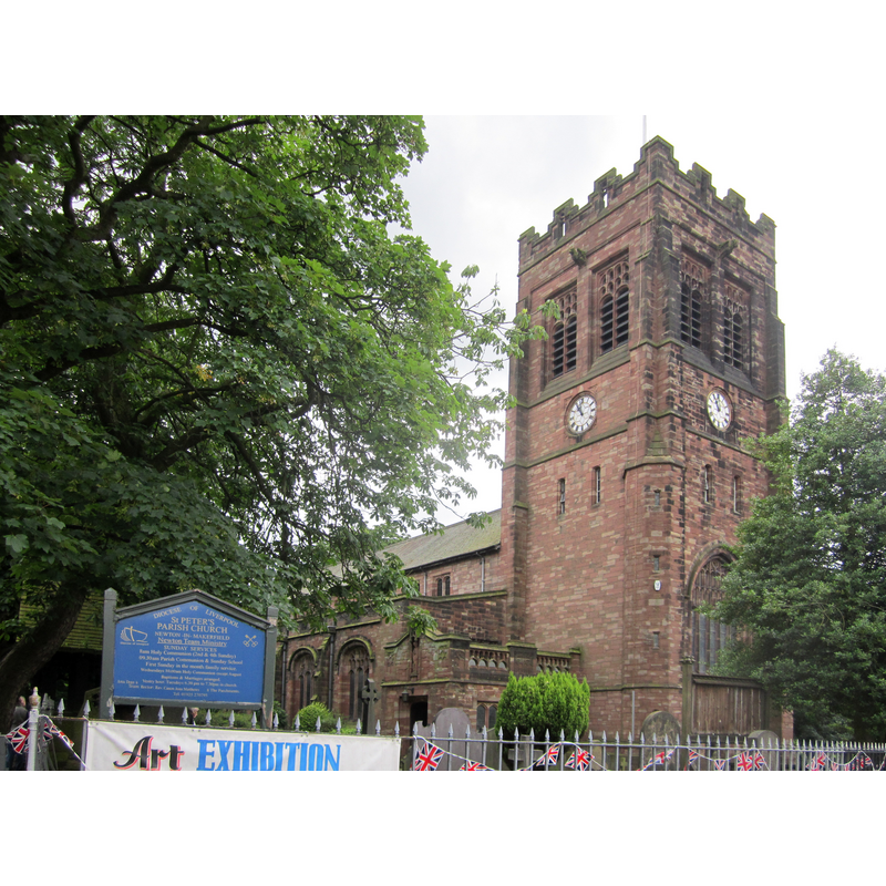
Image copyright © Rept0n1x, 2012
GFDL / CC-BY-SA-3.0,2.5,2.0,1.0
Results: 2 records
view of church exterior - northwest view
Copyright Statement: Image copyright © Rept0n1x, 2012
Image Source: digital photograph taken 14 July 2012 by Rept0n1x [https://commons.wikimedia.org/wiki/File:Newton-le-Willows_(20).JPG] [accessed 13 August 2019]
Copyright Instructions: GFDL / CC-BY-SA-3.0,2.5,2.0,1.0
view of church exterior - southwest view
Scene Description: the late-19th and early-20thC re-building of an earlier chapel
Copyright Statement: Image copyright © Rept0n1x, 2012
Image Source: digital photograph taken 14 July 2012 by Rept0n1x [https://commons.wikimedia.org/wiki/File:Newton-le-Willows_(20).JPG] [accessed 13 August 2019]
Copyright Instructions: GFDL / CC-BY-SA-3.0,2.5,2.0,1.0
INFORMATION
Font ID: 16930NEW
Object Type: Baptismal Font1?
Font Century and Period/Style: Medieval
Church / Chapel Name: Parish Church of St. Peter
Font Location in Church: [cf. FontNotes]
Church Patron Saint(s): St. Peter
Church Address: Church St, Newton-le-Willows WA12 9SR, UK
Site Location: Merseyside, North West, England, United Kingdom
Directions to Site: Located off the A49 [aka Church St], W of the M6, 8 km N of Warrington, 10 km S of Wigan
Historical Region: formerly Lancashire
Font Notes:
Click to view
There are two entries for Newton [-le-Willows] [variant spelling] in the Domesday survey [https://opendomesday.org/place/SJ5995/newton-le-willows/] [accessed 13 August 2019], one of which reports a church and "1.0 church lands" in it. Two churches preceded the present one at Newton-le-Willows, the first of which was a chapel said to date from the mid-13th century [1242]; after the Civil War the chapel was reported in ruins and a new one built in 1682 at a nearby site; the chapel became a parish church in 1844; re-built in two stages in the late-19th century and in the early 20th [source: 'St Peter’s Church – A Historical Summary’, Lynton J. Smith, cited in www.lan-opc.org.uk/Newton-le-Willows/stpeter/index.html [accessed 13 August 2019]]. [NB: we have no information on the medieval font; it may have been destroyed in the fire that burned the chapel]
COORDINATES
UTM: 30U 525615 5923040
Latitude & Longitude (Decimal): 53.455752, -2.614239
Latitude & Longitude (DMS): 53° 27′ 20.71″ N, 2° 36′ 51.26″ W