Melling / Melinge / Melling in Halsall / Mellyngg / Mellyngge
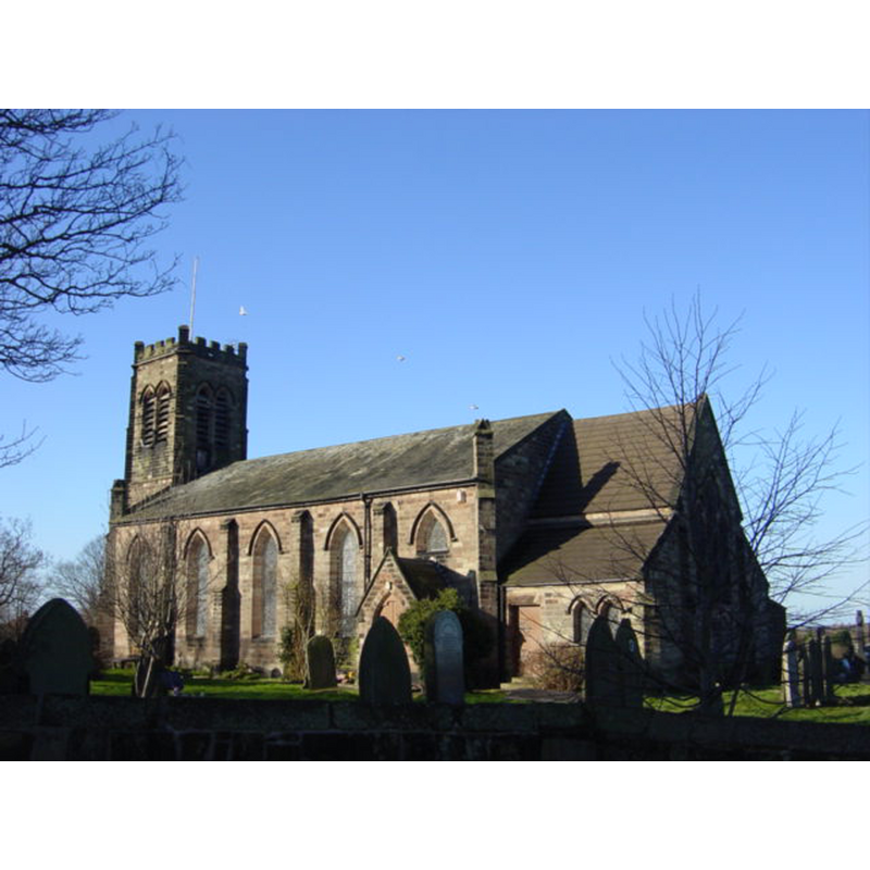
Image copyright © Sue Adair, 2006
CC-BY-SA-3.0
Results: 1 records
view of church exterior - southeast view
Copyright Statement: Image copyright © Sue Adair, 2006
Image Source: digital photograph taken 14 January 2006 by Sue Adair [www.geograph.org.uk/photo/105386] [accessed 25 June 2014]
Copyright Instructions: CC-BY-SA-3.0
INFORMATION
Font ID: 16929MEL
Object Type: Baptismal Font1?
Font Century and Period/Style: 14th - 16th century, Medieval
Church / Chapel Name: Parish Church of St. Thomas
Font Location in Church: [cf. FonNotes]
Church Patron Saint(s): St. Thomas & the Holy Cross
Church Notes: original church here probably ca. 1195
Church Address: Rock Lane Melling, L31 1EN
Site Location: Lancashire, North West, England, United Kingdom
Directions to Site: Located near Halsall, between the M57 and M58, WNW of Kirkby, 11 km NNE of Liverpool
Ecclesiastic Region: Diocese of Liverpool
Historical Region: Hundred of West Derby
Additional Comments: painted font (a thin coat of paint on it reported [cf. FontNotes])
Font Notes:
Click to view
There is an entry for this Melling [variant spelling] in the Domesday survey [http://domesdaymap.co.uk/place/SD3900/melling/] [accessed 25 June 2014], but it mentions neither church nor cleric in it. Ellis (1902) notes: "It is very difficult to assign a date to the font in use Melling church, though, from its size and general character, it is probably pre-Reformation. It stands at the s[outh] w[est] corner of the nave, and consists of an octagonal bowl with plain faces, surmounted by a roll moulding, and diminishing below by a series of four similar mouldings. The stem is a portion only of the original one, a plain octagon, and it stands on the floor without any base. The font is of light-coloured sandstone, but has been covered with a thin coat of paint [...] the tool marks are plainly visible." The Victoria County History (Lancaster, vol. 3, 1907) notes: "The chapel is mentioned in a charter dated about 1210 [...] had always been considered as dependent on Halsall, though the curate, appointed by the rector, was called the 'curate or parish priest of Melling.' [...] later, about 1610, there was neither service nor preacher. [...] As the registers begin in 1613 it is probable that this neglect was noticed by the bishop, who insisted upon some improvement. [...] in 1650, [...] the Commonwealth Surveyors recommended that the chapelry be made a parish of itself." The VCH does not mention a font in the chapel but a footnote reads: "For the font see Trans. Hist. Soc. (New Ser.), xvii, 64." [cf. supra]
COORDINATES
UTM: 30U 505044 5927332
Latitude & Longitude (Decimal): 53.494926, -2.923968
Latitude & Longitude (DMS): 53° 29′ 41.73″ N, 2° 55′ 26.28″ W
MEDIUM AND MEASUREMENTS
Material: stone, sandstone
Font Shape: octagonal, mounted
Basin Interior Shape: round
Basin Exterior Shape: octagonal
Rim Thickness: 10.5 cm [calculated]
Diameter (inside rim): 53.75 cm*
Diameter (includes rim): 75 cm*
Basin Depth: 25 cm*
Basin Total Height: 40 cm*
Font Height (less Plinth): 75 cm*
Notes on Measurements: * [in inches in Ellis (1902: 65)]
REFERENCES
- Victoria County History [online], University of London, 1993-. URL: https://www.british-history.ac.uk.
- Ellis, John W., "The Mediaeval Fonts of the Hundreds of West Derby and Wirral", LVIII (New series: XVII), Transactions of the Historic Society of Lancashire and Cheshire, 1902, pp. 59-80; p. 65