Billinge / Billinge nr. Wigan / Bollynge / Bulling / Bullynth / Bylnge
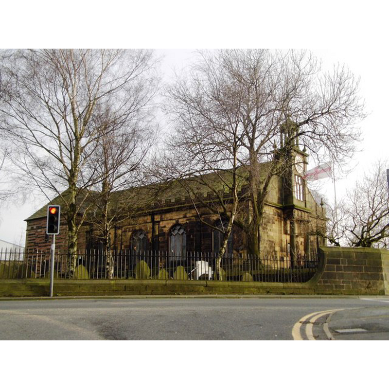
Image copyright © Anthony Parkes, 2014
CC-BY-SA-3.0
Results: 3 records
view of church exterior - northwest view
Scene Description: the 18thC Church of St Aidan
Copyright Statement: Image copyright © Anthony Parkes, 2014
Image Source: digital photograph taken 13 February 2014 by Anthony Parkes [www.geograph.org.uk/photo/3846903] [accessed 16 July 2014]
Copyright Instructions: CC-BY-SA-3.0
view of church exterior - southwest view
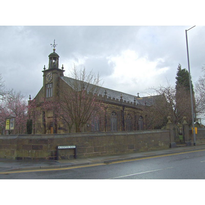
Scene Description: the 18thC Church of St Aidan
Copyright Statement: Image copyright © S Parish, 2008
Image Source: digital photograph taken 9 March 2008 by S Parish [www.geograph.org.uk/photo/725288] [accessed 16 July 2014]
Copyright Instructions: CC-BY-SA-3.0
view of font

Scene Description: the modern font in the 18thC Church of St Aidan
Copyright Statement: Image copyright © Billinge Parish, 2010
Image Source: digital photograph in the Parish website [www.staidanbillinge.org.uk/photos/font.jpg] [accessed 29 September 2010]
Copyright Instructions: PERMISSION NOT AVAILABLE -- IMAGE NOT FOR PUBLIC USE
INFORMATION
Font ID: 16918BIL
Object Type: Baptismal Font1?
Font Century and Period/Style: 16th century, Tudor
Church / Chapel Name: Billinge Chapel [disappeared]
Church Address: address and coordinates are for the 18thC St Aidan's church: Billinge, St Helens WN5 7HD, UK
Site Location: Merseyside, North West, England, United Kingdom
Directions to Site: Located on the B5207, 9 km WSW of Wigan
Ecclesiastic Region: Diocese of Liverpool
Historical Region: formerly Lancashire -- Hundred of West Derby
Additional Comments: disappeared font?
Font Notes:
Click to view
We have not found an entry for Billinge in the Domesday survey; at the time it was one of several 'berewicks' in the hundred of Newton [Neuetone]. The Victoria County History (Lancaster, vol. 4, 1911) notes: "A chapel of ease was built here in the time of Henry VIII [i.e., 1509-1547] at the cost of the inhabitants, who also paid the priest's wages. (fn. 30) At the beginning of Mary's reign James Winstanley of Winstanley, 'minding utterly to destroy the same chapel for ever, out of very malice and hate that he had and bore towards the service of God [...] There was 'no preacher' at Billinge in 1590. [...] Eight years later the building was found to be out of repair; there were no books but a Bible, the curate was 'no minister, but one licensed to read.' [...] The Commonwealth surveyors recommended that the chapel should be made a separate parish church, but this does not seem to have been carried out. [...] The minister in charge was ejected in 1662. [...] The old building was demolished and rebuilt in 1717–18. [...] The church has been of late considerably enlarged under the direction of Mr. T. G. Jackson, R.A. The oldest part of the building dates only from 1717 [...] The church became parochial in 1882." The present baptismal font appears modern; it consists of a roughly hemispherical basin with a moulded upper rim, raised on a moulded circular stem and a round-to-square lower base. [NB: we have no information on whether or not the chapel had baptismal rights and font until the building of the 18th century church].
COORDINATES
UTM: 30U 519575 5928016
Latitude & Longitude (Decimal): 53.500734, -2.704891
Latitude & Longitude (DMS): 53° 30′ 2.64″ N, 2° 42′ 17.61″ W
REFERENCES
- Victoria County History [online], University of London, 1993-. URL: https://www.british-history.ac.uk.