Wormingford / Widemondefort
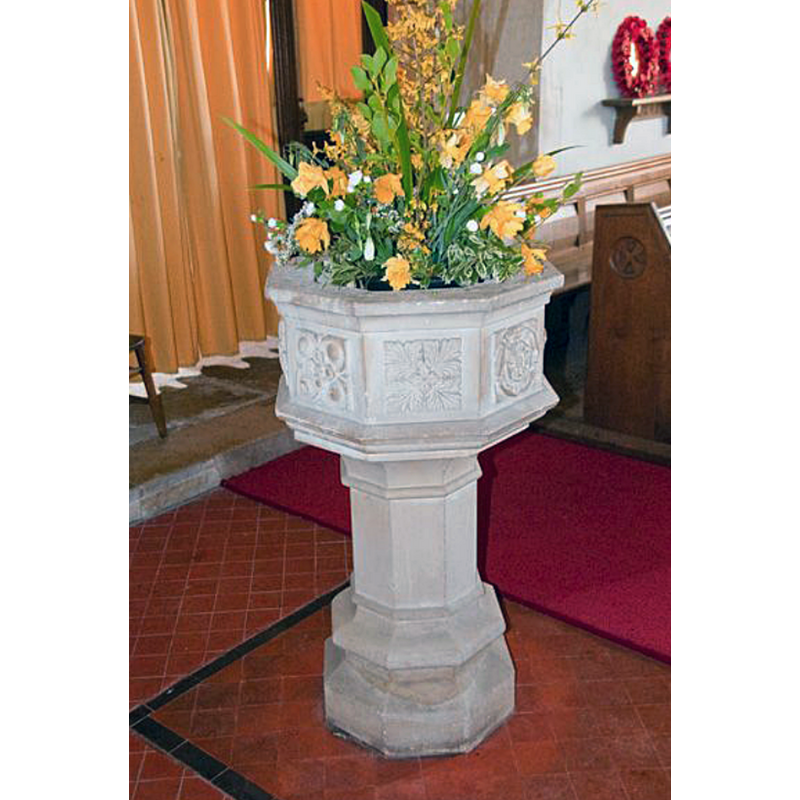
Image copyright © David Ross & Britain Express Ltd, 2019
Standing permission
Results: 2 records
view of font
Scene Description: NB: said to be a copy of an earlier font in this church [cf. FontNotes]
Copyright Statement: Image copyright © David Ross & Britain Express Ltd, 2019
Image Source: digital photograph taken by David Ross [www.britainexpress.com/counties/essex/churches/wormingford.htm] [accessed 18 June 2018]
Copyright Instructions: Standing permission
view of church exterior - southeast view
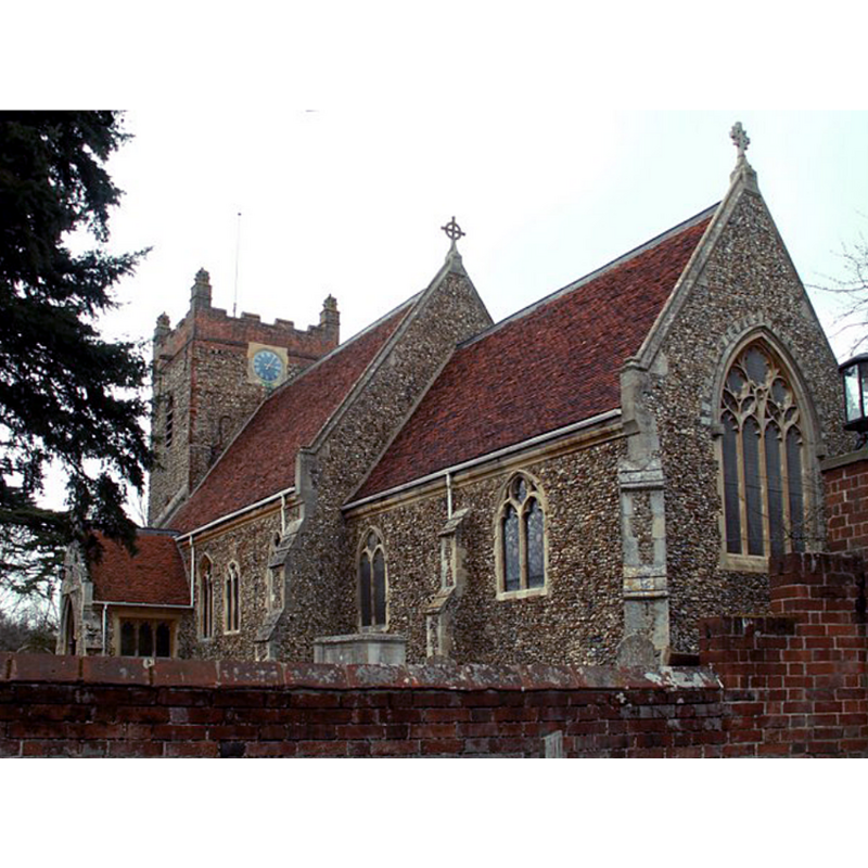
Scene Description: Source caption: "St. Andrew's church, Wormingford, Essex. The nave and tower of this church are Norman. Most of the rest of the church is 14th century."
Copyright Statement: Image copyright © Robert Edwards, 2006
Image Source: digital photograph taken 31 March 2006 by Robert Edwards [www.geograph.org.uk/photo/215249] [accessed 18 June 2018]
Copyright Instructions: CC-BY-SA-2.0
INFORMATION
Font ID: 16916WOR
Object Type: Baptismal Font1?
Font Century and Period/Style: 12th century (early?), Late Norman
Cognate Fonts: [cf. FontNotes]
Church / Chapel Name: Parish Church of St. Andrew
Church Patron Saint(s): St. Andrew
Church Address: Church Road, Wormingford, Essex CO6 3AZ, UK -- Tel.: +44 1206 366930
Site Location: Essex, East, England, United Kingdom
Directions to Site: Located off (N) the B1508, 10 km NW of Colchester, 13 km SE of Sudbury (Suffolk)
Ecclesiastic Region: Diocese of Chelmsford
Historical Region: Hundred of Lexden
Additional Comments: copy / replica font? / disappeared fonts? (1.: the font that served as model for the present one, and 2.: the one from the 12thC church here)
Font Notes:
Click to view
There is an entry for Wormingford [variant spelling] in the Domesday survey [http://opendomesday.org/place/TL9332/wormingford/] [18 June 2018], but it mentions neither priest not church in it. The Victoria County History (Essex, vol. 100, 2001) notes: "Part of the church building is of the early 12th century [...] Restoration of the church in 1869-70 [...] The 19th-century octagonal font is a copy of the medieval one." [NB: if the VCH claim about the present font being a copy of the medieval one is correct the original that served as model must have been a late-medieval one, 15th-century?] The entry for this church in Historic England [Listing NGR: TL9329032245] does not mention a font in it. [NB: we have no information on the whereabouts of the font of the 12th-century church here].
COORDINATES
UTM: 31U 349587 5758283
Latitude & Longitude (Decimal): 51.9551, 0.8115
Latitude & Longitude (DMS): 51° 57' 18" N, 0° 48' 41" E
REFERENCES
- Victoria County History [online], University of London, 1993-. URL: https://www.british-history.ac.uk.