Boston No. 1
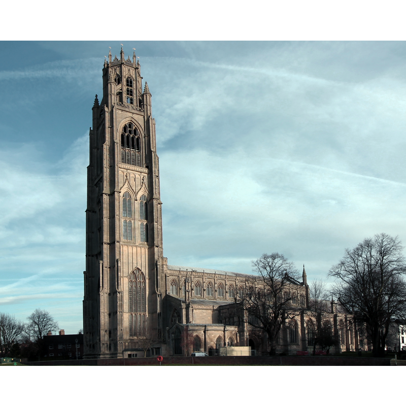
Image copyright © Julian P Guffogg, 2014
CC-BY-SA-2.0
Results: 5 records
view of church exterior - southwest view
Copyright Statement: Image copyright © Julian P Guffogg, 2014
Image Source: edited detail of a digital photograph taken 15 December 2014 by Julian P Guffogg [www.geograph.org.uk/photo/4283729] [accessed 14 May 2019]
Copyright Instructions: CC-BY-SA-2.0
view of church exterior - southeast view
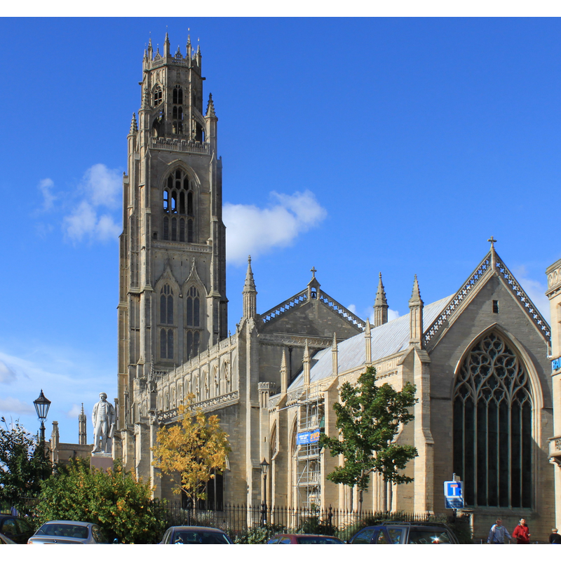
Copyright Statement: Image copyright © BardofL, 2009
Image Source: edited detail of a digital photograph taken 4 October 2009 by BardofL [https://commons.wikimedia.org/wiki/File:Stump%26Ingram.jpeg] [accessed 14 May 2019]
Copyright Instructions: CC-BY-SA-3.0
view of church interior - detail
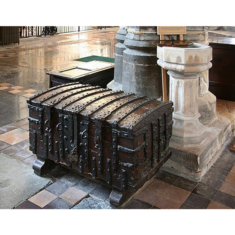
Scene Description: an old chest and a Victorian(?) holy-water stoup in the nave
Copyright Statement: Image copyright © Richard Croft, 2008
Image Source: edited detail of a digital photograph taken 18 September 2008 by Richard Croft [www.geograph.org.uk/photo/995289] [accessed 14 May 2019]
Copyright Instructions: CC-BY-SA-2.0
view of church interior - looking east
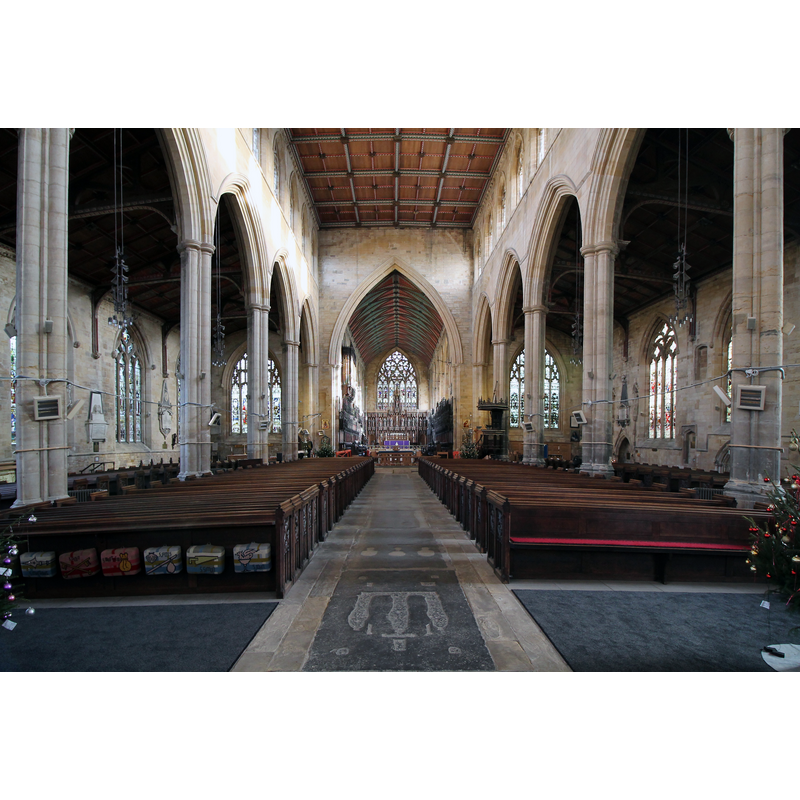
Copyright Statement: Image copyright © Jules & Jenny, 2014
Image Source: digital photograph taken 15 December 2014 by Jules & Jenny [www.flickr.com/photos/78914786@N06/15456306144] [accessed 14 May 2019]
Copyright Instructions: CC-BY-2.0
view of stoup
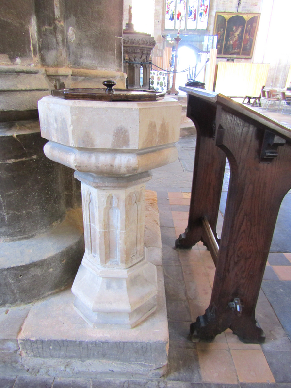
Scene Description: note the cover on it; is it being used as a font?
Copyright Statement: Image copyright © Colin Smith, 2026
Image Source: digital image by Colin Smith
Copyright Instructions: image and permission received from the author (e-mail of 18 January 2026)
INFORMATION
Font ID: 16895BOS
Object Type: Baptismal Font1
Font Date: 1667
Font Century and Period/Style: 17th century(mid), Restoration
Cognate Fonts: We are grateful to Colin Smith for his photograph of the stoup in the nave
Church / Chapel Name: Parish Church of St. Botolph [aka Boston Stump]
Font Location in Church: [cf. FontNotes]
Church Patron Saint(s): St. Botulph [aka St. Botolph, Botolph of Thorney, Botulf]
Church Notes: the present church of St Botolph originated from the former priory church of a Benedictine monastery established on the site ca. 1090
Church Address: Church St, Boston PE21 6NW, UK -- Tel.: +44 1205 310929
Site Location: Lincolnshire, East Midlands, England, United Kingdom
Directions to Site: Located off the A52, on the E banks of the Witham river, 50-60 km ENE of Grantham -- the church is located on Market Place
Ecclesiastic Region: Diocese of Lincoln
Additional Comments: disappeared font? (the font from the original priory church of ca. 1090)
Font Notes:
Click to view
No individual entry for Boston found in the Domesday survey. The Topographer (No. XIV, May 1790: 301) reports: "The font was new 1667", though the church itself dates at least to the early 14th century. [NB: the 1667 would heve been a Restoration font to replace whatever vessel had been used after the loss/rejection of the original medival font -- we have no information on either of those fonts; a modern font now in use at St. Botolph's is listed in this Index as Boston No.2 (Lincs.)]
COORDINATES
UTM: 30U 699671 5874030
Latitude & Longitude (Decimal): 52.978611, -0.025833
Latitude & Longitude (DMS): 52° 58′ 43″ N, 0° 1′ 33″ W