Stapleford Tawney
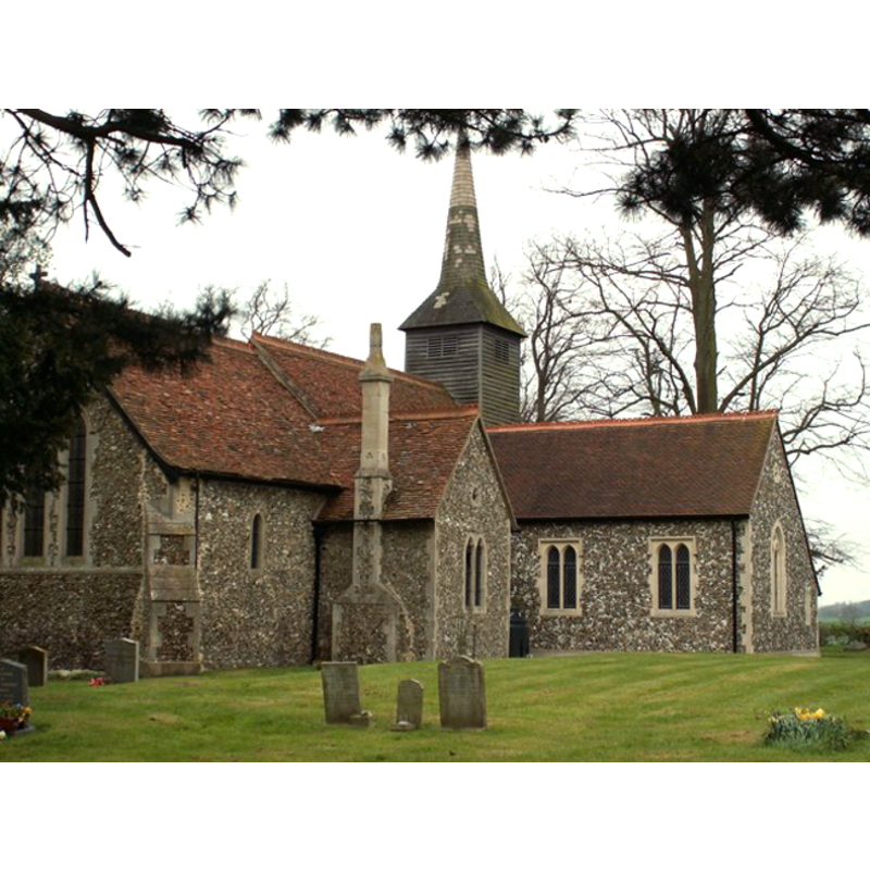
Image copyright © Robert Edwards, 2008
CC-BY-SA-3.0
Results: 2 records
view of church exterior - northeast view
Copyright Statement: Image copyright © Robert Edwards, 2008
Image Source: digital photograph taken 18 April 2008 by Robert Edwards [www.geograph.org.uk/photo/776202] [accessed 28 March 2012]
Copyright Instructions: CC-BY-SA-3.0
view of font and cover
![the cover is older than the font [cf. FontNotes]](/static-50478a99ec6f36a15d6234548c59f63da52304e5/others/permission_not_available.jpg)
Scene Description: the cover is older than the font [cf. FontNotes]
Copyright Statement: Image copyright © Oldpicruss, 2009
Image Source: digital photograph taken 10 September 2009 by Oldpicruss [www.flickr.com/photos/60445511@N05/6218348610/] [accessed 28 March 2012]
Copyright Instructions: PERMISSION NOT AVAILABLE -- IMAGE NOT FOR PUBLIC USE
INFORMATION
Font ID: 16889STA
Object Type: Baptismal Font1?
Font Century and Period/Style: 13th century, Medieval
Church / Chapel Name: Parish Church of St. Mary the Virgin
Church Patron Saint(s): St. Mary the Virgin
Church Address: Church Road [Tawney Lane], Stapleford Tawney, Essex, RM4 1DQ
Site Location: Essex, East, England, United Kingdom
Directions to Site: Located 5 km WSW of Ongar, 10 km ESE of Epping, 11 km N of Romford
Ecclesiastic Region: Diocese of Chelmsford
Historical Region: Hundred of Ongar
Additional Comments: disappeared font? (the one from the medieval church here?)
Font Notes:
Click to view
There is an entry for Stapleford [Tawney] in the Domesday survey [http://opendomesday.org/place/TQ5099/stapleford-tawney/] [accessed 22 June 2016], but it mentions neither cleric nor church in it. The Victoria County History (Essex, vol. 4, 1956) notes: "The chancel was built about 1220. [...] The font in the form of a Norman column dates from the 19th century but the wooden cover is older." The Main Print Collection of the London Metropolitan Archives, City of London, has a watercolour on paper of ca. 1800 of this church and the 'Norman column' font [Catalogue No. k1247323] [http://collage.cityoflondon.gov.uk/collage/app?service=external/Item&sp=Y1%3A114&sp=28124&sp=X] [accessed 21 April 2012]. [NB: we have no information on the font of the medieval church here].
COORDINATES
UTM: 31U 304423 5728109
Latitude & Longitude (Decimal): 51.669863, 0.171621
Latitude & Longitude (DMS): 51° 40′ 11.51″ N, 0° 10′ 17.84″ E
LID INFORMATION
Notes: [cf. FontNotes]
REFERENCES
- Victoria County History [online], University of London, 1993-. URL: https://www.british-history.ac.uk.