Stapleford Abbotts / Stapleford Abbots
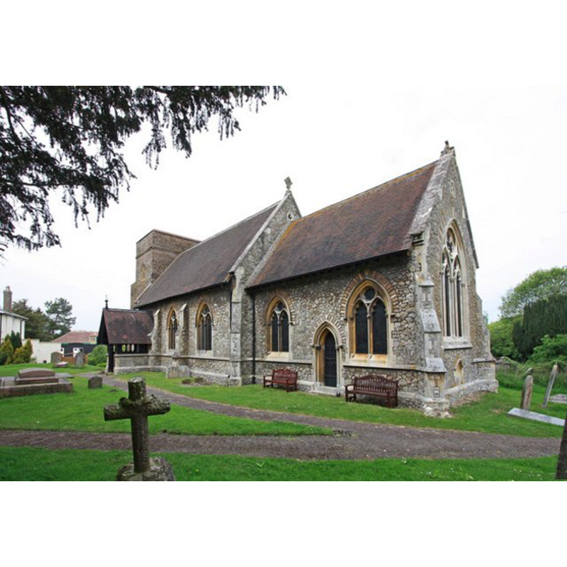
Image copyright © John Salmon, 2010
CC-BY-SA-3.0
Results: 3 records
view of church exterior - southeast view
Copyright Statement: Image copyright © John Salmon, 2010
Image Source: digital photograph taken 20 May 2010 by John Salmon [www.geograph.org.uk/photo/1870906] [accessed 28 March 2012]
Copyright Instructions: CC-BY-SA-3.0
view of church exterior - north view
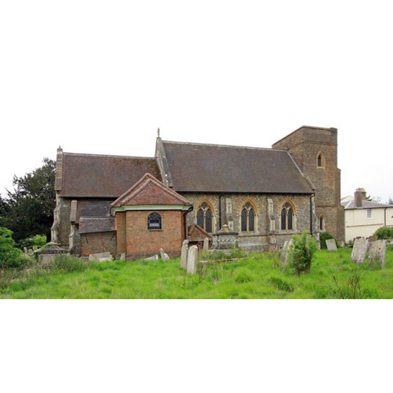
Copyright Statement: Image copyright © John Salmon, 2010
Image Source: digital photograph taken 20 May 2010 by John Salmon [www.geograph.org.uk/photo/1870910] [accessed 28 March 2012]
Copyright Instructions: CC-BY-SA-3.0
view of font and cover

Scene Description: the modern font
Copyright Statement: Image copyright © Oldpicruss, 2009
Image Source: digital photograph taken 1 October 2009 by Oldpicruss [www.flickr.com/photos/60445511@N05/6217827477/] [accessed 28 March 2012]
Copyright Instructions: PERMISSION NOT AVAILABLE -- IMAGE NOT FOR PUBLIC USE
INFORMATION
Font ID: 16888STA
Object Type: Baptismal Font1?
Font Century and Period/Style: 12th century, Late Norman? / Transitional?
Church / Chapel Name: Parish Church of St. Mary
Church Patron Saint(s): St. Mary the Virgin
Church Address: Church Lane, Stapleford Abbotts, Essex, RM4 1ES
Site Location: Essex, East, England, United Kingdom
Directions to Site: Located off the B175, E of Lambourne, 9 km SW of Ongar, NE of London
Ecclesiastic Region: Diocese of Chelmsford
Historical Region: Hundred of Ongar
Additional Comments: disappeared font? (from the medieval church)
Font Notes:
Click to view
There are two entries for Stapleford [Abbots] in the Domesday survey [http://opendomesday.org/place/TQ5095/stapleford-abbotts/] [accessed 22 June 2016], neither of which mentions cleric or church in it. The Victoria County History (Essex, vol. 4, 1956) notes: "A small engraving in the [present] church shows the building before the 19th-century reconstruction. There was evidently a porch in the centre of the south side, flanked by what were apparently 14th-century windows. There was also, high up near the west end of the nave, a single-light window which may have been of the 12th century, indicating a Norman origin for the church." The VCH does not mention a medieval font but reports: "The octagonal font is modern." The Church Builder (no. 3, July 1862: 110) reports the re-opening of the Church of St. Mary on 24 April 1862 (architect T. Jeckyll), and notes: "A handsome new font, sculptured by Westmacott, has been presented by a lady."
COORDINATES
UTM: 31U 304015 5725219
Latitude & Longitude (Decimal): 51.643773, 0.167339
Latitude & Longitude (DMS): 51° 38′ 37.58″ N, 0° 10′ 2.42″ E
REFERENCES
- Victoria County History [online], University of London, 1993-. URL: https://www.british-history.ac.uk.