Marsworth / Maesanwyrth / Maessanworth / Mæssanwyrth / Massewrth / Masworth / Messeworthe / Missevorde
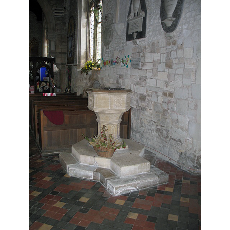
Image copyright © Gerald Massey, 2009
CC-BY-SA-2.0
Results: 3 records
view of font and cover in context - west side
Scene Description: the modern font [cf. FontNotes]
Copyright Statement: Image copyright © Gerald Massey, 2009
Image Source: digital photograph taken 1 October 2009 by Gerald Massey [www.geograph.org.uk/photo/1516671] [accessed 20 November 2015]
Copyright Instructions: CC-BY-SA-2.0
view of church exterior - southeast view
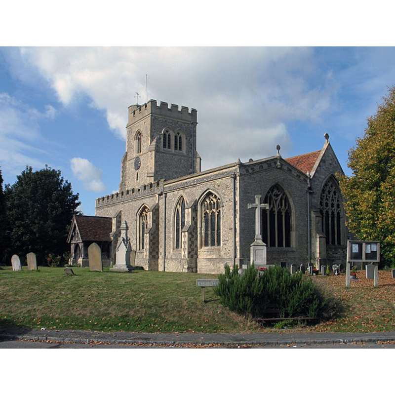
Copyright Statement: Image copyright © Gerald Massey, 2009
Image Source: digital photograph taken 2 October 2009 by Gerald Massey [www.geograph.org.uk/photo/1526560] [accessed 20 November 2015]
Copyright Instructions: CC-BY-SA-2.0
view of church interior - nave - looking east
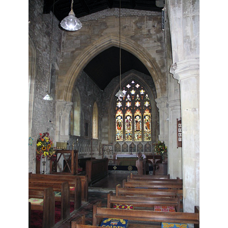
Copyright Statement: Image copyright © Gerald Massey, 2009
Image Source: digital photograph taken 1 October 2009 by Gerald Massey [www.geograph.org.uk/photo/1516674] [accessed 20 November 2015]
Copyright Instructions: CC-BY-SA-2.0
INFORMATION
Font ID: 16879MAE
Object Type: Baptismal Font1
Church / Chapel Name: Parish Church of All Saints
Font Location in Church: [cf. FontNotes]
Church Patron Saint(s): All Saints
Church Address: 69 Vicarage Road, Marsworth, Buckinghamshire HP23 4LU
Site Location: Buckinghamshire, South East, England, United Kingdom
Directions to Site: Marsworth is located 3 km N of Tring, 10 km E of Aylesbury
Ecclesiastic Region: Diocese of Oxford
Historical Region: Hundred of Yardley [in Domesday]
Additional Comments: moved font: [cf. FontNotes] -- disappeared font? (the one from the 12thC church here)
Font Notes:
Click to view
There is an entry for Marsworth [variant spelling] in the Domesday survey [http://opendomesday.org/place/SP9214/marsworth/] [accessed 20 November 2015], but it mentions neither cleric nor church in it. Sheahan (1862) reports a font in this church: "plain, small, and cup-shaped" [NB: this font must be the one referred to in the VCH in 1925 [cf. infra]]. A font is noted in the Victoria County History (Buckingham, vol. 3, 1925) [NB: but it is a font originally from Shenfield St. Mary, and it was later returned to it]: "The font [...] has an octagonal bowl of Purbeck marble with sunk quatrefoil panels variously carved with faces and conventional flowers. It is of late 14th-century workmanship. The stem and base are modern." The VCH (ibid.) footnotes: "This font, which was brought from the garden of Shenfield Rectory (Essex), replaced one acquired in 1860" [VCH source: 'Country Life', 30 October 1909: 596] -- The font was actually returned to Shenfield in 1949; cf. Bettley & Pevsner (2007)] [NB: the church dates at least to 1218, and the VCH (ibid.) suggests "There was a church here probably at the end of the 12th century" but we have no information on its medieval font]
COORDINATES
UTM: 30U 660794 5743826
Latitude & Longitude (Decimal): 51.822103, -0.666869
Latitude & Longitude (DMS): 51° 49′ 19.57″ N, 0° 40′ 0.73″ W
REFERENCES
- Victoria County History [online], University of London, 1993-. URL: https://www.british-history.ac.uk.
- Sheahan, James Joseph, History and topography of Buckinghamshire, comprising a general survey of the county, preceded by an epitome of the early history of Great Britain, London; Pontefract: Longman, Green, Longman, and Roberts; William Edward Bonas [...], 1862, p. 710