East Clandon / Clandon Abbatis / Clandon Abbots / Clandun / Clanedun / Clanedune / Clendon
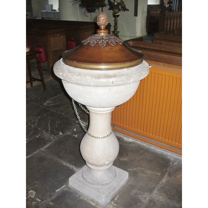
Image copyright © Colin Smith, 2015
Image and permission received (e-mail of 20 December 2015)
Results: 6 records
view of font and cover
Scene Description: the 18thC font
Copyright Statement: Image copyright © Colin Smith, 2015
Image Source: digital photograph taken 20 November 2015 by Colin Smith
Copyright Instructions: Image and permission received (e-mail of 20 December 2015)
view of font and cover
Scene Description: the 18thC font
Copyright Statement: Image copyright © Colin Smith, 2015
Image Source: digital photograph taken 20 November 2015 by Colin Smith
Copyright Instructions: Image and permission received (e-mail of 20 December 2015)
view of church exterior - northeast view
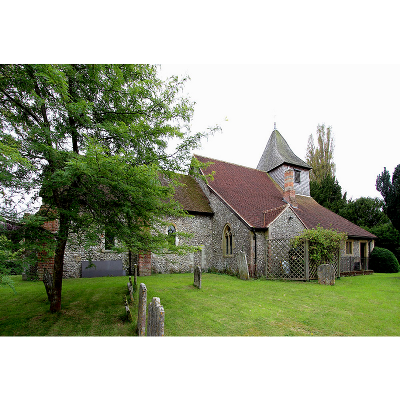
Copyright Statement: Image copyright © John Salmon, 2014
Image Source: digital photograph taken 25 September 204 by John Salmon [www.geograph.org.uk/photo/4190273] [accessed 17 December 2015]
Copyright Instructions: CC-BY-SA-2.0
view of church exterior - southwest view
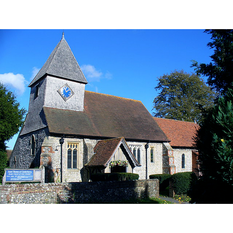
Scene Description: Source caption: "Saint Thomas of Canterbury, East Clandon. Parish church on the site of a church since Domesday times. It is flint-walled with a shingled tower."
Copyright Statement: Image copyright © Colin Smith, 2007
Image Source: digital photograph taken 30 October 2007 by Colin Smith [www.geograph.org.uk/photo/598583] [accessed 17 December 2015]
Copyright Instructions: CC-BY-SA-2.0
view of church interior - nave - looking east
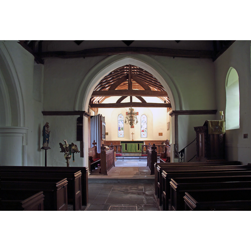
Copyright Statement: Image copyright © John Salmon, 2014
Image Source: digital photograph taken 25 September 204 by John Salmon [www.geograph.org.uk/photo/4190297] [accessed 17 December 2015]
Copyright Instructions: CC-BY-SA-2.0
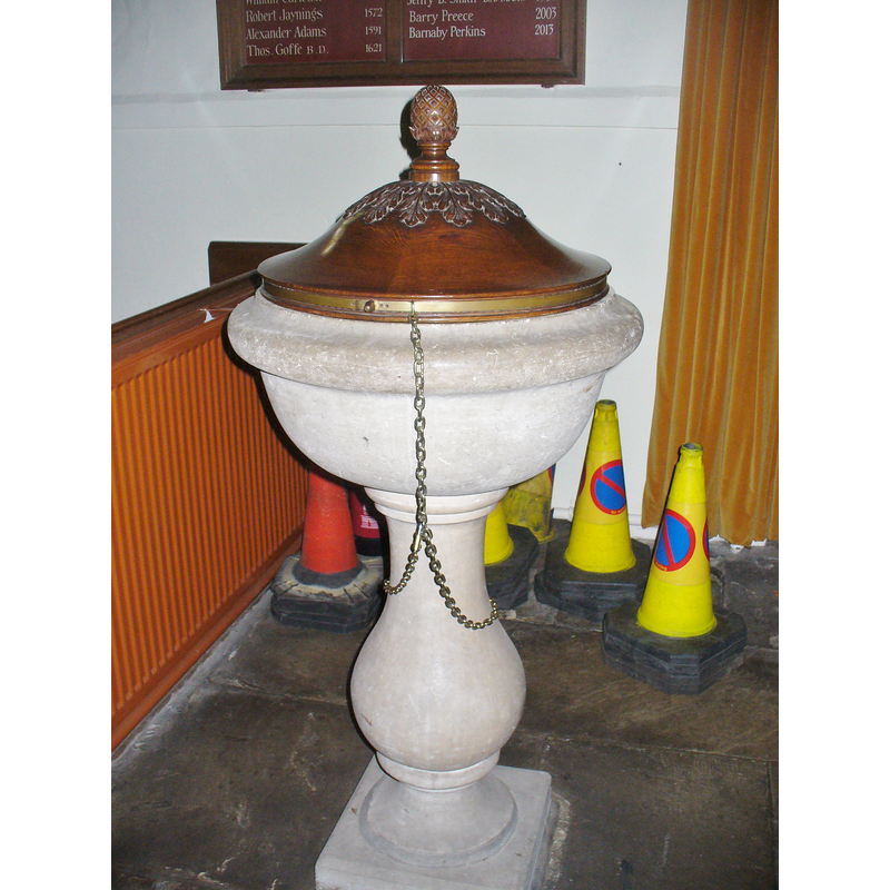
view of font cover
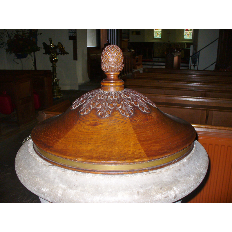
Scene Description: the modern font cover on the 18thC font
Copyright Statement: Image copyright © Colin Smith, 2015
Image Source: digital photograph taken 20 November 2015 by Colin Smith
Copyright Instructions: Image and permission received (e-mail of 20 December 2015)
INFORMATION
Font ID: 16877CLA
Object Type: Baptismal Font1?
Font Date: ca. 1100?
Font Century and Period/Style: 11th - 12th century, Norman
Church / Chapel Name: Parish Church of St. Thomas of Canterbury
Church Patron Saint(s): St. Thomas of Canterbury [aka St. Thomas à Becket]
Church Address: The Street, East Clandon, Surrey, GU4 7RY
Site Location: Surrey, South East, England, United Kingdom
Directions to Site: Located just E of West Clandon, N of Shire, on the A246, 8 km ENE of Guildford
Ecclesiastic Region: Diocese of Guildford
Historical Region: Hundred of Woking
Additional Comments: disappeared font? (the one from the ca.1100 church here?)
Font Notes:
Click to view
There are two entries for [East] Clandon [variant spelling] in the Domesday survey [http://opendomesday.org/place/TQ0651/east-clandon/] [accessed 17 December 2015], neither of which mentions cleric or church in it. Allen (1831) mentions a square font in this church. The Victoria County History (Surrey, vol. 3, 1911) notes: "The church of East Clandon, which is mentioned at the time of Domesday [cf. supra], was, like the manor, held by Chertsey Abbey until the Dissolution [...] The nave, which is short for its breadth, is evidently of early origin, probably dating from the end of the 11th century; but no architectural details of the original building are left to give a clue to its exact age. [...] The font dates from the 18th century and is of stone, with a small cup-shaped bowl on a turned baluster stem." [NB: either Allen got this wrong, or he saw an earlier font in this church, a font no longer there; we have no other information on the medieval font(s) of this church]
Credit and Acknowledgements: We are grateful to Colin Smith for his photographs of this church and modern font
COORDINATES
UTM: 30U 675705 5681212
Latitude & Longitude (Decimal): 51.255157, -0.481988
Latitude & Longitude (DMS): 51° 15′ 18.56″ N, 0° 28′ 55.16″ W
MEDIUM AND MEASUREMENTS
Material: stone
Font Shape: square
Basin Exterior Shape: square
REFERENCES
- Victoria County History [online], University of London, 1993-. URL: https://www.british-history.ac.uk.
- Allen, Thomas, A History of the County of Surrey ; comprising every object of topographical, geological, or historical interest, London: Isaac Taylor Hinton, 1831, vol. 2: 146