East Horsley / Horslei
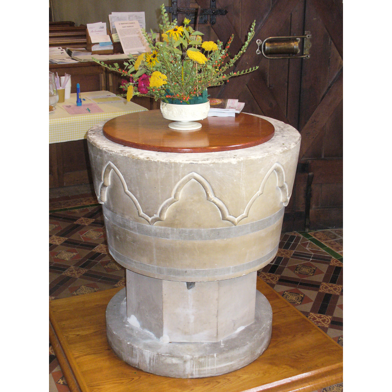
Image copyright © Colin Smith, 2010
Standing permission
Results: 2 records
view of font and cover
Copyright Statement: Image copyright © Colin Smith, 2010
Image Source: digital photograph taken 11 September 2010
Copyright Instructions: Standing permission
view of church exterior
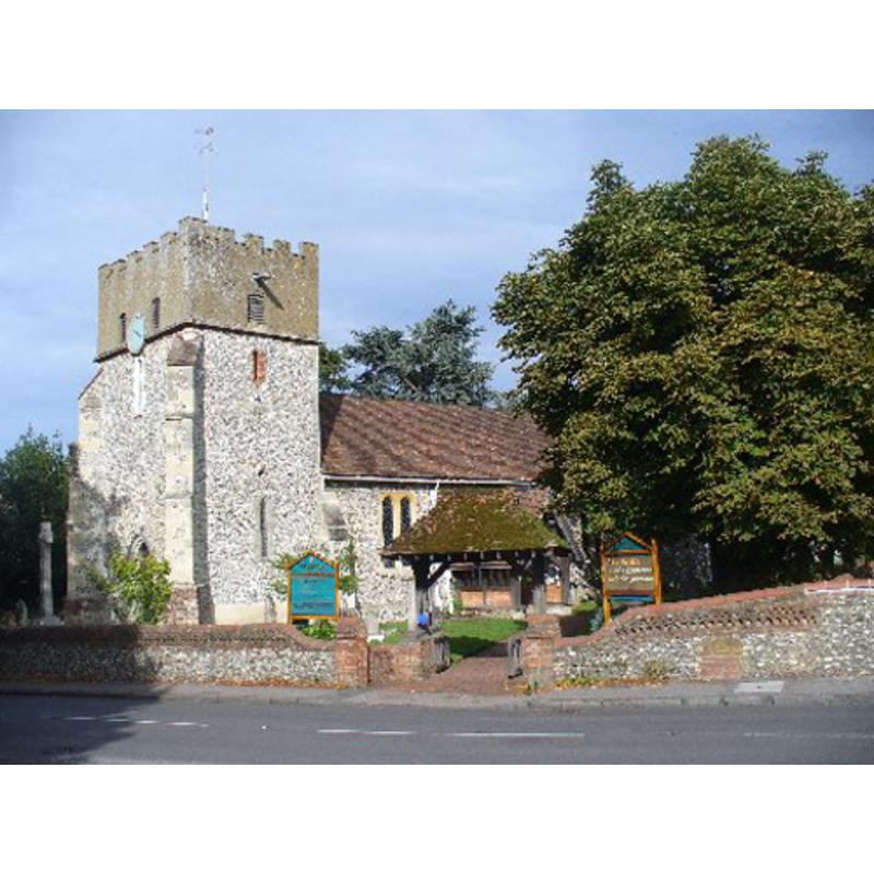
Copyright Statement: Image copyright © Colin Smith, 2010
Image Source: digital photograph taken 11 September 2010
Copyright Instructions: Standing permission
INFORMATION
Font ID: 16876HOR
Object Type: Baptismal Font1
Font Century and Period/Style: 13th century [re-cut] / 18th - 19th century, Medieval? / Modern?
Church / Chapel Name: Parish Church of St. Martin
Font Location in Church: Inside the church
Church Patron Saint(s): St. Martin of Tours
Church Address: Ockham Road South, East Horsley, Surrey, KT24 6RL
Site Location: Surrey, South East, England, United Kingdom
Directions to Site: Located on the A246 between Leatherhead and Guildford
Ecclesiastic Region: Diocese of Guildford
Historical Region: Hundred of Woking
Additional Comments: altered font: re-cut?
Font Notes:
Click to view
There is an entry for [East] Horsley [variant spelling] in the Domesday survey [http://opendomesday.org/place/TQ0952/east-horsley/] [accessed 17 December 2015], but there is no mention of cleric or church in it. The entry for this parish in the Victoria County History (Surrey, vol. 3, 1911) notes: "Much repair and rebuilding has obscured the history of the building, but before 1869 the chancel was of 13th-century date, and the nave, which was not entirely rebuilt, is probably older. The west tower is so covered with plaster that little can be said of its history; it opens to the nave by a modern arch, above which is a blocked pointed arch, presumably of 13th-century date. A third arch, now quite covered up, is said to exist above the pointed arch, and on the strength of this a pre-Conquest date has been claimed for the tower. It would be interesting if any proof could be obtained. [...] All the internal fittings are modern except two Jacobean chairs in the chancel". Like its sister font in West Horsley, the present round tub appears to have been a medieval font greatly altered by the Victorians (?), and is now a bucket-shaped basin with a modern set of trefoiled arch-heads around the sides; on an octagonal stem and a round lower base. The wooden cover is plain, flat and round; modern.
Credit and Acknowledgements: We are greatful to Colin Smith for his photographs of church and font
COORDINATES
UTM: 30U 679201 5682310
Latitude & Longitude (Decimal): 51.263932, -0.431388
Latitude & Longitude (DMS): 51° 15′ 50.15″ N, 0° 25′ 53″ W
REFERENCES
- Victoria County History [online], University of London, 1993-. URL: https://www.british-history.ac.uk.