Esher / Aissale / Aissela / Aissele / Asher / Eschere / Esere / Esher Episcopi / Eshere / Esschere
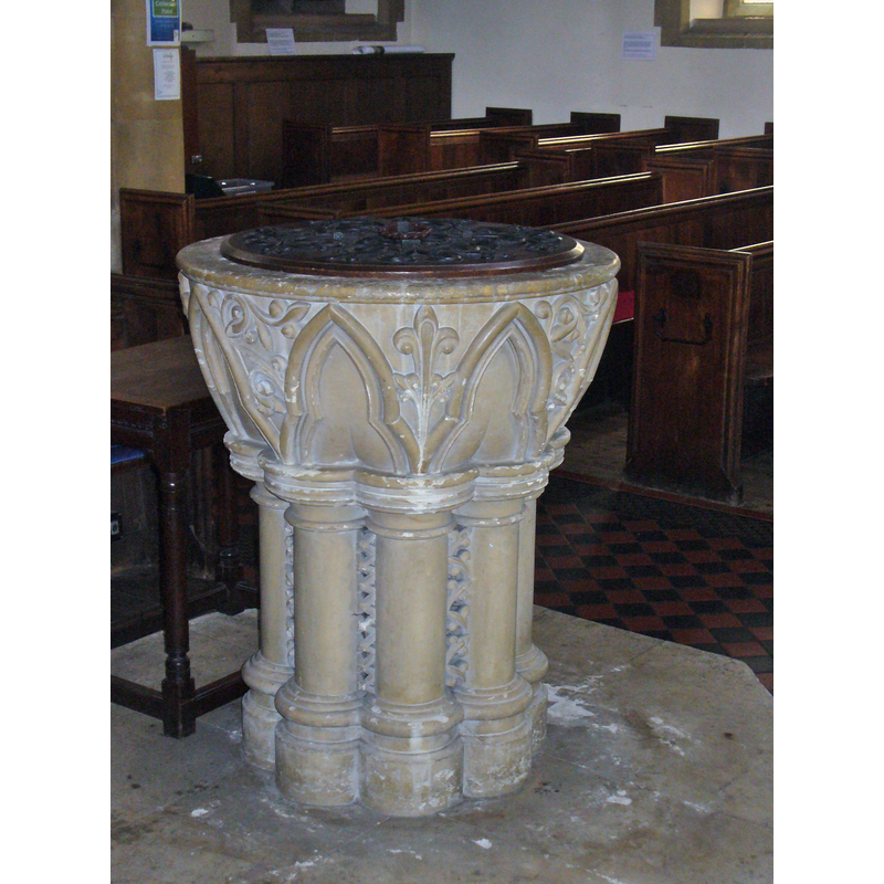
Image copyright © Colin Smith, 2015
Image and permission received (e-mail of 16 August 2015)
Results: 11 records
view of font
Scene Description: the 19thC font
Copyright Statement: Image copyright © Colin Smith, 2015
Image Source: digital photograph taken 19 June 2015 by Colin Smith
Copyright Instructions: Image and permission received (e-mail of 16 August 2015)
view of font
Scene Description: the late font in the 16thC church
Copyright Statement: Image copyright © John Salmon, 2005
Image Source: digital photograph taken 14 October 2005 by John Salmon [www.geograph.org.uk/photo/1663752] [accessed 16 August 2015]
Copyright Instructions: CC-BY-SA-2.0
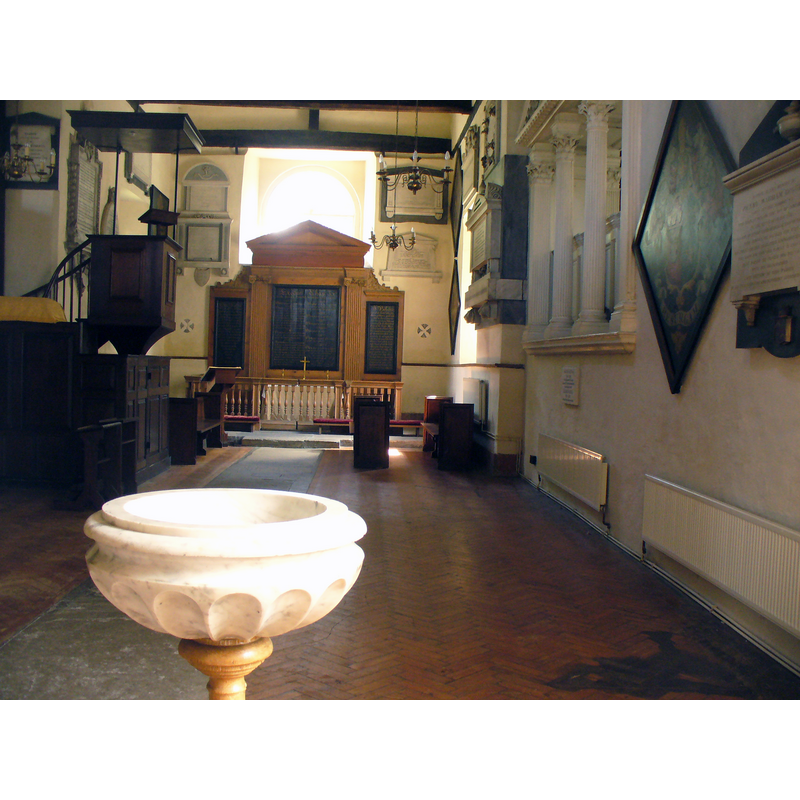
view of basin - interior
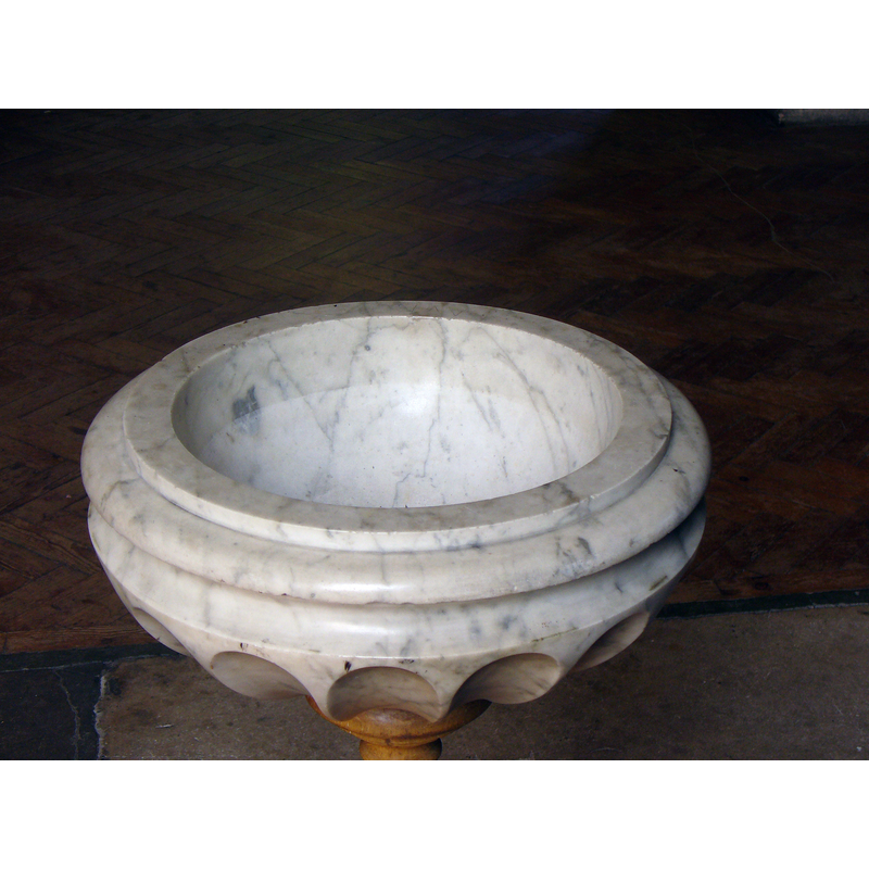
Copyright Statement: Image copyright © Colin Smith, 2015
Image Source: digital photograph taken 7 August 2015 by Colin Smith
Copyright Instructions: Image and permission received (e-mail of 16 August 2015)
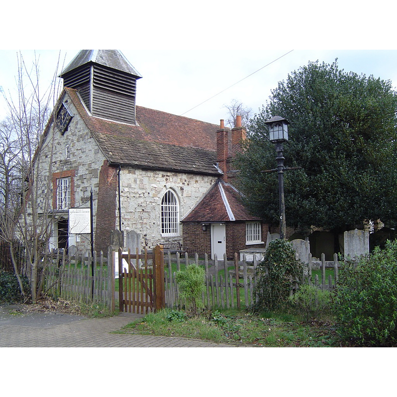
view of church exterior - northeast view
Scene Description: the 19thC church
Copyright Statement: Image copyright © John Salmon, 2005
Image Source: digital photograph taken 14 October 2005 by John Salmon [www.geograph.org.uk/photo/1664858] [accessed 16 August 2015]
Copyright Instructions: CC-BY-SA-2.0
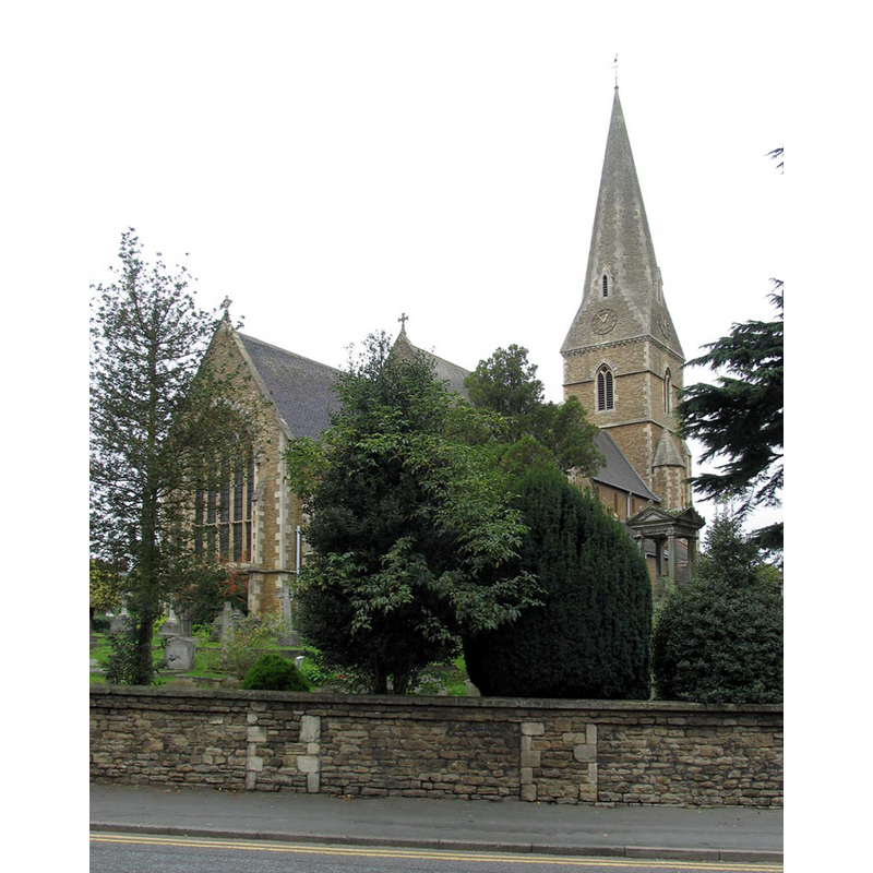
view of church exterior - southwest view
Scene Description: Source caption: "Esher Church. Historic parish church which still has some Norman stonework. It contains some royal memorials - royalty once lived at nearby Claremont."
Copyright Statement: Image copyright © Colin Smith, 2012
Image Source: digital photograph taken 22 April 2012 by Colin Smith [www.geograph.org.uk/photo/2913970] [accessed 16 August 2015]
Copyright Instructions: CC-BY-SA-2.0
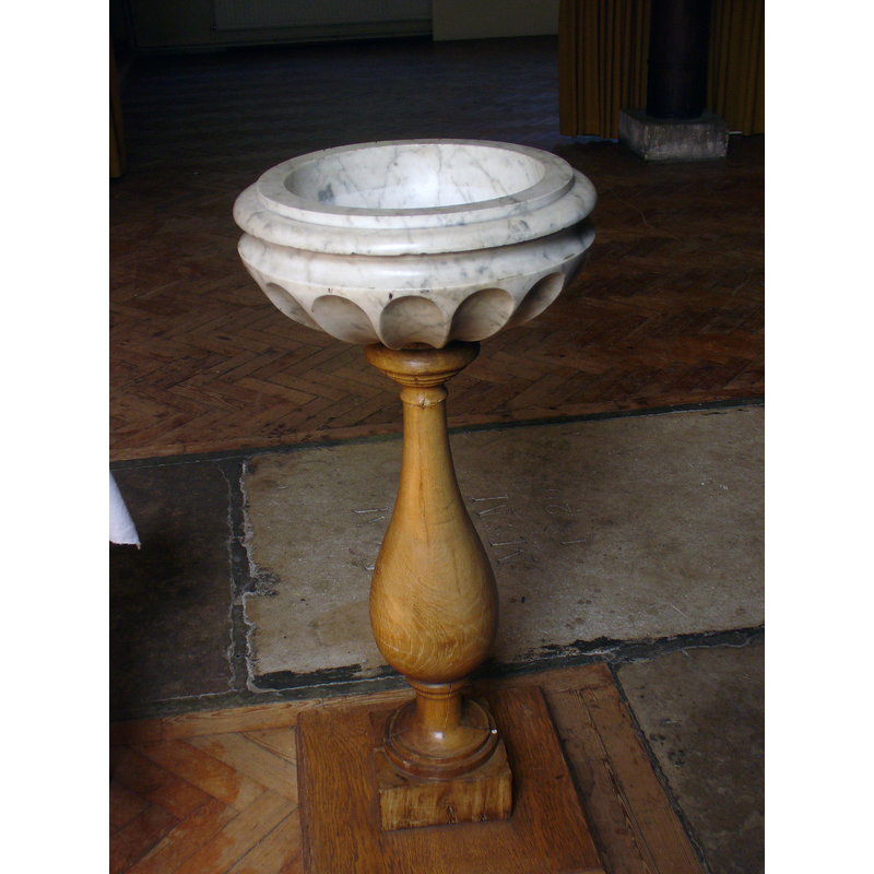
view of font in context
Copyright Statement: Image copyright © Colin Smith, 2015
Image Source: digital photograph taken 7 August 2015 by Colin Smith
Copyright Instructions: Image and permission received (e-mail of 16 August 2015)
view of font and cover in context
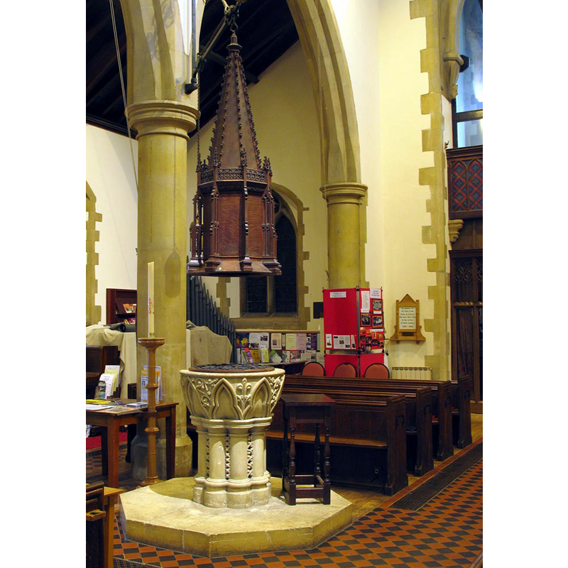
Scene Description: the 19thC font and cover in the 19thC church
Copyright Statement: Image copyright © John Salmon, 2005
Image Source: digital photograph taken 14 October 2005 by John Salmon [www.geograph.org.uk/photo/1664833] [accessed 16 August 2015]
Copyright Instructions: CC-BY-SA-2.0
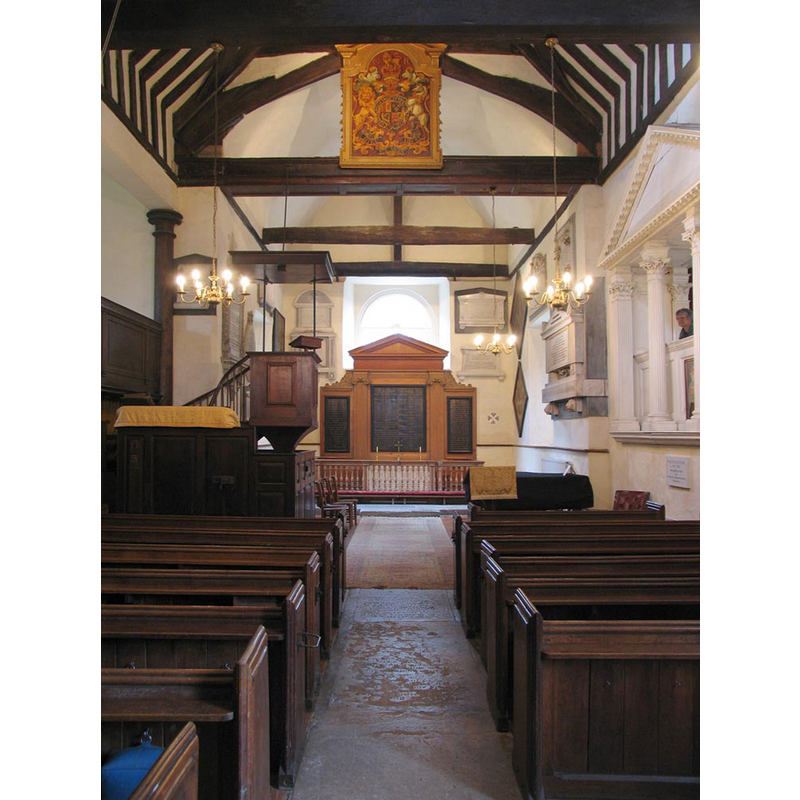
view of church interior - nave - looking east
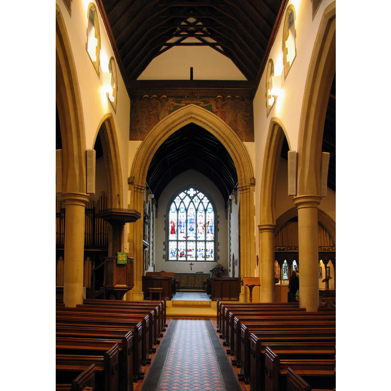
Scene Description: the 19thC church
Copyright Statement: Image copyright © John Salmon, 2005
Image Source: digital photograph taken 14 October 2005 by John Salmon [www.geograph.org.uk/photo/1664841] [accessed 16 August 2015]
Copyright Instructions: CC-BY-SA-2.0
view of church interior - nave - looking west

Copyright Statement: Image copyright © John Salmon, 2005
Image Source: digital photograph taken 14 October 2005 by John Salmon [www.geograph.org.uk/photo/1664733] [accessed 16 August 2015]
Copyright Instructions: CC-BY-SA-2.0
view of church interior - nave - looking east
Scene Description: the 16thC church
Copyright Statement: Image copyright © John Salmon, 2005
Image Source: digital photograph taken 14 October 2005 by John Salmon [www.geograph.org.uk/photo/1664728] [accessed 16 August 2015]
Copyright Instructions: CC-BY-SA-2.0
view of font cover
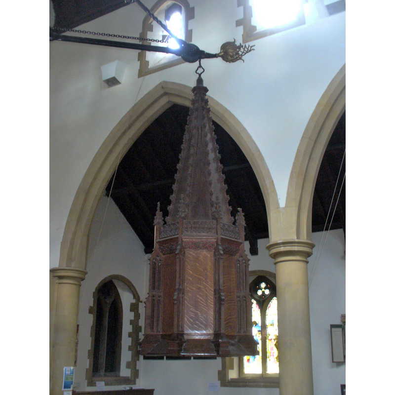
Scene Description: the 19thC cover
Copyright Statement: Image copyright © Colin Smith, 2015
Image Source: digital photograph taken 19 June 2015 by Colin Smith
Copyright Instructions: Image and permission received (e-mail of 16 August 2015)
INFORMATION
Font ID: 16874ESH
Object Type: Baptismal Font1?
Font Century and Period/Style: 13th century, Early English
Church / Chapel Name: Parish Church of St. George [aka Sandy Chapel]
Church Patron Saint(s): St. George
Church Address: St. George: Esher Park Avenue, Esher, Surrey KT10 9NX -- Christ Church: Park Road, Esher, Surrey KT10 8QS
Site Location: Surrey, South East, England, United Kingdom
Directions to Site: Located 6 km SW of Kingston-upon-Thames, N of Cobham. W of Thames Ditton
Ecclesiastic Region: Diocese of Guildford
Historical Region: Hundred of Elmbridge
Additional Comments: disappeared font? (the one from the original 13thC church here)
Font Notes:
Click to view
There are six entries for Esher [variant spelling] in the Domesday survey [http://opendomesday.org/place/TQ1364/esher/] [accessed 16 August 2015], none of which mention cleric or church in it. Allen (1831) notes: "The font is an octagonal basin, on each side of which is carved a rose, supported by a plain octagonal pillar." The Victoria County History (Surrey, vol. 3, 1911) reports: "The church of Esher is not mentioned in Domesday. There was a church there at the end of the 13th century [...] The church of ST. GEORGE, known locally as Sandy (i.e. Sandon) Chapel, consists of a chancel, nave, north aisle, projecting bay on the south with private pews above a vault, a south vestry, and a shingled bell-turret on the west gable. [...] There is a small marble font". The VCH (ibid.) notes a modern church, Christ Church, of the mid-19th century, and remarks that there is no trace of the medieval church. [NB: not clear whether the font reported in Allen is the same as the one in the VCH; we have no information on the medieval font, or the later 16th-century font of St. George's].
Credit and Acknowledgements: We are grateful to Coiln Smith for his photographs of these two churches and their modern fonts
COORDINATES
UTM: 30U 683122 5694480
Latitude & Longitude (Decimal): 51.372, -0.369
Latitude & Longitude (DMS): 51° 22′ 19.2″ N, 0° 22′ 8.4″ W
MEDIUM AND MEASUREMENTS
Material: stone, marble
Font Shape: octagonal, mounted
Basin Exterior Shape: octagonal
REFERENCES
- Victoria County History [online], University of London, 1993-. URL: https://www.british-history.ac.uk.
- Allen, Thomas, A History of the County of Surrey ; comprising every object of topographical, geological, or historical interest, London: Isaac Taylor Hinton, 1831, vol. 2: 13