Guildford No. 2 / Gildeford / Guldforde
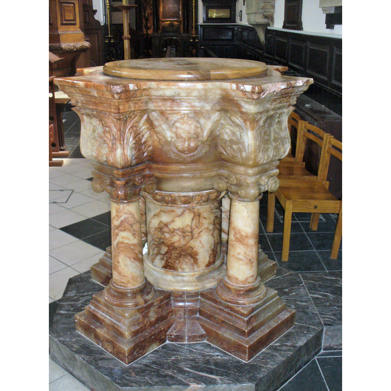
Image copyright © Colin Smith, 2016
Image and permission received (e-mail of 13 July 2016)
Results: 9 records
view of font and cover
Scene Description: the modern font
Copyright Statement: Image copyright © Colin Smith, 2016
Image Source: digital photograph taken 26 April 2016 by Colin Smith
Copyright Instructions: Image and permission received (e-mail of 13 July 2016)
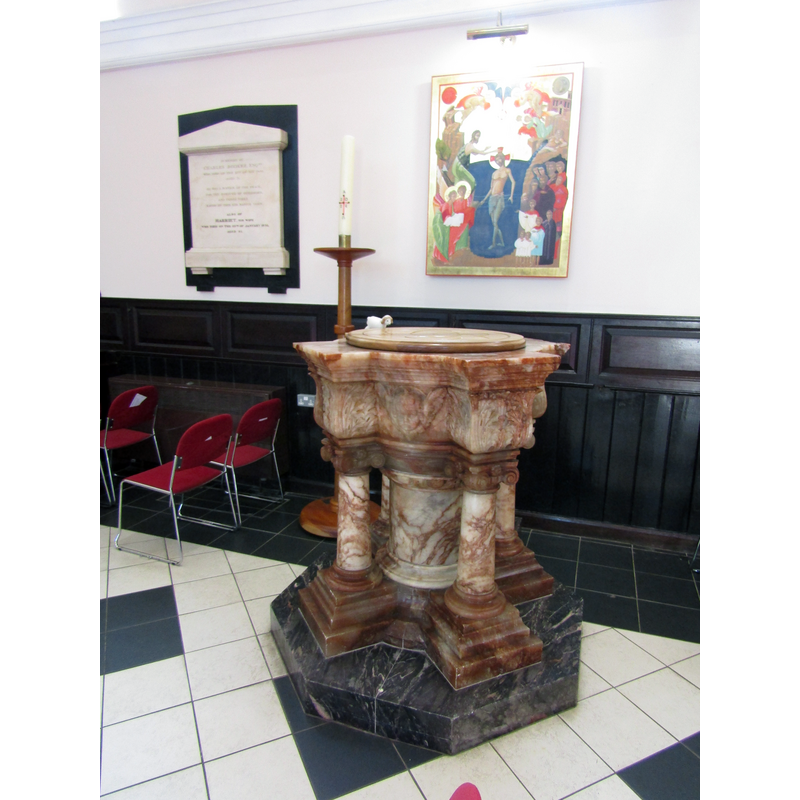
view of font and cover in context
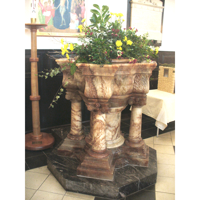
Scene Description: the modern font
Copyright Statement: Image copyright © Colin Smith, 2012
Image Source: digital photograph taken 3 January 2012 by Colin Smith
Copyright Instructions: Image and permission received (e-mail of 2 January 2012)
view of basin - detail
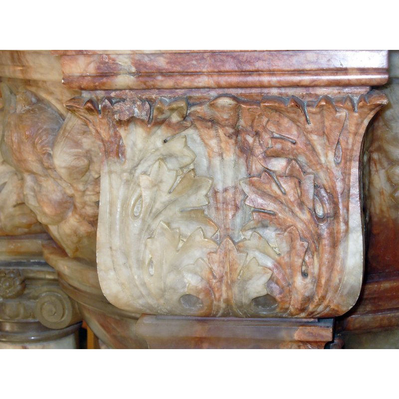
Scene Description: the modern font
Copyright Statement: Image copyright © Colin Smith, 2016
Image Source: digital photograph taken 26 April 2016 by Colin Smith
Copyright Instructions: Image and permission received (e-mail of 13 July 2016)
view of basin - detail
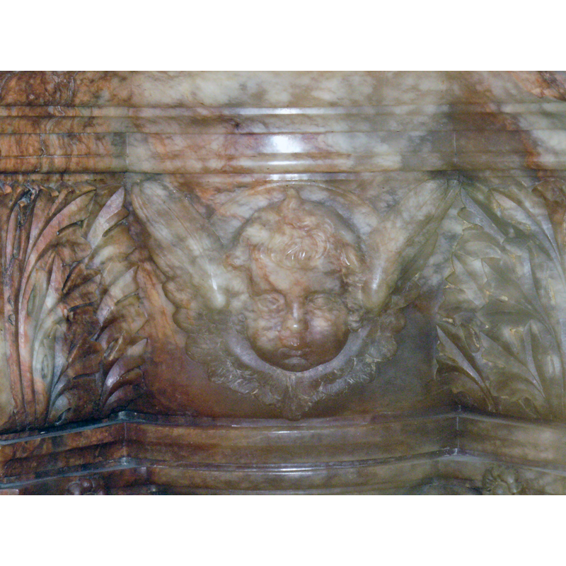
Scene Description: the modern font
Copyright Statement: Image copyright © Colin Smith, 2016
Image Source: digital photograph taken 26 April 2016 by Colin Smith
Copyright Instructions: Image and permission received (e-mail of 13 July 2016)
view of church exterior - north view
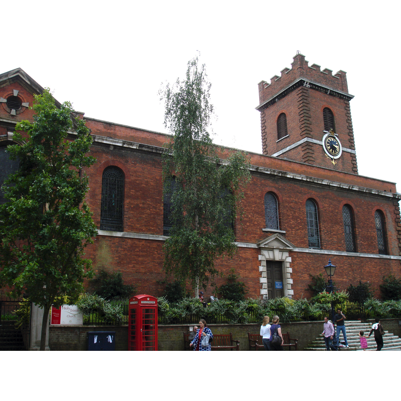
Scene Description: the modern church
Copyright Statement: Image copyright © [in the public domain]
Image Source: digital photograph taken 21 July 2007 by John Armagh [https://en.wikipedia.org/wiki/File:HolyTrinityGuildford.jpg] [accessed 22 August 2015]
Copyright Instructions: PD-Self
view of church interior - detail
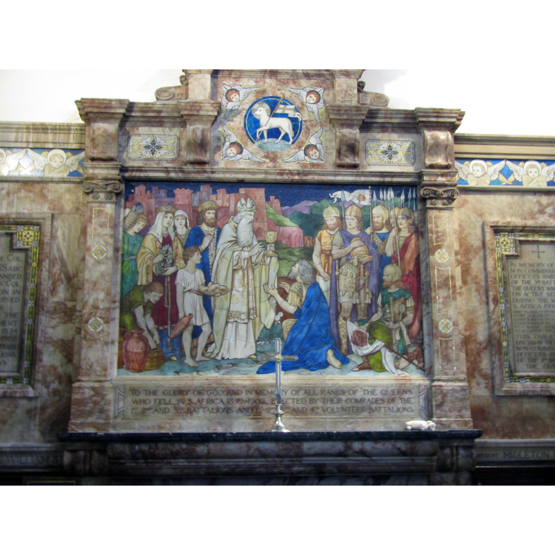
Copyright Statement: Image copyright © Colin Smith, 2023
Image Source: digital photograph 12 September 2022 by Colin Smith
Copyright Instructions: Image and permission received from the author (e-mail of 11 February 2023)
view of church interior - chancel and east end
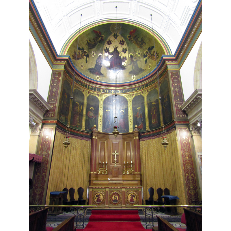
Copyright Statement: Image copyright © Colin Smith, 2023
Image Source: digital photograph 12 September 2022 by Colin Smith
Copyright Instructions: Image and permission received from the author (e-mail of 11 February 2023)
view of church interior - looking west
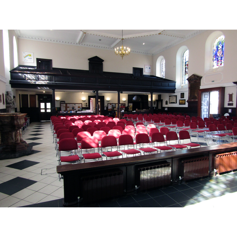
Scene Description: the modern font seen here on the left
Copyright Statement: Image copyright © Colin Smith, 2023
Image Source: digital photograph 12 September 2022 by Colin Smith
Copyright Instructions: Image and permission received from the author (e-mail of 11 February 2023)
view of font and cover in context
Scene Description: the modern font
Copyright Statement: Image copyright © Colin Smith, 2023
Image Source: digital photograph 12 September 2022 by Colin Smith
Copyright Instructions: Image and permission received from the author (e-mail of 11 February 2023)
INFORMATION
Font ID: 16867GUI
Object Type: Baptismal Font1?
Font Date: ca. 1200?
Font Century and Period/Style: 12th - 13th century, Medieval
Church / Chapel Name: Parish Church of the Holy [and Univided] Trinity
Church Patron Saint(s): The Holy Trinity
Church Notes: earliest chapel may have existed here ca. 1200; medieval church collapsed in 1740; new church built in same site
Church Address: High Street, Guildford, Surrey GU1 3HP
Site Location: Surrey, South East, England, United Kingdom
Directions to Site: Located on the S side of High Street
Ecclesiastic Region: Diocese of Guildford [formerly in the Diocese of Winchester]
Historical Region: Hundred of Woking
Additional Comments: disappeared font? / destroyed font? (font from the original ca.1200? church here)
Font Notes:
Click to view
There are seven entries for Guildford [variant spelling] in the Domesday survey [http://opendomesday.org/place/SU9949/guildford/] [accessed 22 August 2015] none of which mentions cleric or church in it. Brayley (1841) notes that the old church, "an ancient structure, which was becoming decayed" was repaired in 1739, but collapsed in 1740; a new church was built and open for worship on 18 September 1763; the font is noted: "a small font of white marble". Brayley (ibid.) includes part of the churchwardens accounts for the year 1512, among which is an expense for new wax used for the font taper and Pascal candle. The Victoria County History (Surrey, vol. 3, 1911) notes: "The old church fell down in 1740 owing to the arches under the tower having been taken away to improve its acoustic properties when the church was repaired in the previous year. The present building, which was erected on the old site (i.e. on the extreme edge of the ancient town) in 1749–63, consists of an apsidal chancel with north and south chapels and a wide aisleless nave with a tower and porches at the west end and a south-west vestry. It is partly modelled upon St. Katherine Coleman, Fenchurch Street. [...] The fragments in the porch under the tower include 12th-century scalloped capitals and mouldings of 13th and 14th-century dates. [...] In 1910 the northwest porch was converted into a baptistery, and an alabaster font has been erected in it." English Heritage [Listing NGR: SU9988149499] (1953) notes: "Font in octagonal baptistry with panelled ceiling to south west corner, adjacent to the tower. Rich Baroque style with red marble bowl on centre stem decorated with cherubs heads and acanthus leafs; domed and composite-columned font cover above." [NB: we have no information on the earlier font, which may have been destroyed in the collapse of the old church].
Credit and Acknowledgements: We are grateful to Colin Smith for his photographs of the church and modern font here
COORDINATES
UTM: 30U 669582 5678866
Latitude & Longitude (Decimal): 51.235929, -0.570753
Latitude & Longitude (DMS): 51° 14′ 9.34″ N, 0° 34′ 14.71″ W
REFERENCES
- Victoria County History [online], University of London, 1993-. URL: https://www.british-history.ac.uk.
- Brayley, Edward Westlake, A topographical history of Surrey, Dorking; London: Robert Best Ede; Tilt and Bogue, 1841, vol. 1: 331-332, 347