Leigh nr. Reigate / Lee / Legh / Leghe / Leygh / Lye / The Lea
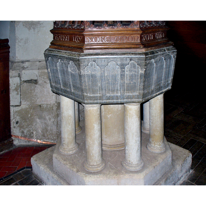
Image copyright © Colin Smith, 2015
Image and permission received (e-mail of 6 June 2015)
Results: 4 records
view of font
Scene Description: showing the inscription on the modern font cover
Copyright Statement: Image copyright © Colin Smith, 2015
Image Source: digital photograph taken 13 May 2015 by Colin Smith
Copyright Instructions: Image and permission received (e-mail of 6 June 2015)
view of church exterior - southeast view
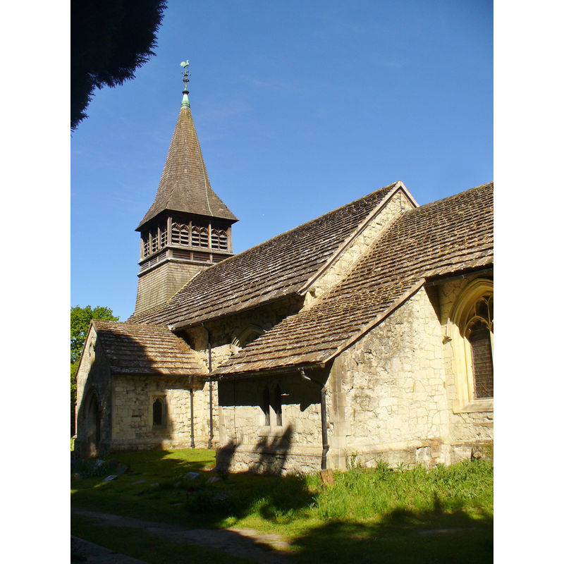
Copyright Statement: Image copyright © Colin Smith, 2015
Image Source: digital photograph taken 13 May 2015 by Colin Smith
Copyright Instructions: Image and permission received (e-mail of 6 June 2015)
view of font and cover in context
![the present font [cf. FontNotes], located at the west end of the nave](/static-50478a99ec6f36a15d6234548c59f63da52304e5/compressed/1150606003_compressed.png)
Scene Description: the present font [cf. FontNotes], located at the west end of the nave
Copyright Statement: Image copyright © Colin Smith, 2015
Image Source: digital photograph taken 13 May 2015 by Colin Smith
Copyright Instructions: Image and permission received (e-mail of 6 June 2015)
view of church interior - nave - looking west
![the font cover is visible at the far [west] end, left [south] side](/static-50478a99ec6f36a15d6234548c59f63da52304e5/compressed/1150606002_compressed.png)
Scene Description: the font cover is visible at the far [west] end, left [south] side
Copyright Statement: Image copyright © Colin Smith, 2015
Image Source: digital photograph taken 13 May 2015 by Colin Smith
Copyright Instructions: Image and permission received (e-mail of 6 June 2015)
INFORMATION
Font ID: 16856LEI
Object Type: Baptismal Font1
Font Century and Period/Style: 13th century, Medieval
Workshop/Group/Artisan: lead font
Church / Chapel Name: Parish Church of St. Bartholomew
Font Location in Church: [cf. FontNotes]
Church Patron Saint(s): St. Bartholomew
Church Notes: original church here before 1202; present building 15thC
Church Address: Village Green / Church Road, Leigh, Surrey RH2 8NJ -- Tel.: +44 1306 611224
Site Location: Surrey, South East, England, United Kingdom
Directions to Site: Located between Reigaite and Dorking, 5 km SE of Reigate
Ecclesiastic Region: Diocese of Southwark
Historical Region: Hundred of Reigate
Additional Comments: disappeared font? (the lead font, no longer in the church in 1911)
Font Notes:
Click to view
No entry for this Leigh found in the Domesday survey. A letter to the editor of The Gentleman's Magazine (issue of June 1828: 489) on the Parish of Leigh, in the Weald of Surrey, notes the church and its font: "The font is a large stone, surmounted by a leaden reservoir." Appears in Allen (1831) described in exactly those words. Brayley (1850) mentions an old gallery at the west end of the nave, "beneath which is the font, a large circular basin, of lead, for immersion." The Victoria County History (Surrey, vol. 3, 1911) notes: "The advowson of the church was granted to the priory of St. Mary Overy, Southwark, by charter of Hamelin de Warenne in 1202; [...] it is not evident when it ceased to belong to this priory, but the church was in the hands of the Prior and convent of Newark next Guildford by 1262 [...] The [present] building is of 15th-century origin, but has been much modernized [...] The font has an octagonal bowl of grey marble with shallow trefoiled panels in 13th-century style, carried on a central stone stem and a cluster of shafts." The entry for this church in English Heritage [Listing NGR: TQ2245346944] (1966) notes: "Octagonal marble font on centre stem with surrounding pillars and three 'shouldered' arched panels on each face", but has nothing on the missing lead basin. [NB: the leaden reservoir must have been removed between 1850 and 1911 -- we have no information on its whereabouts]
Credit and Acknowledgements: We are grateful to Colin Smith for his photographs of this church and its present font
COORDINATES
UTM: 30U 692212 5676635
Latitude & Longitude (Decimal): 51.208726, -0.248154
Latitude & Longitude (DMS): 51° 12′ 31.42″ N, 0° 14′ 53.35″ W
MEDIUM AND MEASUREMENTS
Material: metal, lead (basin)
Font Shape: round
Basin Interior Shape: round
Basin Exterior Shape: round
REFERENCES
- Victoria County History [online], University of London, 1993-. URL: https://www.british-history.ac.uk.
- Allen, Thomas, A History of the County of Surrey ; comprising every object of topographical, geological, or historical interest, London: Isaac Taylor Hinton, 1831, vol. 2: 278
- Brayley, Edward Wedlake, A topographical history of Surrey, London: G. Willis, 1850, vol. 4: 284