Buckland / Bochelant / Bocland / Bockland / Buckland nr. Dorking
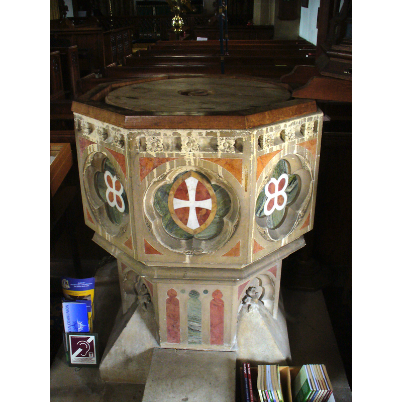
Image copyright © Colin Smith, 2011
CC-BY-SA-2.0
Results: 4 records
view of font
Scene Description: the inner basin of the modern font appears octagonal as well and has an additional cover, plain with a ring handle
Copyright Statement: Image copyright © Colin Smith, 2011
Image Source: digital photograph taken 10 July 2011 by Colin Smith [www.geograph.org.uk/photo/2500506] [accessed 2 June 2015]
Copyright Instructions: CC-BY-SA-2.0
view of church exterior - southwest view
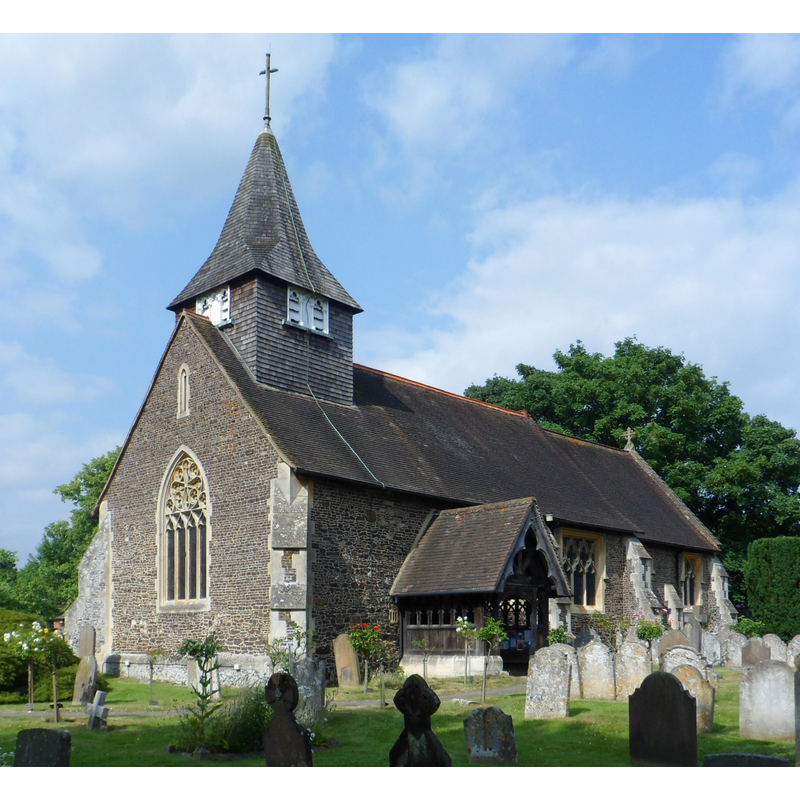
Copyright Statement: Image copyright © The Voice of Hassocks, 2013
Image Source: digital photograph taken 10 July 2013 by The Voice of Hassocks [http://commons.wikimedia.org/wiki/File:St_Mary_the_Virgin's_Church,_Reigate_Road,_Buckland_(NHLE_Code_1378123).JPG] [accessed 2 June 2015]
Copyright Instructions: CC-BY-SA-2.0
view of church interior - nave - looking east
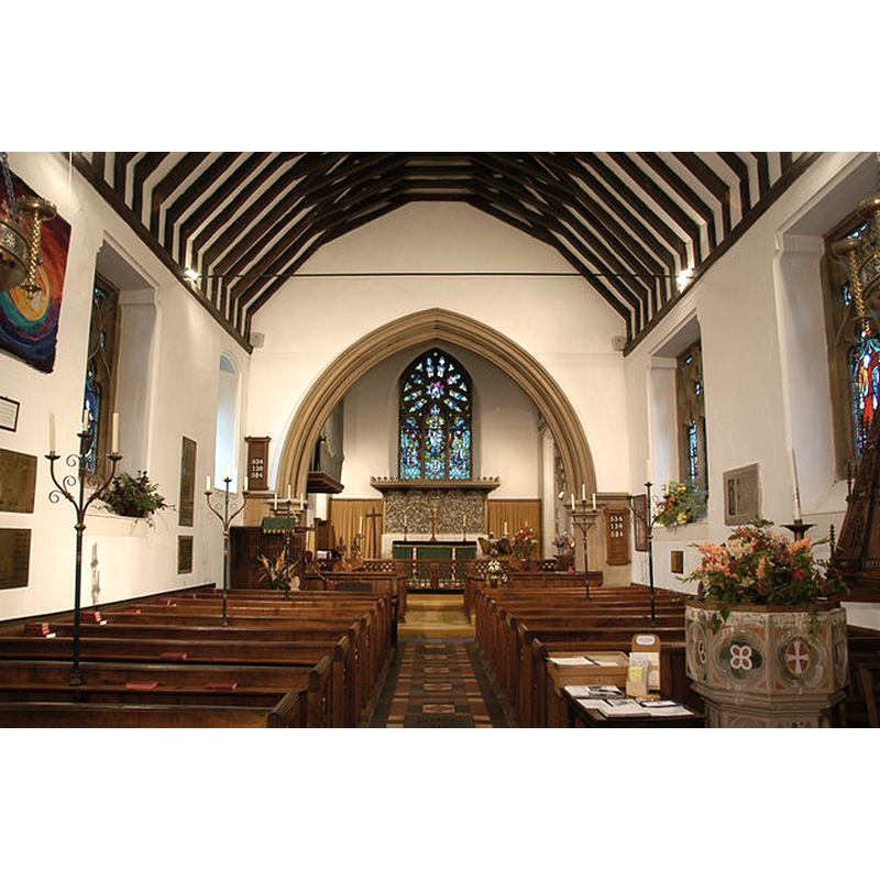
Scene Description: the modern font and its later cover in 2006
Copyright Statement: Image copyright © James Day, 2006
Image Source: digital photograph taken 2 October 2006 by James Day [www.geograph.org.uk/photo/371491] [accessed 2 June 2015]
Copyright Instructions: CC-BY-SA-2.0
view of font and cover in context
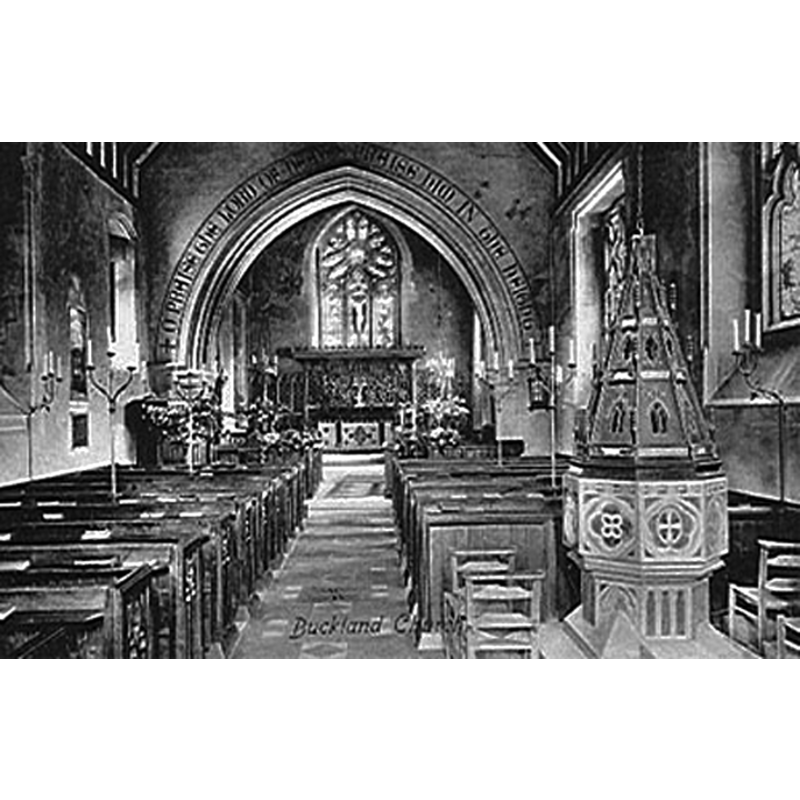
Scene Description: the modern font and its tall cover ca. 1909
Copyright Statement: Image copyright © Buckland Parish, 2010
Image Source: postcard [ca. 1909?] reproduced in the Parish website [http://www.stmarythevirginbuckland.net/resources_history.php] [accessed 12 August 2010]
Copyright Instructions: No known copyright restriction / Fair Dealing
INFORMATION
Font ID: 16855BUC
Object Type: Baptismal Font1?
Font Century and Period/Style: 11th century, Pre-Conquest? / Norman
Church / Chapel Name: Parish Church of St. Mary the Virgin [aka Our Lady's]
Church Patron Saint(s): St. Mary the Virgin
Church Address: Reigate Road, Buckland, Surrey, RH3 7BB
Site Location: Surrey, South East, England, United Kingdom
Directions to Site: Located on the A25, between Dorking and Reigate
Ecclesiastic Region: Diocese of Southwark
Historical Region: Hundred of Reigate [in Domedsday]
Additional Comments: disappeared font? (the one from the Domesday church here)
Font Notes:
Click to view
There is an entry for this Buckland [variant spelling] in the Domesday survey [http://opendomesday.org/place/TQ2250/buckland/] [accessed 2 June 2015]; it mentions a church in it. A font here is noted in Manning & Bray (1804-1818) [cf. infra]. Brayley (1850) notes: "The font is octagonal, plain and neat, with pointed arches: this appears to be the old font, mentioned by Manning and Bray as having been thrown aside in the vestry, and succeeded by a small marble basin on a slender mahogany pillar." The Victoria County History (Surrey, vol. 3, 1911) notes: "The Domesday Survey records the existence of a church at Buckland. (fn. 62) From its foundation it belonged to the manor of Buckland, and was held with it as 'the church of the manor,' until 1567 [...] The church was rebuilt in 1860, and has no architectural details earlier than this date, and all the fittings are modern." The Parish website [www.stmarythevirginbuckland.net/resources_history.php] [accessed 12 August 2010] notes: "The font was referred to by Manning & Bray in 1818 as the ‘old octagonal font in storage’ [...] It is made of various colours of marble. It is suspected that the ornate octagonal ‘spire’ cover was the later work of Hardman in 1860." The same Parish site reproduces a ca. 1909 postcard showing a font and cover in the context of the church interior; the font in this image is modern, octagonal, and appears to match the multi-coloured marble font mentioned in the Parish entry, definitely not an ancient font. The English Heritage entry [Listing NGR: TQ2217750830] (1966) reads: "Solid font of multicoloured marbles inlaid in chalk, red, green and white, of octagonal plan with trefoil and quatrefoil panels on sides. Thick octagonal stem with broach stops forming square plinth, elaborate, crocketed and pierced octagonal plan spired font cover."
COORDINATES
UTM: 30U 692194 5680176
Latitude & Longitude (Decimal): 51.240536, -0.246516
Latitude & Longitude (DMS): 51° 14′ 25.93″ N, 0° 14′ 47.46″ W
REFERENCES
- Castilla y León: paisaje, arte, historia y tradición, León: Edilesa, 1999, Surrey, vol. 3: 173-175 / [www.british-history.ac.uk/vch/surrey/vol3/pp173-175] [accessed 14 December 2015]
- Brayley, Edward Wedlake, A topographical history of Surrey, London: G. Willis, 1850, vol. 4: 262
- Manning, Owen, The History and Antiquities of the County of Surrey, London: [Printed for J. White by J. Nichols], 1804-1814, vol. 5