Betchworth / Beceswrde / Becesuuorde / Becesworde / Bechesworth / East Betchworth
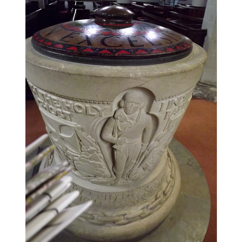
Image copyright © Colin Smith, 2012
Image and permission received (email of 16 July 2012)
Results: 5 records
view of font and cover - side 4
Copyright Statement: Image copyright © Colin Smith, 2012
Image Source: digital photograph taken 29 June 2012 by Colin Smith
Copyright Instructions: Image and permission received (email of 16 July 2012)
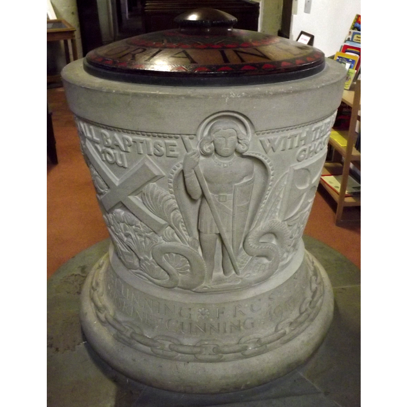
view of font and cover - side 3
Copyright Statement: Image copyright © Colin Smith, 2012
Image Source: digital photograph taken 29 June 2012 by Colin Smith
Copyright Instructions: Image and permission received (email of 16 July 2012)
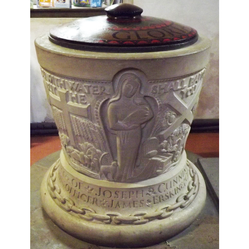
view of font and cover - side 2
Copyright Statement: Image copyright © Colin Smith, 2012
Image Source: digital photograph taken 29 June 2012 by Colin Smith
Copyright Instructions: Image and permission received (email of 16 July 2012)
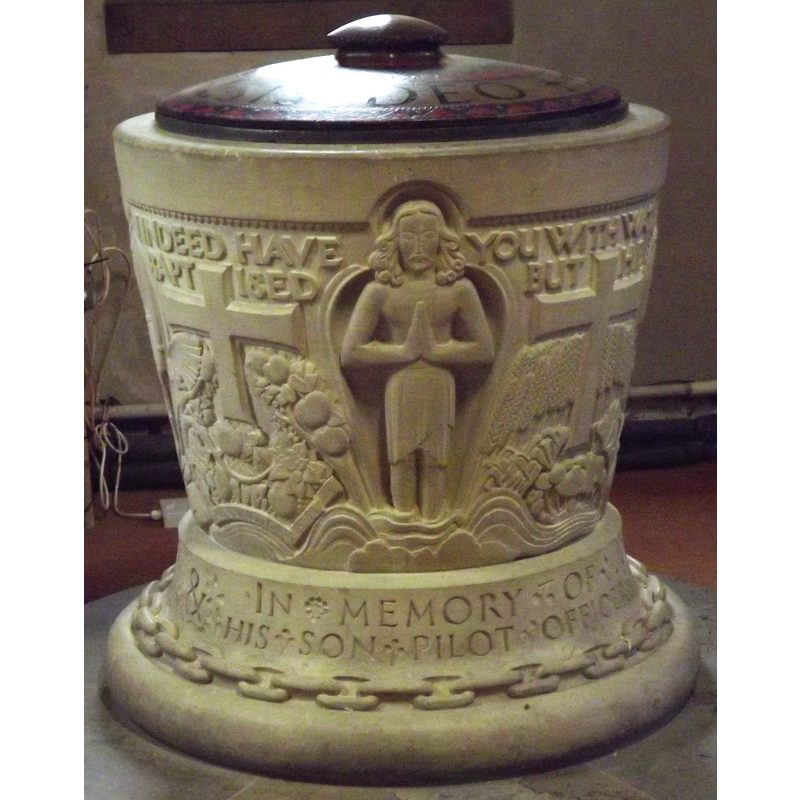
view of font and cover - side 1
Copyright Statement: Image copyright © Colin Smith, 2012
Image Source: digital photograph taken 29 June 2012 by Colin Smith
Copyright Instructions: Image and permission received (email of 16 July 2012)
view of church exterior - northeast view
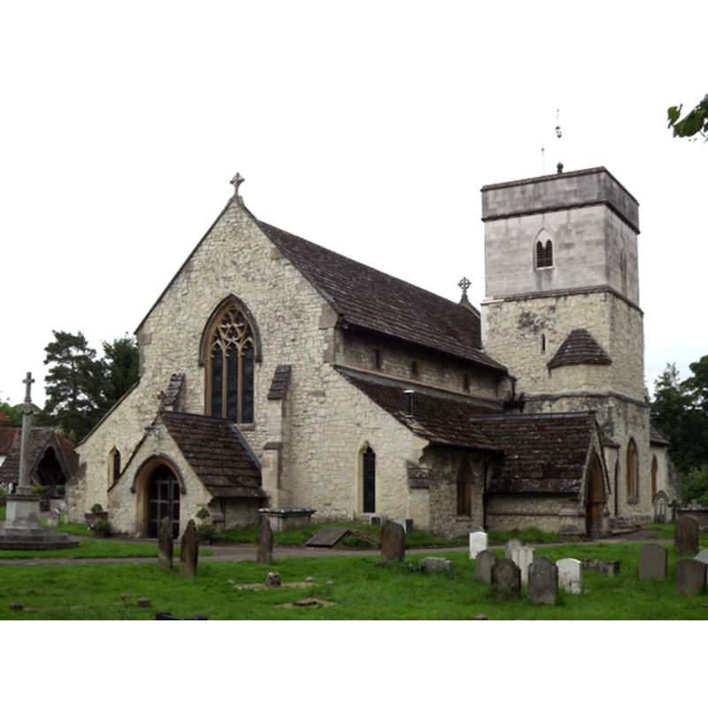
Copyright Statement: Image copyright © Colin Smith, 2012
Image Source: digital photograph taken 29 June 2012 by Colin Smith [www.geograph.org.uk/photo/3017545] [accessed 30 Agust 2012]
Copyright Instructions: Image and permission received (email of 16 July 2012)
INFORMATION
Font ID: 16854BET
Object Type: Baptismal Font1?
Font Century and Period/Style: 11th century, Pre-Conquest? / Norman
Church / Chapel Name: Parish Church of St. Michael
Church Patron Saint(s): St. Michael
Church Address: Church Street, Betchworth, Surrey, RH3 7DW
Site Location: Surrey, South East, England, United Kingdom
Directions to Site: Located off (S) the A25, equidistant, 5 km, from Dorking and Reigate
Ecclesiastic Region: Diocese of Southwark
Historical Region: Hundred of Wotton [in Domesday] -- Hundred of Reigate
Additional Comments: disappeared font? (the fonts from the Domesday-time church here
Font Notes:
Click to view
There are two entries for Betchworth [variant spelling] in the Domesday survey [http://opendomesday.org/place/TQ2149/betchworth/] [accessed 14 December 2015], one of which mentions a church in it. Brayley (1850) remarks: "An old font, merely a basin in a mahogany case, was removed in the summer of 1844; and one of stone, octagonal, with pointed arches, and its three easternmost faces sculptured with different devices, was substituted: it rests on a large circular pillar, and four smaller columns, rising from a square base." The Victoria County History (Surrey, vol. 3, 1911) notes: "From the fact that a church is mentioned in Domesday and that a capital or base of a pre-Conquest shaft is to be seen built into a modern window, [...] it is practically certain that there was a Saxon church, and that of stone." The Parish website [www.stmichaelsbetchworth.net/resources_history.php] [accessed 12 August 2010] notes: "The font is the work of the distinguished sculptor Eric Kennington and was dedicated in 1951. It was given by Mrs. Cunning of Broome Park in memory of her husband, Dr. Joseph Cunning and their only son, Pilot Officer James Erskine Cunning, who was killed in action in 1941." [NB: this modern font has trefoiled niches with Christ, the Madonna and Child, St. George and the dragon, and aviator in uniform, as well as an inscription, wings, etc., on the sides; the font is in the bucket-shaped tub traditional Norman design, but the decoration is modern; the wooden cover is a low dome, also modern].
Credit and Acknowledgements: We are grateful to Colin Smith for his photographs of church and modern font
COORDINATES
UTM: 30U 690705 5679356
Latitude & Longitude (Decimal): 51.233665, -0.268264
Latitude & Longitude (DMS): 51° 14′ 1.19″ N, 0° 16′ 5.75″ W
REFERENCES
- Victoria County History [online], University of London, 1993-. URL: https://www.british-history.ac.uk.
- Brayley, Edward Wedlake, A topographical history of Surrey, London: G. Willis, 1850, vol. 4: 254-255