Tatsfield / Tate Feld / Tatelefelle / Tatelysfeld / Tatlesfeld / Tattelesfeld / Tattesfeld
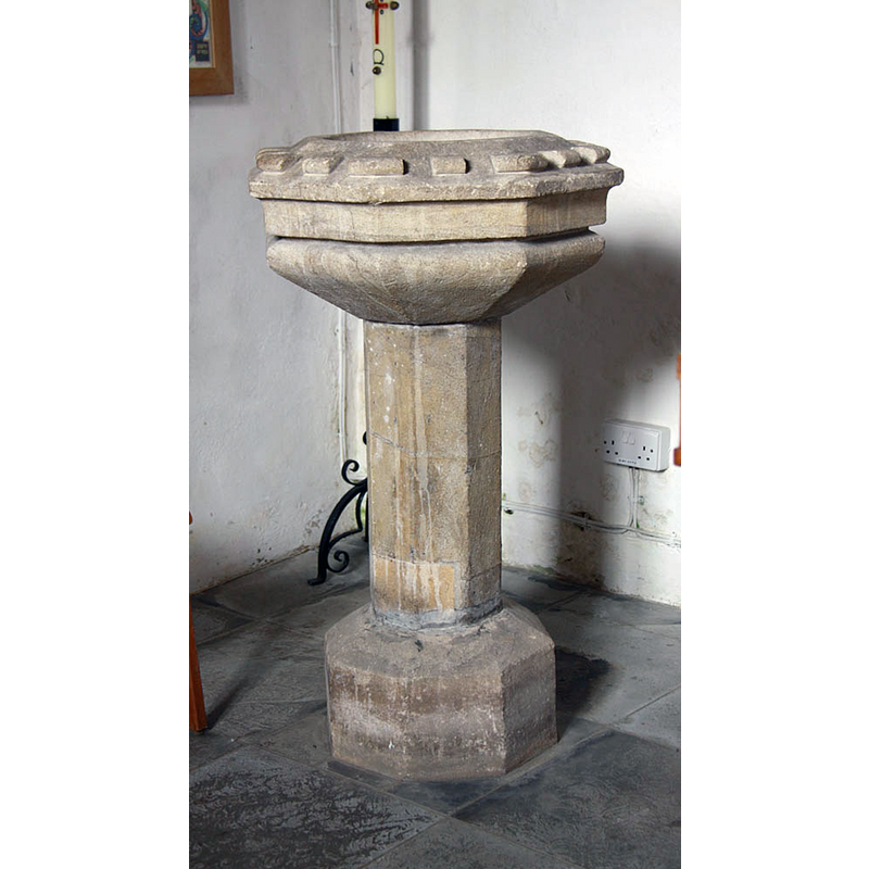
Image copyright © John Salmon, 2010
CC-BY-SA-2.0
Results: 4 records
view of font
Scene Description: the present font [cf. FontNotes]
Copyright Statement: Image copyright © John Salmon, 2010
Image Source: digital photograph taken 3 August 2010 by John Salmon [www.geograph.org.uk/photo/2015435] [accessed 28 March 2016]
Copyright Instructions: CC-BY-SA-2.0
view of church exterior - northeast view
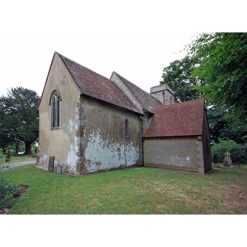
Copyright Statement: Image copyright © John Salmon, 2010
Image Source: digital photograph taken 3 August 2010 by John Salmon [www.geograph.org.uk/photo/2015448] [accessed 28 March 2016]
Copyright Instructions: CC-BY-SA-2.0
view of church exterior - south view
![EXT S digital photograph taken 3 August 2010 by John Salmon [www.geograph.org.uk/photo/2015443] [accessed 28 March 2016]
EXT NE digital photograph taken 3 August 2010 by John Salmon [www.geograph.org.uk/photo/2015448] [accessed 28 March 2016]
INT E digital photograph taken 3 August 2010 by John Salmon [www.geograph.org.uk/photo/2015460] [accessed 28 March 2016]
FONT digital photograph taken 3 August 2010 by John Salmon [www.geograph.org.uk/photo/2015435] [accessed 28 March 2016]](/static-50478a99ec6f36a15d6234548c59f63da52304e5/compressed/1160328008_compressed.png)
Scene Description: EXT S digital photograph taken 3 August 2010 by John Salmon [www.geograph.org.uk/photo/2015443] [accessed 28 March 2016]
EXT NE digital photograph taken 3 August 2010 by John Salmon [www.geograph.org.uk/photo/2015448] [accessed 28 March 2016]
INT E digital photograph taken 3 August 2010 by John Salmon [www.geograph.org.uk/photo/2015460] [accessed 28 March 2016]
FONT digital photograph taken 3 August 2010 by John Salmon [www.geograph.org.uk/photo/2015435] [accessed 28 March 2016]
Copyright Statement: Image copyright © John Salmon, 2010
Image Source: digital photograph taken 3 August 2010 by John Salmon [www.geograph.org.uk/photo/2015443] [accessed 28 March 2016]
Copyright Instructions: CC-BY-SA-2.0
view of church interior - nave - looking east
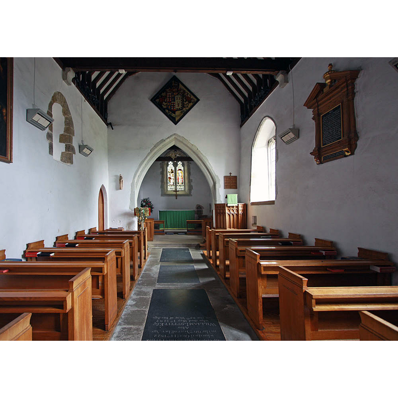
Copyright Statement: Image copyright © John Salmon, 2010
Image Source: digital photograph taken 3 August 2010 by John Salmon [www.geograph.org.uk/photo/2015460] [accessed 28 March 2016]
Copyright Instructions: CC-BY-SA-2.0
INFORMATION
Font ID: 16852TAT
Object Type: Baptismal Font1
Font Century and Period/Style: 15th century / 19th century, Medieval? / Modern?
Church / Chapel Name: Parish Church of St. Mary the Virgin
Font Location in Church: Inside the church
Church Patron Saint(s): St. Mary the Virgin
Church Address: Tatsfield, Surrey TN16 2JX
Site Location: Surrey, South East, England, United Kingdom
Directions to Site: Located off (W) the A233, just N of Limpsfield and the county border with Kent, 15 km SE of Croydon
Ecclesiastic Region: Diocese of Southwark
Historical Region: Hundred of Tandridge
Additional Comments: disappeared font? (the one from the 11thC church here)
Font Notes:
Click to view
There is an entry for Tatsfield [variant spelling] in the Domesday survey [http://opendomesday.org/place/TQ4257/tatsfield/] [accessed 28 March 2016], but it mentions neither cleric nor church in it. Brayley (1850) writes: "The font is a small rude, octagonal stone basin, supported by a pillar in the centre." The Victoria County History (Surrey, vol. 4, 1912) notes: "The church is of unknown dedication. [...] There was probably a church here in the 11th century. The nave is certainly at least as old as c. 1075 [...] All the seating and other fittings, including the communion rails and font, are modern. The font existing in 1720 had a 'stone bason sunk within a square pedestal.'" [NB: the VCH gives the dedication of the church as unknown]. The HER databse [www.exploringsurreyspast.org.uk/GetRecord/SHHER_11059] [accessed 12 August 2010] gives the dedication of the church as St. Mary the Virgin, and describes the present font: "Stone font, bowl on stem with billet type decoration on top." [NB: the two fonts mentioned in these sources may be one and the same; an unidentified local source claims the present font, with a plain square basin, is late-Medieval; we have no information on the whereabouts of the earlier font]
COORDINATES
UTM: 31U 292942 5685865
Latitude & Longitude (Decimal): 51.286417, 0.030577
Latitude & Longitude (DMS): 51° 17′ 11.1″ N, 0° 1′ 50.08″ E
MEDIUM AND MEASUREMENTS
Material: stone
Font Shape: square, mounted
Basin Exterior Shape: square
REFERENCES
- Victoria County History [online], University of London, 1993-. URL: https://www.british-history.ac.uk.
- Brayley, Edward Wedlake, A topographical history of Surrey, London: G. Willis, 1850, vol. 4: 201