Horne nr. Godstone
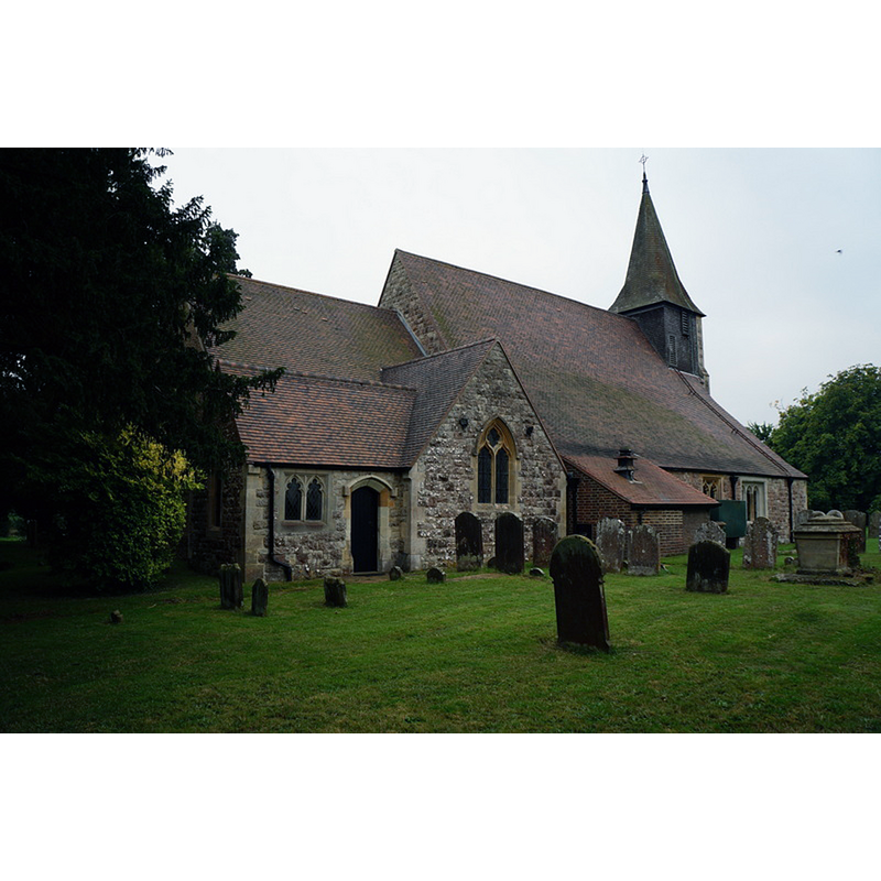
Image copyright © Ian S, 2013
CC-BY-SA-2.0
Results: 4 records
view of church exterior - northeast view
Copyright Statement: Image copyright © Ian S, 2013
Image Source: digital photograph taken 1 October 2013 by Ian S [www.geograph.org.uk/photo/3691260] [accessed 24 March 2016]
Copyright Instructions: CC-BY-SA-2.0
view of church exterior - southwest view
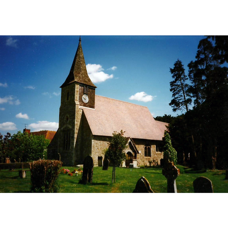
Copyright Statement: Image copyright © Roger Smith, 2010
Image Source: photograph taken 3 June 1996 by Roger Smith [www.geograph.org.uk/photo/2205466] [accessed 24 March 2016]
Copyright Instructions: CC-BY-SA-2.0
angel - in a quatrefoil - 2
![[cf. Font notes]](/static-50478a99ec6f36a15d6234548c59f63da52304e5/others/image_not_available.jpg)
Scene Description: [cf. Font notes]
![[cf. Font notes]](/static-50478a99ec6f36a15d6234548c59f63da52304e5/bsi-testing-site/others/image_not_available.jpg)
design element - motifs - floral - in a quatrefoil - 6
Scene Description: [cf. Font notes]
INFORMATION
Font ID: 16845HOR
Object Type: Baptismal Font1
Font Century and Period/Style: 15th century, Perpendicular
Church / Chapel Name: Parish Church of St. Mary the Virgin
Font Location in Church: Inside the church, by the entranceway
Church Patron Saint(s): St. Mary the Virgin
Church Address: Church Road, Horne, Surrey RH6 9LA
Site Location: Surrey, South East, England, United Kingdom
Directions to Site: Located off (E) the A22, W of Godstone, ENE of Gatwick Airport
Ecclesiastic Region: Diocese of Southwark
Historical Region: Hundred of Tandridge
Additional Comments: disappeared font? (the one from the 12th-13thC church here)
Font Notes:
Click to view
No individuaj entry found in the Domesday survey. Allen (1831) writes: "There is an ancient octagon font, with roses and quatrefoils on the sides, in two of which is the representation of an angel, his hands held up and nearly joined, as if holding a sheld, but none remains." In Brayley (1850): "Near the entrance is an ancient octagonal stone font, ornamented with quatrefoils, &c., within square panels; in two of which are rude figures of angels; and, in the other six, various devices of flowers, &c." The Victoria County History (Surrey, vol. 4, 1912) notes: "Unfortunately a drastic restoration in 1880, when the north aisle and organ chamber were added and the spire and porch rebuilt, robbed the building of almost all its archaeological interest and completely destroyed its early history. The oldest feature now remaining is the south doorway, which dates from the middle of the 13th century, but this may possibly have been inserted in the walls of a 12th-century nave. [...] the font is of 15th-century date. The bowl is octagonal, with a quatrefoil panel in each face, in the middle of each of which is a conventional leaf or flower, and stands on an octagonal stem having a small chamfered base. The connecting piece between the bowl and the stem is unmoulded, being simply chamfered, with a small bowtel at the necking, but has carved on its four eastern faces naturalistic leaves in the following order: on the south-east, three oak leaves; the east, three horse-chestnut leaves; on the north-east, five ivy leaves; and on the north three oak leaves." [NB: there is no menton of angels in the VCH entry].
COORDINATES
UTM: 30U 703429 5674217
Latitude & Longitude (Decimal): 51.183125, -0.089153
Latitude & Longitude (DMS): 51° 10′ 59.25″ N, 0° 5′ 20.95″ W
MEDIUM AND MEASUREMENTS
Material: stone
Font Shape: octagonal, mounted
Basin Interior Shape: round
Basin Exterior Shape: octagonal
REFERENCES
- Victoria County History [online], University of London, 1993-. URL: https://www.british-history.ac.uk.
- Allen, Thomas, A History of the County of Surrey ; comprising every object of topographical, geological, or historical interest, London: Isaac Taylor Hinton, 1831, vol. 2: 86
- Brayley, Edward Wedlake, A topographical history of Surrey, London: G. Willis, 1850, vol. 4: 149