Sutton / Sudtone / Sutton-by-Cheam / Sutton Common, Sutton New Town
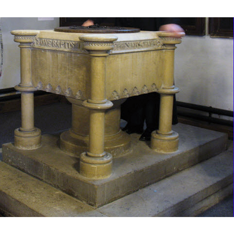
Image copyright © Stephen Craven, 2008
CC-BY-SA-2.0
Results: 3 records
view of font and cover
Scene Description: the modern font
Copyright Statement: Image copyright © Stephen Craven, 2008
Image Source: edited detail of a digital photograph taken 26 August 2008 by Stephen Craven [www.geograph.org.uk/photo/938031] [accessed 21 March 2016]
Copyright Instructions: CC-BY-SA-2.0
view of church exterior - southwest end
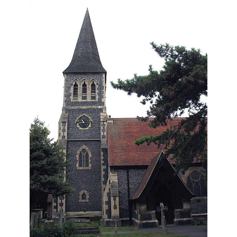
Scene Description: Source caption: "St Nicholas is the town centre Anglican church in Sutton, though in ecumenical partnership with other denominations and in a Team Ministry with other Anglican churches. The present building, which is listed, was designed by Edwin Nash and opened in 1864, but on a site that has been used as a church since Saxon times. It is difficult to photograph the entire building as it is hemmed in by trees and other buildings. This is the south side."
Copyright Statement: Image copyright © Stephen Craven, 2008
Image Source: digital photograph taken 26 August 2008 by Stephen Craven [www.geograph.org.uk/photo/938023] [accessed 21 March 2016]
Copyright Instructions: CC-BY-SA-2.0
view of church interior - nave - looking east
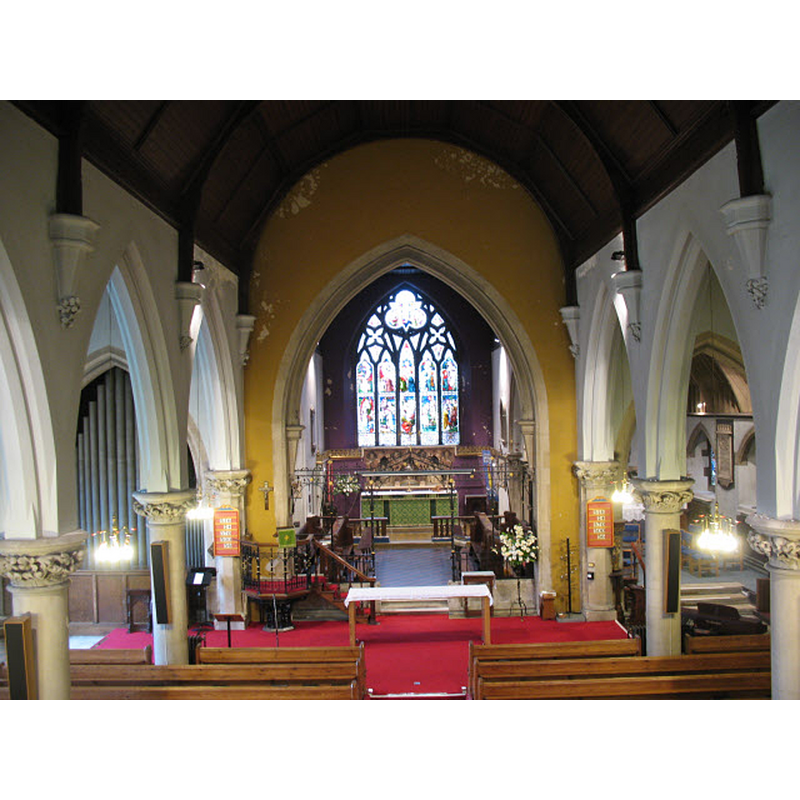
Copyright Statement: Image copyright © Stephen Craven, 2008
Image Source: digital photograph taken 26 August 2008 by Stephen Craven [www.geograph.org.uk/photo/938028] [accessed 21 March 2016]
Copyright Instructions: CC-BY-SA-2.0
INFORMATION
Font ID: 16842SUT
Object Type: Baptismal Font1?
Church / Chapel Name: Parish Church of St. Nicholas
Church Patron Saint(s): St. Nicholas of Myra
Church Address: St Nicholas Way, Sutton, Greater London SM1 2RG
Site Location: Greater London, South East, England, United Kingdom
Directions to Site: Located just NE Cheam, 17 km SW of Charing Cross, in the London borough of Sutton
Ecclesiastic Region: Diocese of Southwark
Historical Region: Hundred of Wallington -- formerly in Surrey
Additional Comments: disappeared fonts? (the ones from the two Domesday-time churches here)
Font Notes:
Click to view
There is an entry for Sutton[-by-Cheam] [variant spelling] in the Domesday survey [http://opendomesday.org/place/TQ2563/sutton-by-cheam/] [accessed 21 March 2016]; it reports two churches in it. Brayley (1850) reports: "A small stone font, or basin, is in one of the pews, near the vestry." The Victoria County History (Surrey, vol. 4, 1912) notes: "In the Domesday Survey two churches are mentioned on the manor [...] The church of ST. NICHOLAS, rebuilt in the year 1862"; no font mentioned in the VCH entry. [NB: the medieval church was demolished in 1860 and a new building erected soon thereafter; the font Brayley reports would have been 17th-century or later, most likely, perhaps even from the Commonwealth times (1649), when many medieval fonts were replaced by simple basins; the present font is modern; we have no information on the medieval font]
COORDINATES
UTM: 30U 695288 5693903
Latitude & Longitude (Decimal): 51.362769, -0.194736
Latitude & Longitude (DMS): 51° 21′ 45.97″ N, 0° 11′ 41.05″ W
REFERENCES
- Victoria County History [online], University of London, 1993-. URL: https://www.british-history.ac.uk.
- Brayley, Edward Wedlake, A topographical history of Surrey, London: G. Willis, 1850