Morden nr. London / Mordon / Mordone / Mordune
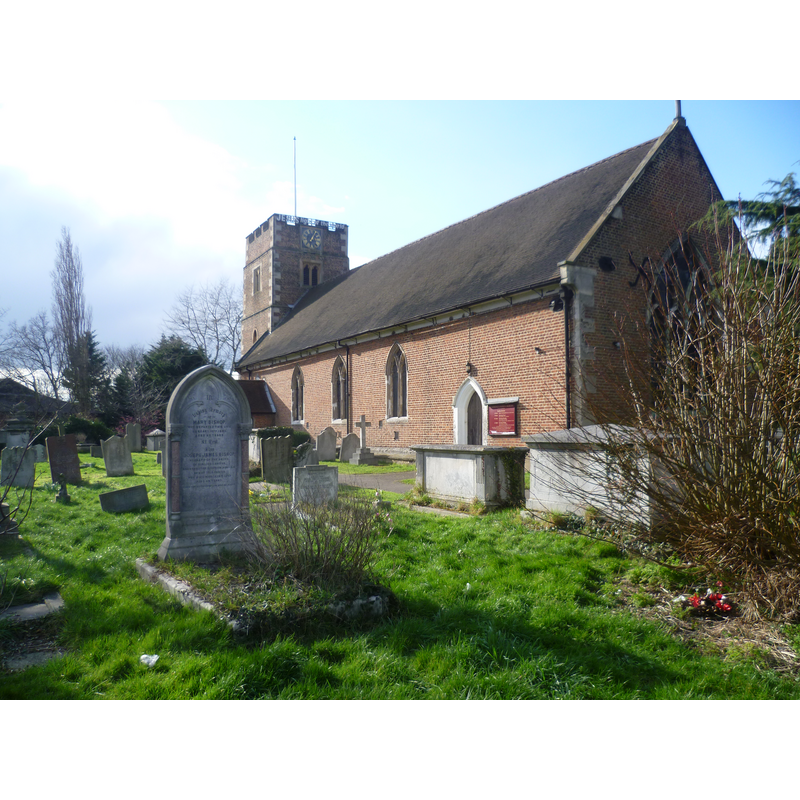
Image copyright © Marathon, 2013
CC-BY-SA-2.0
Results: 4 records
view of church exterior - southeast view
Scene Description: Source caption: "St Lawrence Church, Morden. The parish of Morden was one of the smallest of the ancient Surrey parishes. It centred on the parish church of St Lawrence. A church was recorded there in the early 13th century and one may have existed in late Saxon times. It was substantially refurbished in 1636 when the nave was refaced in brick and the tower was rebuilt. This was just before the Civil War and not a common time for church building. This is the view from London Road (A24)."
Copyright Statement: Image copyright © Marathon, 2013
Image Source: digital photograph taken 13 March 2013 by Marathon [www.geograph.org.uk/photo/3369378] [accessed 21 March 2016]
Copyright Instructions: CC-BY-SA-2.0
view of church exterior - southeast view
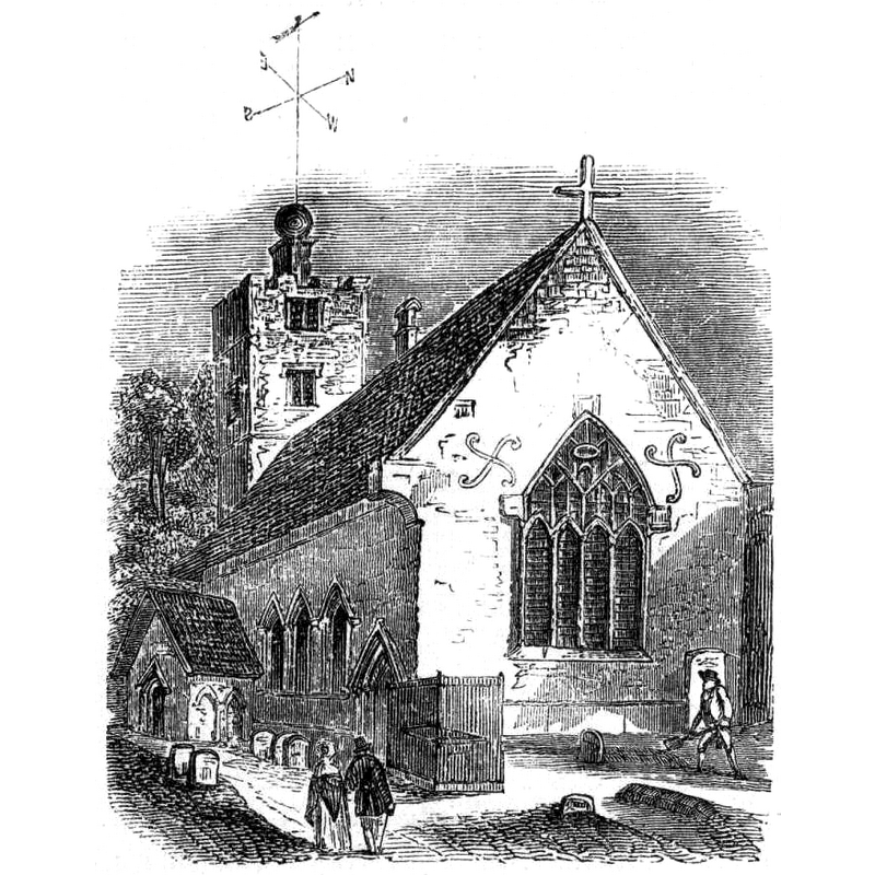
Copyright Statement: Image copyright © [in the public domain]
Image Source: drawing in the Illustrated London News, Issue 487, 24 May 1851, page 443 [https://commons.wikimedia.org/wiki/File:St_Lawrence_Church,_Morden,_1851.png] [accessed 21 March 2016]
Copyright Instructions: PD UK
view of church interior - nave - looking east
![Source caption: "St Lawrence church, Morden: interior [...] The church has a well kept 17th century interior although the pulpit with tester board dates from 1720, and the pews and stone monuments are 19th century."](/static-50478a99ec6f36a15d6234548c59f63da52304e5/compressed/1160321008_compressed.png)
Scene Description: Source caption: "St Lawrence church, Morden: interior [...] The church has a well kept 17th century interior although the pulpit with tester board dates from 1720, and the pews and stone monuments are 19th century."
Copyright Statement: Image copyright © Stephen Craven, 2015
Image Source: digital photograph taken 22 January 2015 by Stephen Craven [www.geograph.org.uk/photo/4321096] [accessed 21 March 2016]
Copyright Instructions: CC-BY-SA-2.0
design element - motifs - quatrefoil


INFORMATION
Font ID: 16840MOR
Object Type: Baptismal Font1?
Font Century and Period/Style: Medieval
Church / Chapel Name: Parish Church of St. Lawrence
Church Patron Saint(s): St. Lawrence [aka Laurence]
Church Address: London Road, Morden, Merton, Greater London SM4 5HE
Site Location: Greater London, South East, England, United Kingdom
Directions to Site: Located sanwiched between the A24 and the A297, just WSW of Mitcham, 16 km SW of central London, in the London borough of Merton
Ecclesiastic Region: Diocese of Southwark
Historical Region: formerly Surrey
Additional Comments: disappeared fonts? (one from the original 13thC (?) church here; another as reported in Allen [cf. infra])
Font Notes:
Click to view
There is an entry for this Morden [variant spelling] in the Domesday survey [http://opendomesday.org/place/TQ2567/morden/] [accessed 21 March 2016], but it mentions neither cleric nor church in it. Lysons (1792) writes: "The church, which is dedicated to St. Lawrence, is built of brick, and consists of a nave and chancel, which are of the same height, and separated only by a raised step in the floor. At the west end is a low tower. The present structure was erected about the year 1636. The windows, which are of stone, and of Gothic architecture, appear to have belonged to the old church. The font nearly resembles that at Mitcham, but the workmanship is not so rich." Allen (1831) notes: "The font nearly resembles that at Mitcham, but the workmanship is not so rich." The Mirror of Literature, Amusement, and Instruction (vol. 2, no. 19, 9 November 1844: 301) reports: "a new and elegant stone font, of an octagonal form, with quatre [sic] ornaments, sunk in the panel, supported by a pedestal, The font was executed by Mr. Legran, a pupil of Chantrey's." Brayley (1850) reports also a modern font described much as in The Mirror... above, with quatrefoil decoration, and gives the artist's name as "Mr. James Legrew". The Victoria County History (Surrey, vol. 4, 1912) notes: "The advowson of the church belonged with the manor to the Abbot and convent of Westminster. In 1283 the abbey attempted the appropriation of the church, but did not complete it until 1300. [...] The church was entirely rebuilt in the year 1636 [...] The font is modern." [NB: Lysons [cf. supra] does not give a date for the font, but his comparison with the one at nearby Mitcham would indicate that it was late-Medieval; we have no information on the whereabouts of that font, or of its predecessor, the original font of the medieval church here]
COORDINATES
UTM: 30U 694505 5697156
Latitude & Longitude (Decimal): 51.39225, -0.204197
Latitude & Longitude (DMS): 51° 23′ 32.1″ N, 0° 12′ 15.11″ W
REFERENCES
- Victoria County History [online], University of London, 1993-. URL: https://www.british-history.ac.uk.
- Allen, Thomas, A History of the County of Surrey ; comprising every object of topographical, geological, or historical interest, London: Isaac Taylor Hinton, 1831, vol. 2: 337
- Frend, William H.C., "A Deposit of Roman Lead from North Lodge Farm, Barnwell, Northants.", 25, Britannia, 1994, pp. 224-226; vol. 4: 98
- Lysons, Daniel, The Environs of London, being an historical account of the towns, villages, and hamlets, within twelve miles of that capital, London: printed by A. Strahan for T. Cadell, Jun. and W. Davies, 1795-1796, [http://www.british-history.ac.uk/report.aspx?compid=45384] [accessed 9 August 2010]