Chiddingfold / Chedelingefelt / Chidingefalde / Chudyngfold
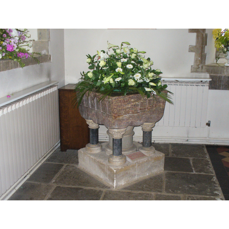
Image copyright © Colin Smith, 2011
Standing permission
Results: 2 records
view of font
Scene Description: the late-Victorian font
Copyright Statement: Image copyright © Colin Smith, 2011
Image Source: digital photograph taken May 2011 by Colin Smith
Copyright Instructions: Standing permission
view of church exterior - southwest view
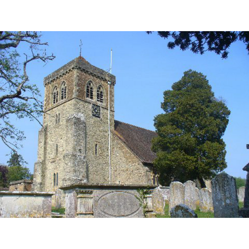
Copyright Statement: Image copyright © Colin Smith, 2011
Image Source: digital photograph taken May 2011 by Colin Smith
Copyright Instructions: Standing permission
INFORMATION
Font ID: 16829CHI
Object Type: Baptismal Font1
Font Century and Period/Style: 13th century, Early English
Church / Chapel Name: Parish Church of St. Mary
Font Location in Church: Inside the church
Church Patron Saint(s): St. Mary the Virgin
Church Address: Petworth Road, Chiddingfold, Surrey, GU8 4QA
Site Location: Surrey, South East, England, United Kingdom
Directions to Site: Located off (W) the A283, S of Hambledon
Ecclesiastic Region: Diocese of Guildford
Historical Region: Hundred of Godalming
Additional Comments: disappeared font? (the one from the pre-Conquest church?) -- disused font (the 13th-century font)
Font Notes:
Click to view
No entry found for Chiddingfold in the Domesday survey. Allen (1831) notes: "The font is a round basin, on a pillar of Sussex marble." Noted in Brayley (1850): "The font is a plain but massive basin, of Sussex marble, standing on a circular column and base of the same material." The Victoria County History (Surrey, vol. 3, 1911) reports: "The church is not mentioned in the Domesday Survey. Chiddingfold was then parochially part of Godalming, of which it was later a chapelry. It was in existence late in the 12th century, for circa 1180 Ralph de Lechlade granted the church of Chiddingfold with the chapel of Piperham (i.e. Haslemere) to his clerk, Geoffrey de Lechlade, to hold for an annual pension of 1 lb. of wax; and a vicar was instituted in 1185. [...] There is some possibility that the nave occupies the same area as a pre-Conquest original, and that portions of its quoins remain in the piers at the angles [...] The early church would appear to have remained till the end of the 12th century, when aisles were added to the nave, and the forerunners of the present arcades were pierced through the older walls. [...] There is a 13th-century font, disused, besides the modern one." [NB: the VCH (ibid.) notes that the original church dated to pre-Conquest dates, but we have no information on its font] [NB: the modern font is a square table-top basin raised on five columnar supports, a late-Victorian imitation of a classic Norman font design; it has a pyramidal wooden cover probably of the same date]
Credit and Acknowledgements: We are grateful to Colin Smith for his photograph of the church and its modern font
COORDINATES
UTM: 30U 665917 5664654
Latitude & Longitude (Decimal): 51.109323, -0.629766
Latitude & Longitude (DMS): 51° 6′ 33.56″ N, 0° 37′ 47.16″ W
MEDIUM AND MEASUREMENTS
Material: stone, marble (Sussex)
Font Shape: round, mounted
Basin Interior Shape: round
Basin Exterior Shape: round
REFERENCES
- Victoria County History [online], University of London, 1993-. URL: https://www.british-history.ac.uk.
- Allen, Thomas, A History of the County of Surrey ; comprising every object of topographical, geological, or historical interest, London: Isaac Taylor Hinton, 1831, vol. 2: 77
- Brayley, Edward Wedlake, A topographical history of Surrey, London: G. Willis, 1850, vol. 5: 247