Puttenham / Potenham / Putenham / Reddesolham? / Redessolham? / Rodsall?
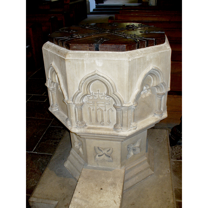
Image copyright © Colin Smith, 2015
Image and permission received (e-mail of 7 April 2015)
Results: 7 records
view of font and cover - west side
Scene Description: the modern font
Copyright Statement: Image copyright © Colin Smith, 2015
Image Source: digital photograph taken 8 February 2015 by Colin Smith
Copyright Instructions: Image and permission received (e-mail of 7 April 2015)
view of font and cover - north side
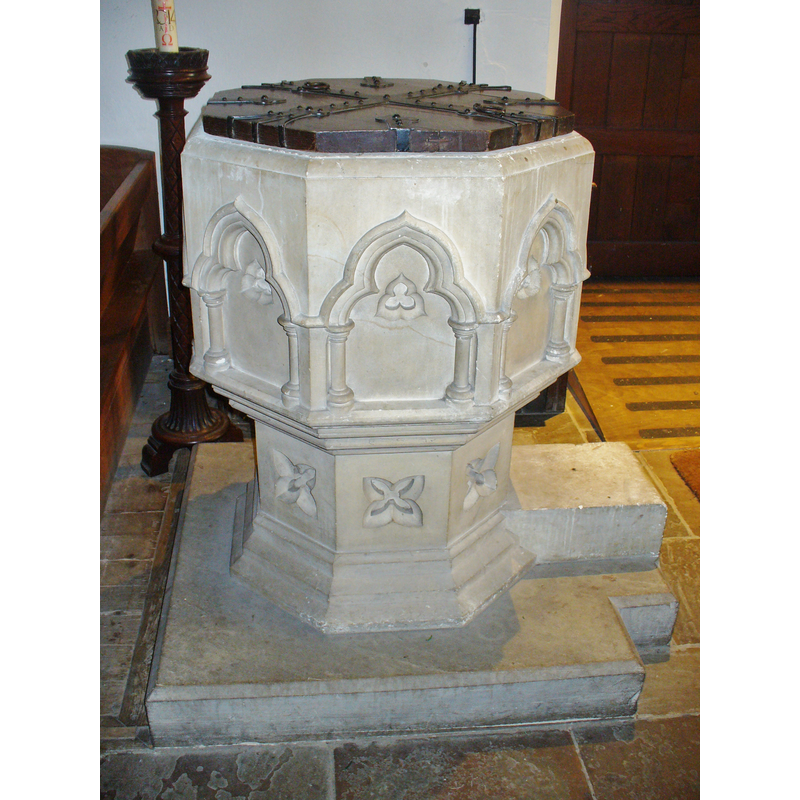
Scene Description: the modern font
Copyright Statement: Image copyright © Colin Smith, 2015
Image Source: digital photograph taken 8 February 2015 by Colin Smith
Copyright Instructions: Image and permission received (e-mail of 7 April 2015)
view of church exterior - west view
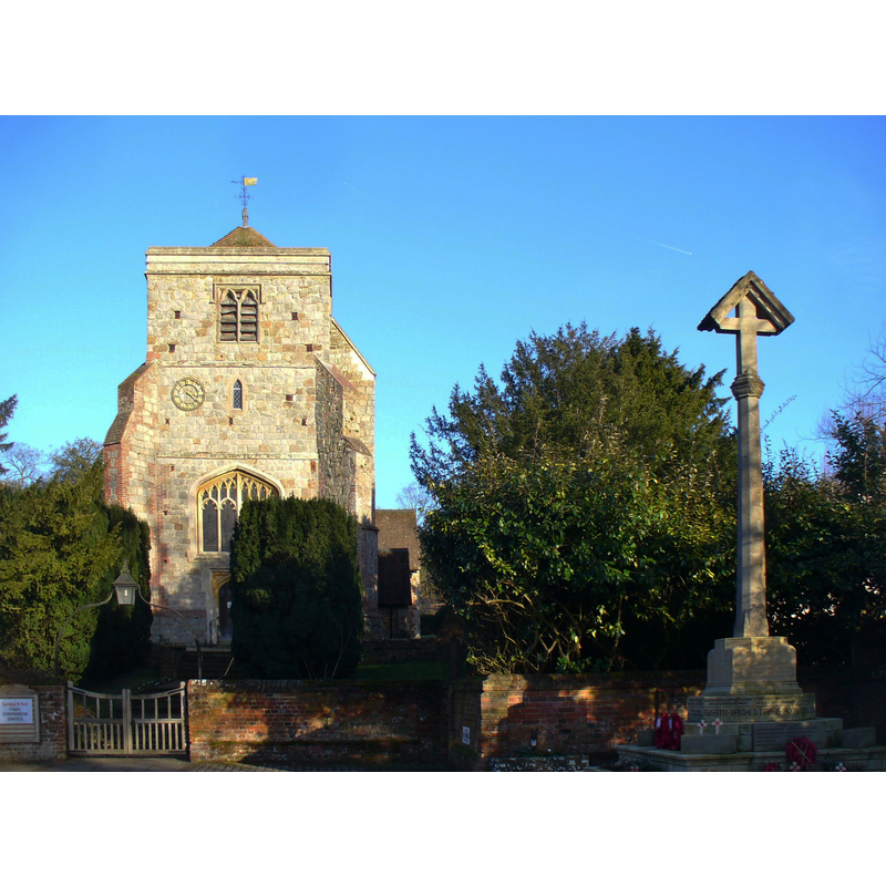
Copyright Statement: Image copyright © Colin Smith, 2015
Image Source: digital photograph taken 8 February 2015 by Colin Smith
Copyright Instructions: Image and permission received (e-mail of 7 April 2015)
view of church exterior - north view
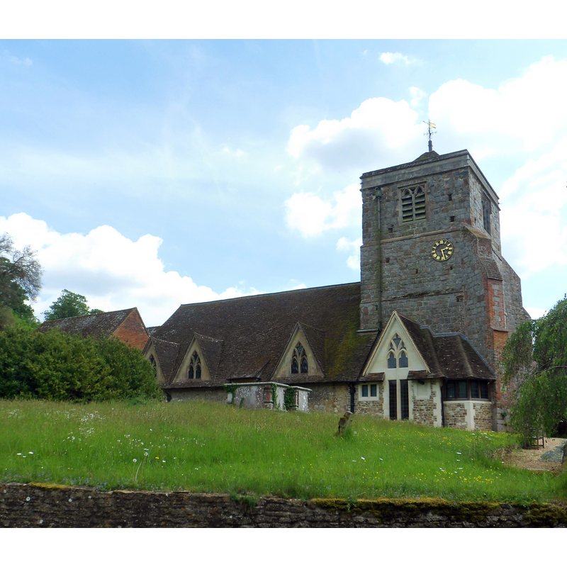
Copyright Statement: Image copyright © [in the public domain]
Image Source: digital photograph taken 16 May 2014 by Hassocks5489 [http://commons.wikimedia.org/wiki/File:St_John_the_Baptist's_Church,_The_Street,_Puttenham_(May_2014)_(1).JPG] [accessed 20 April 2015]
Copyright Instructions: CC-Zero
view of font and cover in context
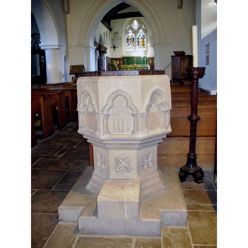
Scene Description: the modern font
Copyright Statement: Image copyright © Colin Smith, 2015
Image Source: digital photograph taken 8 February 2015 by Colin Smith
Copyright Instructions: Image and permission received (e-mail of 7 April 2015)
view of church interior - chancel
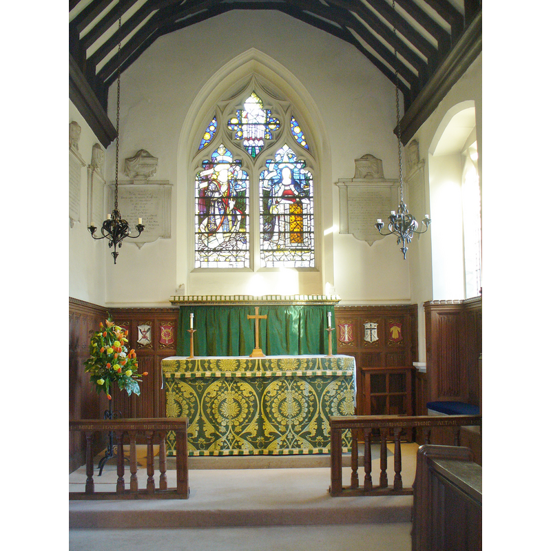
Copyright Statement: Image copyright © Colin Smith, 2015
Image Source: digital photograph taken 8 February 2015 by Colin Smith
Copyright Instructions: Image and permission received (e-mail of 7 April 2015)
view of church interior - nave - looking east
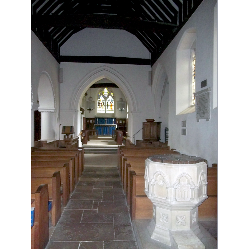
Scene Description: with the modern font in the foreground
Copyright Statement: Image copyright © Simon Burchell, 2013
Image Source: digital photograph taken 2 March 2013 by Simon Burchell [http://commons.wikimedia.org/wiki/File:St_John_the_Baptist_Church,_Puttenham,_Surrey_4.JPG] [accessed 20 April 2015]
Copyright Instructions: CC-BY-SA-3.0
INFORMATION
Font ID: 16828PUT
Object Type: Baptismal Font1
Font Date: ca. 1200?
Font Century and Period/Style: 12th - 13th century, Medieval
Church / Chapel Name: Parish Church of St. John the Baptist
Font Location in Church: [cf. FontNotes]
Church Patron Saint(s): St. John the Baptist
Church Address: 34 The Street, Puttenham, Surrey GU3 1AR
Site Location: Surrey, South East, England, United Kingdom
Directions to Site: Located 7 km W of Guilford, 9 km E of Farnham
Ecclesiastic Region: Diocese of Guildford [formerly in the Diocese of Winchester]
Historical Region: Hundred of Godalming
Additional Comments: disappeared font? (the one from the ca. 1200 church here?)
Font Notes:
Click to view
[NB: not clear whether the Domesday entry [Folio 31v] for Rodsall [aka Reddesolham / Redessolham] should be identified with this Puttenham, or it referred only to a hamlet of Puttenham named Rodsall, as indicated in Henshall & Wilkinson (1799) -- in any case, the Domesday entry [http://opendomesday.org/place/SU9245/rodsall/] [accessed 20 April 2015] mentions neither cleric nor church in it]. Allen (1831) does not mention a font in this church. Brayley (1850) notes: "The font is of a square form, of freestone." The Victoria County History (Surrey, vol. 3, 1911) reports that the church goes back to 1200 [or earlier], and notes the font as modern, "the successor of that described in Manning and Bray's Surr. as 'of a square form, of freestone.'" [i.e., Owen Manning & William Bray, The history and antiquities of the county of Surrey, 1804-1814]. The British Listed Buildings database [www.britishlistedbuildings.co.uk/en-288159-church-of-st-john-the-baptist-puttenham] [accessed 4 August 2010] reports: "Octagonal stone font with trefoil panels and [arches]" [NB: this modern font may be from the 1860s renovation of the church]
Credit and Acknowledgements: We are grateful to Colin Smith for his photographs of this church and modern font
COORDINATES
UTM: 30U 663003 5677133
Latitude & Longitude (Decimal): 51.222283, -0.66571
Latitude & Longitude (DMS): 51° 13′ 20.22″ N, 0° 39′ 56.56″ W
MEDIUM AND MEASUREMENTS
Material: stone
Font Shape: square
Basin Exterior Shape: square
REFERENCES
- Victoria County History [online], University of London, 1993-. URL: https://www.british-history.ac.uk.
- Brayley, Edward Wedlake, A topographical history of Surrey, London: G. Willis, 1850, vol. 5: 243
- Manning, Owen, The History and Antiquities of the County of Surrey, London: [Printed for J. White by J. Nichols], 1804-1814