Manuden / Magettana / Magghedana / Maneguedana / Menghedana
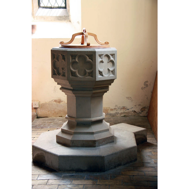
Image copyright © John Salmon, 2011
CC-BY-SA-3.0
Results: 5 records
view of font and cover
Scene Description: the modern font
Copyright Statement: Image copyright © John Salmon, 2011
Image Source: digital photograph taken 8 August 2011 by John Salmon [www.geograph.org.uk/photo/2576980] [accessed 8 April 2020]
Copyright Instructions: CC-BY-SA-3.0
view of church exterior - southeast view
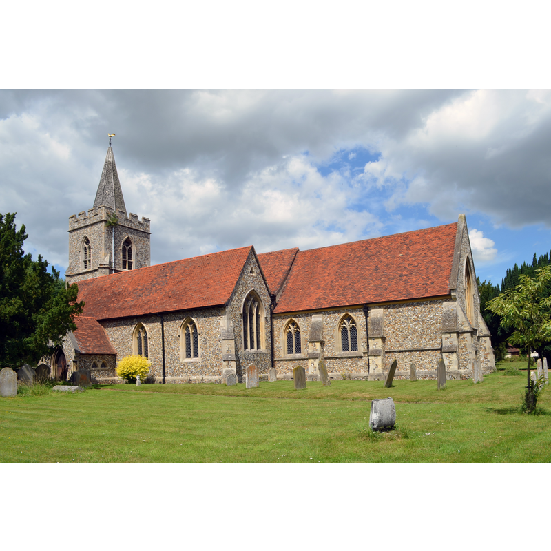
Copyright Statement: Image copyright © Jules & Jenny, 2014
Image Source: digital photograph taken 7 July 2014 by Jules & Jenny [https://commons.wikimedia.org/wiki/File:Manuden,_St_Mary's_church_(40101361322).jpg] [accessed 8 April 2020]
Copyright Instructions: CC-BY-2.0
view of church interior - looking west
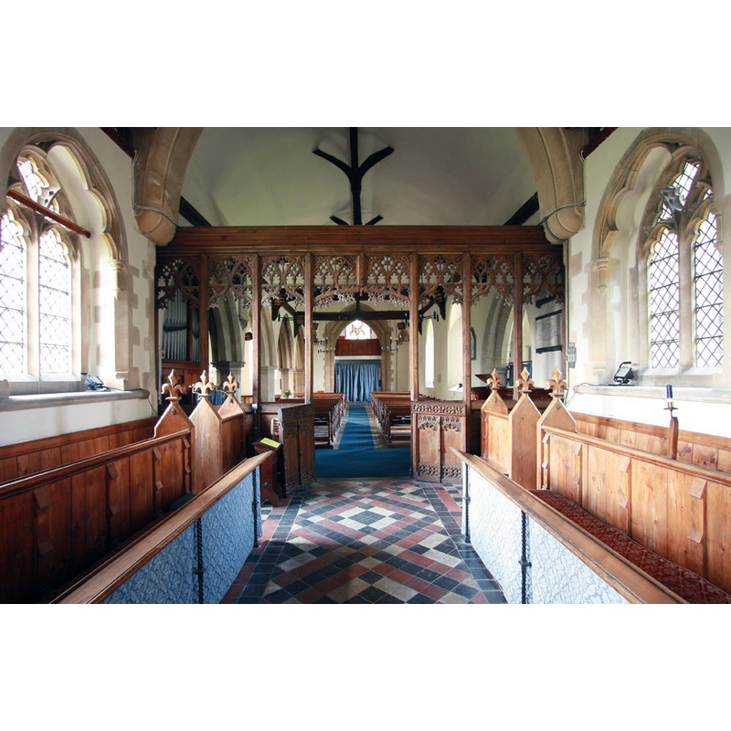
Scene Description: view from the choir
Copyright Statement: Image copyright © John Salmon, 2011
Image Source: digital photograph taken 8 August 2011 by John Salmon [www.geograph.org.uk/photo/2576976] [accessed 8 April 2020]
Copyright Instructions: CC-BY-SA-3.0
view of church interior - looking east
Copyright Statement: Image copyright © Julian P Guffogg, 2014
Image Source: digital photograph taken 7 July 2014 by Julian P Guffogg [www.geograph.org.uk/photo/4062539).jpg] [accessed 8 April 2020]
Copyright Instructions: CC-BY-SA-3.0
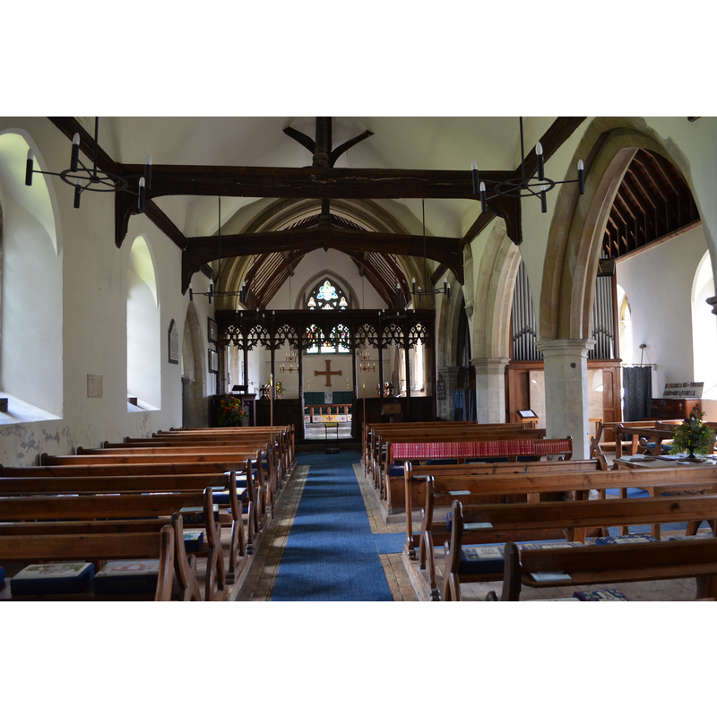
view of font and cover in context
![the modern font is visible in the left [south] aisle, through the second arch of the arcade](/static-50478a99ec6f36a15d6234548c59f63da52304e5/compressed/1200408009_compressed.png)
Scene Description: the modern font is visible in the left [south] aisle, through the second arch of the arcade
Copyright Statement: Image copyright © John Salmon, 2011
Image Source: digital photograph taken 8 August 2011 by John Salmon [www.geograph.org.uk/photo/2576980] [accessed 8 April 2020]
Copyright Instructions: CC-BY-SA-3.0
INFORMATION
Font ID: 16793MAN
Object Type: Baptismal Font1?
Font Century and Period/Style: 11th century, Pre-Conquest? / Norman
Church / Chapel Name: Parish Church of St. Mary the Virgin
Font Location in Church: Inside the church, S aisle, W end
Church Patron Saint(s): St. Mary the Virgin
Church Address: 34 The St, Manuden, Bishop's Stortford CM231DF, UK -- Tel.: +44 1799 550703
Site Location: Essex, East, England, United Kingdom
Directions to Site: Located on Manuden Rd [ala The Street], W of the B1383 and the M11, 6 km N of Bishop's Stortford, WNW of Stanstead airport, 13 km SW of Saffron Walden, 33 km NW of Chelmsford
Ecclesiastic Region: Diocese of Chelmsford
Historical Region: Hundred of Clavering
Additional Comments: disappeared font? (the one from the Domesday-time church here)
Font Notes:
Click to view
There are four entries for Manuden [variant spellings] in the Domesday survey [https://opendomesday.org/place/TL4926/manuden/] [accessed 8 April 2020] one of which reports a priestbut not a church in it, though there must have been one there. The present polygonal font located at the west end of the south aisle is modern, probably from the 1860s re-building of the medieval church [NB: we have no information on the font of the medieval church here]
COORDINATES
UTM: 31U 305179 5755755
Latitude & Longitude (Decimal): 51.9184, 0.167
Latitude & Longitude (DMS): 51° 55′ 6.24″ N, 0° 10′ 1.2″ E