Hutton Magna / Hoton / Hoton Lungevylers / Hottun / Hottune / Hutton Longvilliers / Hutton Long Villiers / Hutton Longvyllers / Mickle Hutton
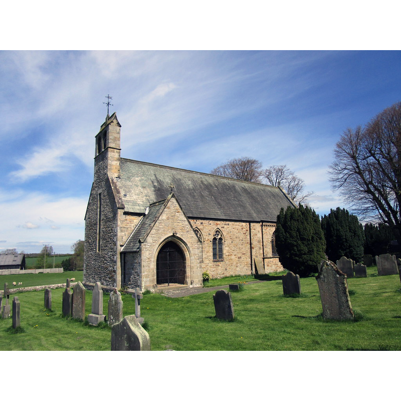
Image copyright © Jonathan Thacker, 2018
CC-BY-SA-2.0
Results: 2 records
view of church exterior - southwest view
Copyright Statement: Image copyright © Jonathan Thacker, 2018
Image Source: digital photograph taken 4 May 2018 by Jonathan Thacker [www.geograph.org.uk/photo/5767057] [accessed 12 November 2019]
Copyright Instructions: CC-BY-SA-2.0
view of church exterior in context - west view
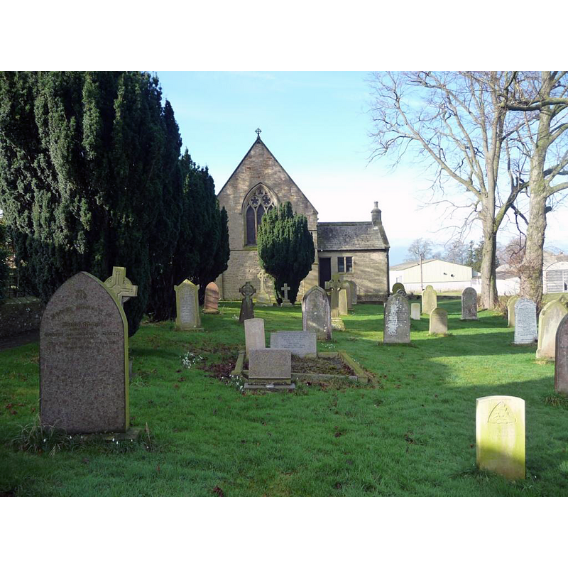
Scene Description: Source caption: "St Mary's and the churchyard, Hutton Magna. Looking west from just inside the churchyard."
Copyright Statement: Image copyright © Christine Johnstone, 2017
Image Source: digital photograph taken 17 Februaty 2017 by Christine Johnstone [www.geograph.org.uk/photo/5310251] [accessed 22 July 2017]
Copyright Instructions: CC-BY-SA-2.0
INFORMATION
Font ID: 16775HUT
Object Type: Baptismal Font1
Font Century and Period/Style: Medival [composite]
Church / Chapel Name: Parish Church of St. Mary
Font Location in Church: In the porch [cf. FontNotes]
Church Patron Saint(s): St. Mary the Virgin
Church Address: Hutton Magna, Richmond DL11 7HL, UK -- Tel.: +44 1833 621217
Site Location: Durham, North East, England, United Kingdom
Directions to Site: Located off (N) the A66, 13 km NNW of Richmond, in Teesdale
Ecclesiastic Region: Diocese of Leeds [Diocese of Ripon & Leeds]
Historical Region: Hundred of Land of Count Alan -- formerly North Riding of Yorkshire
Additional Comments: disused font? [cf. FontNotes]
Font Notes:
Click to view
There is an entry for Hutton [Magna] [variant spelling] in the Domesday survey [https://opendomesday.org/place/NZ1212/hutton-magna/] [accessed 12 November 2019] but it mentions neither cleric nor church in it. The entry for this parish in the Victoria County History (York North Riding, vol. 1, 1914) notes: "The church of ST. MARY was rebuilt in 1878 [...] The south doorway of the nave is a plain piece of 12th-century work re-used, and two small round heads of 12th-century lights are built into the porch, together with what may be part of a small holy water stone and a gable cross. The font in the church is modern, but in the porch is the rough circular bowl of a font, with staple marks, which is evidently ancient." The entry for this church in Historic England [Listing NGR: NZ1263712477] notes: "Parish church. 1878 by Austin, Johnson and Hicks, incorporating some features from medieval church. [...] In porch an old font bowl and, built into walls, two small C12 window heads and C13/14 headstone or finial cross."
COORDINATES
UTM: 30U 577249 6040661
Latitude & Longitude (Decimal): 54.507658, -1.806921
Latitude & Longitude (DMS): 54° 30′ 27.57″ N, 1° 48′ 24.92″ W
MEDIUM AND MEASUREMENTS
Material: stone
Font Shape: round
Basin Interior Shape: round
Basin Exterior Shape: round
REFERENCES
- Victoria County History [online], University of London, 1993-. URL: https://www.british-history.ac.uk.