Latton nr. Harlow / Lattune / St. Mary at Latton, New Harlow
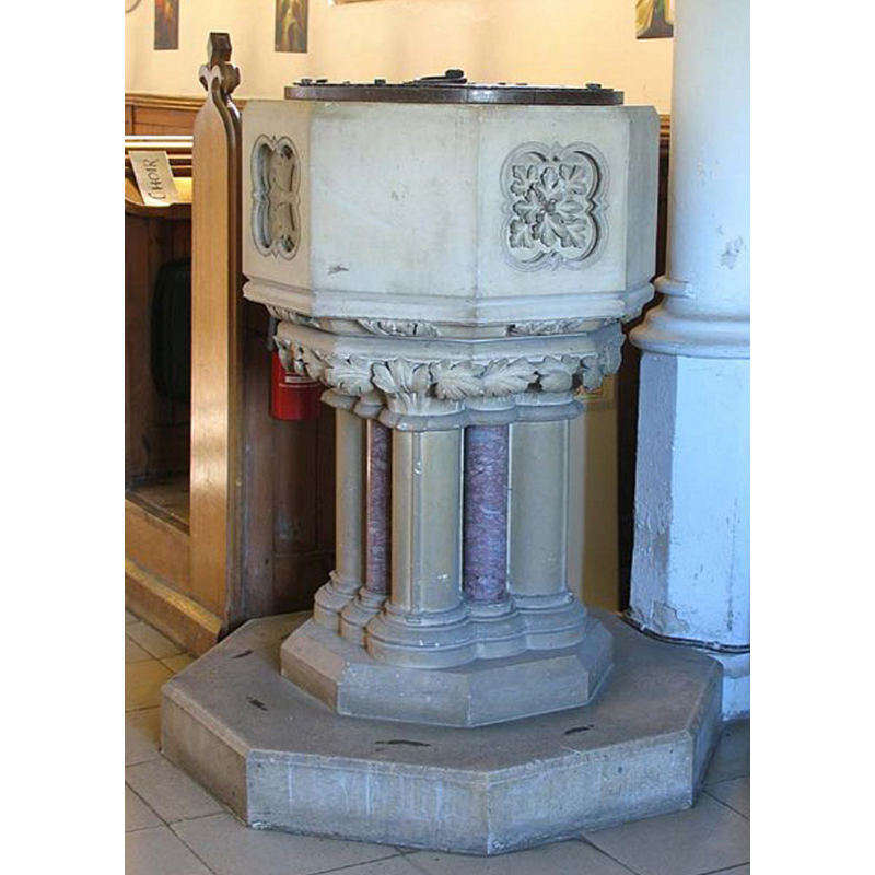
Image copyright © John Salmon, 2007
CC-BY-SA-2.0
Results: 5 records
view of font and cover
Scene Description: the modern font in use
Copyright Statement: Image copyright © John Salmon, 2007
Image Source: digital photograph taken 14 March 2007 by John Salmon [www.geograph.org.uk/photo/373557] [accessed 7 June 2018]
Copyright Instructions: CC-BY-SA-2.0
view of font and cover
![the modern font [cf. Font notes]](/static-50478a99ec6f36a15d6234548c59f63da52304e5/compressed/1100803010_compressed.png)
Scene Description: the modern font [cf. Font notes]
Copyright Statement: Image copyright © John Whitworth, 2008
Image Source: digital photograph taken by John Whitworth [www.essexchurches.info]
Copyright Instructions: Standing permission
view of church exterior - southeast view
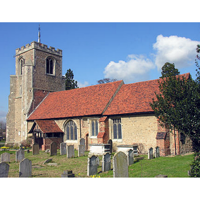
Copyright Statement: Image copyright © John Whitworth, 2008
Image Source: digital photograph taken by John Whitworth [www.essexchurches.info]
Copyright Instructions: Standing permission
view of church interior - nave - looking west
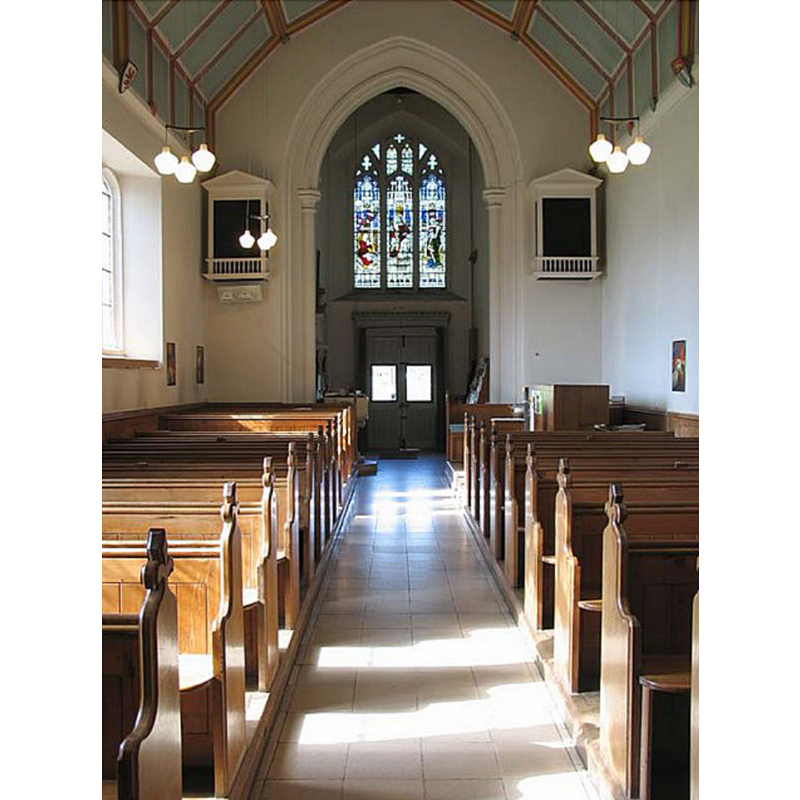
Copyright Statement: Image copyright © John Salmon, 2007
Image Source: digital photograph taken 14 March 2007 by John Salmon [www.geograph.org.uk/photo/373556] [accessed 7 June 2018]
Copyright Instructions: CC-BY-SA-2.0
view of church interior - nave - looking east
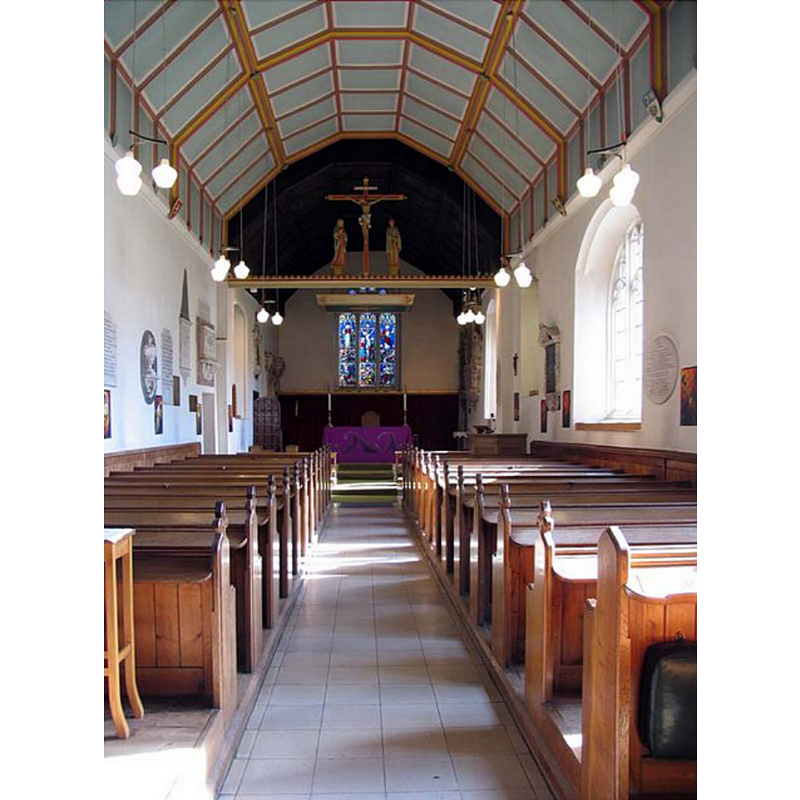
Copyright Statement: Image copyright © John Salmon, 2007
Image Source: digital photograph taken 14 March 2007 by John Salmon [www.geograph.org.uk/photo/373550] [accessed 7 June 2018]
Copyright Instructions: CC-BY-SA-2.0
INFORMATION
Font ID: 16768LAT
Object Type: Baptismal Font1?
Font Century and Period/Style: 11th century, Pre-Conquest
Church / Chapel Name: Parish Church of St. Mary-at-Latton
Church Patron Saint(s): St. Mary the Virgin
Church Address: The Gowers First Avenue, Harlow, Essex CM20 2JP, UK -- Tel.: +44 1279 424005
Site Location: Essex, East, England, United Kingdom
Directions to Site: Located off (W) the A414, E of Harlow
Ecclesiastic Region: Diocese of Chelmsford
Historical Region: Hundred of Harlow
Additional Comments: disappeared font? (the one from the pre-Conquest church here)
Font Notes:
Click to view
There are three entries for this Latton [variant spellings] in the Domesday survey [http://opendomesday.org/place/TL4610/latton/] [accessed 7 June 2018]; a priest, a church and "0.5 church lands" are mentioned. The entry for this church in Historic England [Listing NGR: TL4640410881] mentions no font in it. The entry for this parish in the Victoria County History (Essex, vol. 8, 1983) notes: "In 1066 and 1086 there was a priest on Peter de Valognes's manor (Latton Hall). In 1086 there was also a priest, holding ½ hide belonging to the church, on the count of Boulogne's manor (Mark Hall). [...] The church was damaged by a rocket bomb in 1945. Repairs during the 1950s revealed architectural features previously hidden under cement. Further damage was caused by a fire in 1964, but the church was completely restored in 1965, and in 1971 a vestry was built on the north side of the nave. The tower was restored in 1977"; there is no mention of a font in the VCH entry. The present [2010] baptismal font at St. Mary's is modern, probably 19th-century, and consists of an octagonal basin with chamfered top and bottom, four of the sides carved with quatrefoils inscribing symbols; foliage on the underbowl chamfer; base with clustered colonnettes with foliated capitals and moulded bases; octagonal plinth. Flat wooden cover also modern.
Credit and Acknowledgements: We are grateful to John Whitworth, of www.essexchurches.info, for his photographs of this church and modern font
COORDINATES
UTM: 31U 295640 5739920
Latitude & Longitude (Decimal): 51.772797, 0.037842
Latitude & Longitude (DMS): 51° 46′ 22.07″ N, 0° 2′ 16.23″ E
LID INFORMATION
Date: modern
Material: wood
Apparatus: no
Notes: [cf. FontNotes]
REFERENCES
- Victoria County History [online], University of London, 1993-. URL: https://www.british-history.ac.uk.