Great Easton nr. Bishop's Stortford
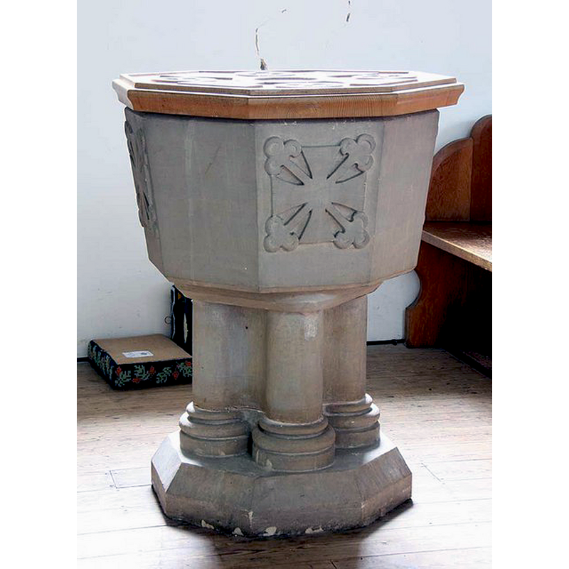
Image copyright © John Salmon, 2009
CC-BY-SA-2.0
Results: 3 records
view of font and cover
Scene Description: the modern font
Copyright Statement: Image copyright © John Salmon, 2009
Image Source: digital photograph taken 13 May 2009 by John Salmon ['www.geograph.org.uk/photo/1304837] [accessed 12 August 2015]
Copyright Instructions: CC-BY-SA-2.0
view of church exterior - northwest view
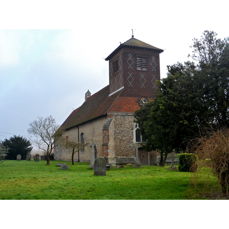
Scene Description: Source caption: "Church of St John and St Giles, Great Easton. Most of the church dates from the C12 and C13 although the tower was added in C19."
Copyright Statement: Image copyright © Bikeboy, 2015
Image Source: digital photograph taken 15 February 2015 by Bikeboy [www.geograph.org.uk/photo/4351713] [accessed 12 August 2015]
Copyright Instructions: CC-BY-SA-2.0
view of church interior - nave - looking east
![the moder font is partially visible here at the far [east] of the right [south] bank of benches](/static-50478a99ec6f36a15d6234548c59f63da52304e5/compressed/1150901026_compressed.png)
Scene Description: the moder font is partially visible here at the far [east] of the right [south] bank of benches
Copyright Statement: Image copyright © John Salmon, 2009
Image Source: digital photograph taken 13 May 2009 by John Salmon ['www.geograph.org.uk/photo/1304831] [accessed 12 August 2015]
Copyright Instructions: CC-BY-SA-2.0
INFORMATION
Font ID: 16762EAS
Object Type: Baptismal Font1?
Font Century and Period/Style: 11th century, Pre-Conquest? / Norman
Church / Chapel Name: Parish Church of St. John and St. Giles
Church Patron Saint(s): St. John & St. Giles
Church Notes: original church 11thC?
Church Address: The Endway, Great Easton, Essex CM6 2HF
Site Location: Essex, East, England, United Kingdom
Directions to Site: Located off (W) the B184, just SE of Bishop's Stortford, ENE of the Stanstead Airport
Ecclesiastic Region: Diocese of Chelmsford
Historical Region: Hundred of Dunmow [in Domesday]
Additional Comments: disappeared font? (the one from the Domesday-time church here)
Font Notes:
Click to view
There are four entries for [Great and Little] Easton [variant spelling] in the Domesday survey [http://opendomesday.org/place/XX0000/great-and-little-easton/] [accessed 12 August 2015], two of which report a priest in each, but not a corresponding church, though there probably were there. The Brentwood U3A website [http://brentwoodu3a.org.uk] [accessed 6 July 2010]: "1899 Stone Font with a cover of Elm recently presented to the church." [NB: we have no information on the font of the Domesday-time church here].
COORDINATES
UTM: 31U 316638 5753715
Latitude & Longitude (Decimal): 51.903966, 0.334524
Latitude & Longitude (DMS): 51° 54′ 14.28″ N, 0° 20′ 4.28″ E
LID INFORMATION
Date: modern
Material: wood, elm
Notes: [cf. FontNotes]