Walton / Eadolfenaesse / Walton-on-the-Naze / Walton-le-Soken
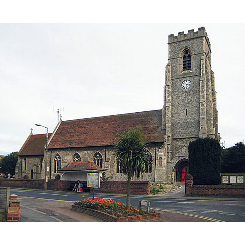
Image copyright © Nigel Cox, 2009
CC-BY-SA-2.0
Results: 1 records
view of church exterior - north view
Scene Description: Source caption: "Walton-on-the-Naze: All Saints Church. Walton's original church eventually succumbed to the erosion of the cliffs and fell into the sea around 1798, so the current church, set well inland, is not particularly old. The first church on this site was one built of brick with construction starting in 1804, and a tower being added later. However the growth of Walton as a holiday resort and the construction of the railway in Victorian times led to a rapid growth in population. As a consequence a new church built in stone was planned and built progressively as the old brick one was dismantled. The chancel to the left and the nave in the centre were built between 1874 and 1882, and the tower on the right added from start to finish during 1896."
Copyright Statement: Image copyright © Nigel Cox, 2009
Image Source: digital photograph taken 30 August 2009 by Nigel Cox [www.geograph.org.uk/photo/1475668] [accessed 19 October 2018]
Copyright Instructions: CC-BY-SA-2.0
INFORMATION
Font ID: 16743WAL
Object Type: Baptismal Font1?
Font Century and Period/Style: Medieval
Church / Chapel Name: Parish Church of All Saints [old church; disappeared]
Church Patron Saint(s): All Saints
Church Address: High St, Walton on the Naze CO14 8BU, UK -- Tel.: +44 1255 675351
Site Location: Essex, East, England, United Kingdom
Directions to Site: Located just NE of Frinton-on-Sea, 10 km NNE of Clacton-on-Sea, along the coast
Ecclesiastic Region: Diocese of Chelmsford
Additional Comments: disappeared font? (the one from the medieval (?) church washed away by the sea in the late-18thC)
Font Notes:
Click to view
No entry found for this Walton in the Domesday survey. White's Directory of 1848 [www.historyhouse.co.uk/placeW/essexw05a.html] [accessed 10 October 2011] notes: "The old parish church (All Saints), after remaining a considerable time in ruins, was washed away in 1796, and the sea has now advanced several hundred feet beyond the place where it stood. A small new Church was erected in 1804, and it was enlarged, and nearly all rebuilt in 1832 and 1835, chiefly by subscriptions, to meet the wants of the growing population". The British Listed Buildings website [http://www.britishlistedbuildings.co.uk/en-119930-church-of-all-saints-frinton-and-walton] [accessed 30 June 2010] reports: "Octagonal stone font, pointed quatrefoils to panels each with shield or foliate centre", a font probably of the late-19th century re-building of an early-19th century church. Bettley & Pevsner (2007) note that "the medieval church of Walton-le-Soken, recorded as a ruin by Morant, was lost to the sea in 1796" [NB: we have no information on the medieval font of the disappeared church].
COORDINATES
UTM: 31U 380734 5745573
Latitude & Longitude (Decimal): 51.84821, 1.2685
Latitude & Longitude (DMS): 51° 50′ 53.56″ N, 1° 16′ 6.6″ E
REFERENCES
- Bettley, James, Essex, New Haven and London: Yale University Press, 2007, p. 816