Beauchamp Roding
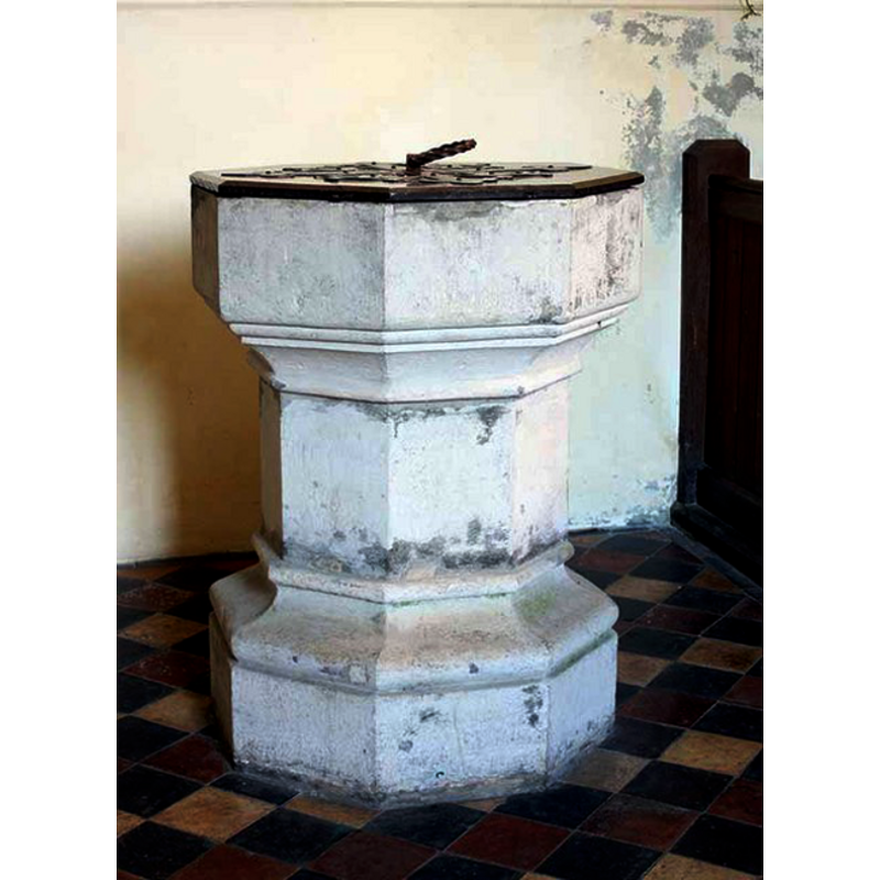
Image copyright © John Salmon, 2008
CC-BY-SA-3.0
Results: 5 records
view of font and cover
Scene Description: the modern font
Copyright Statement: Image copyright © John Salmon, 2008
Image Source: digital photograph taken 13 September 2008 by John Salmon [www.geograph.org.uk/photo/965033] [accessed 28 March 2012]
Copyright Instructions: CC-BY-SA-3.0
view of church exterior - north view
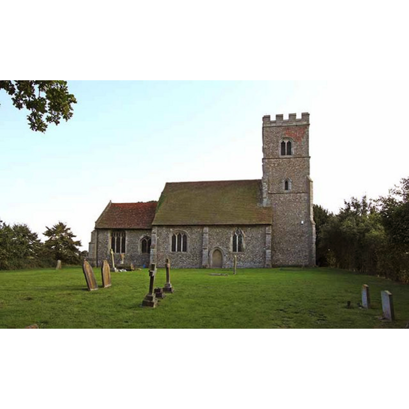
Copyright Statement: Image copyright © John Salmon, 2008
Image Source: digital photograph taken 13 September 2008 by John Salmon [www.geograph.org.uk/photo/964997] [accessed 28 March 2012]
Copyright Instructions: CC-BY-SA-3.0
view of church exterior - south view
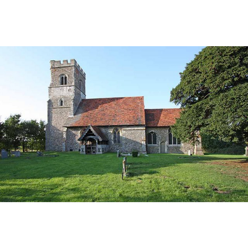
Copyright Statement: Image copyright © John Salmon, 2008
Image Source: digital photograph taken 13 September 2008 by John Salmon [www.geograph.org.uk/photo/965011] [accessed 28 March 2012]
Copyright Instructions: CC-BY-SA-3.0
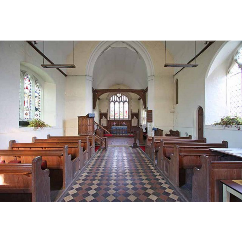
view of church interior - nave - looking west
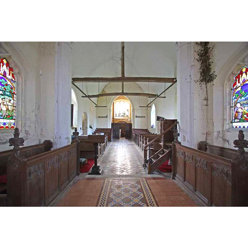
Scene Description: the top of the modern font is visible towards the back (west), on the left (south) side, by the south doorway
Copyright Statement: Image copyright © John Salmon, 2008
Image Source: digital photograph taken 13 September 2008 by John Salmon [www.geograph.org.uk/photo/965018] [accessed 28 March 2012]
Copyright Instructions: CC-BY-SA-3.0
view of church interior - nave - looking east
Copyright Statement: Image copyright © John Salmon, 2008
Image Source: digital photograph taken 13 September 2008 by John Salmon [www.geograph.org.uk/photo/965012] [accessed 28 March 2012]
Copyright Instructions: CC-BY-SA-3.0
INFORMATION
Font ID: 16694BEA
Object Type: Baptismal Font1?
Font Century and Period/Style: 11th - 12th century, Medieval
Church / Chapel Name: Parish Church of St. Botolph
Church Patron Saint(s): St. Botulph [aka St. Botolph, Botolph of Thorney, Botulf]
Church Address: Beauchamp Roding, Essex, CM5 0PG
Site Location: Essex, East, England, United Kingdom
Directions to Site: Located off (E) the B184, 8 km from Chipping Ongar
Ecclesiastic Region: Diocese of Chelmsford
Additional Comments: disappeared font?
Font Notes:
Click to view
The Victoria County History (Essex, vol. 4, 1956) notes: "The dedication suggests that there was a church at Beauchamp Roding before the Norman Conquest [...] The nave is built on an 11th- or 12th-century plan but the present structure probably dates from the 14th century"; the VCH entry does not mention a font in it. The present font is located towards the west end of the nave, on the south side; it consists of an octagonal basin with plain vertical sides and a moulded underbowl chamfer; raised on a plain broad octagonal stem, and a moulded lower base also octagonal; the whole font is whitewashed; it is of a design that is difficult to date, especially if it has been re-cut; it could be 15th century or 19th century. The wooden cover is octagonal and flat, with metal decoration and ring handle; probably Victorian. [NB: we have no information on the medieval font]
COORDINATES
UTM: 31U 312668 5738249
Latitude & Longitude (Decimal): 51.763749, 0.285253
Latitude & Longitude (DMS): 51° 45′ 49.49″ N, 0° 17′ 6.91″ E
LID INFORMATION
Date: modern
Material: wood, oak?
Apparatus: no
Notes: octagonal and flat, with metal decoration and ring handle; modern
REFERENCES
- Victoria County History [online], University of London, 1993-. URL: https://www.british-history.ac.uk.