Alresford / Aleforda / Eilesforda / Elesforda
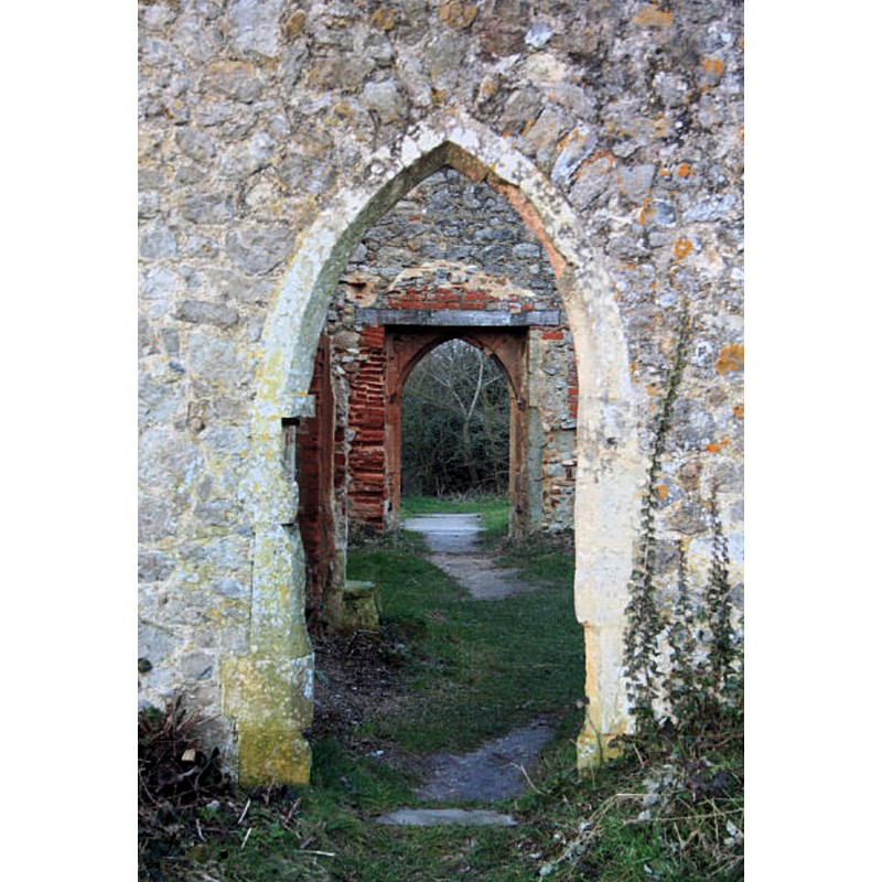
Image copyright © Bob Jones, 2009
CC-BY-SA-2.0
Results: 4 records
view of church exterior - south portal
Scene Description: Source caption: "Doorways in ruined church. Looking northwards through doorways of the ruined church of St Peter, Alresford."
Copyright Statement: Image copyright © Bob Jones, 2009
Image Source: digital photograph taken 21 January 2009 by Bob Jones [www.geograph.org.uk/photo/1143915] [accessed 28 June 2018]
Copyright Instructions: CC-BY-SA-2.0
view of church exterior - south view
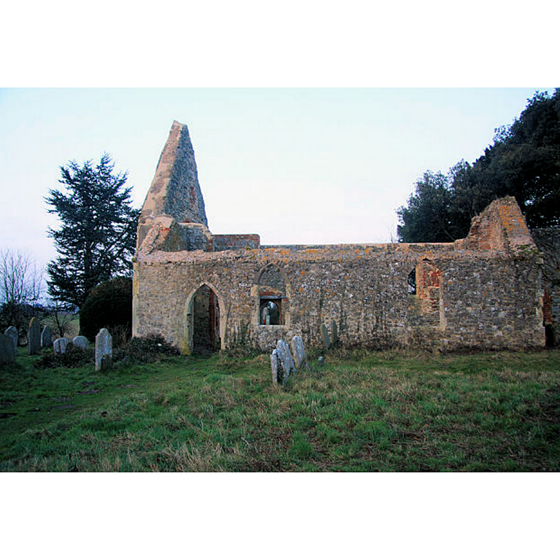
Scene Description: Source caption: "Ruined church of St Peter, Alresford. This 14th century church was destroyed by fire in 1971."
Copyright Statement: Image copyright © Bob Jones, 2009
Image Source: digital photograph taken 21 January 2009 by Bob Jones [www.geograph.org.uk/photo/1143917] [accessed 28 June 2018]
Copyright Instructions: CC-BY-SA-2.0
view of church exterior - southwest view
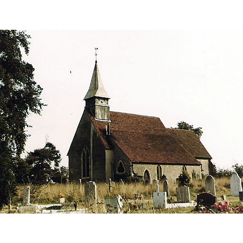
Scene Description: originally a 12th-13thC church; re-built in the 19thC; shown here two years before a fire gutted it in 1971
Copyright Statement: Image copyright © George Burbage, 2007
Image Source: digital image of a 1969 photograph taken by George Burbage [https://commons.wikimedia.org/wiki/File:St._Peter's_Anglican_Church,_Alresford,_Essex_001.jpg] [accessed 28 June 2018]
Copyright Instructions: GFDL / CC-BY-SA-3.0-migrated
view of church interior - nave - looking east
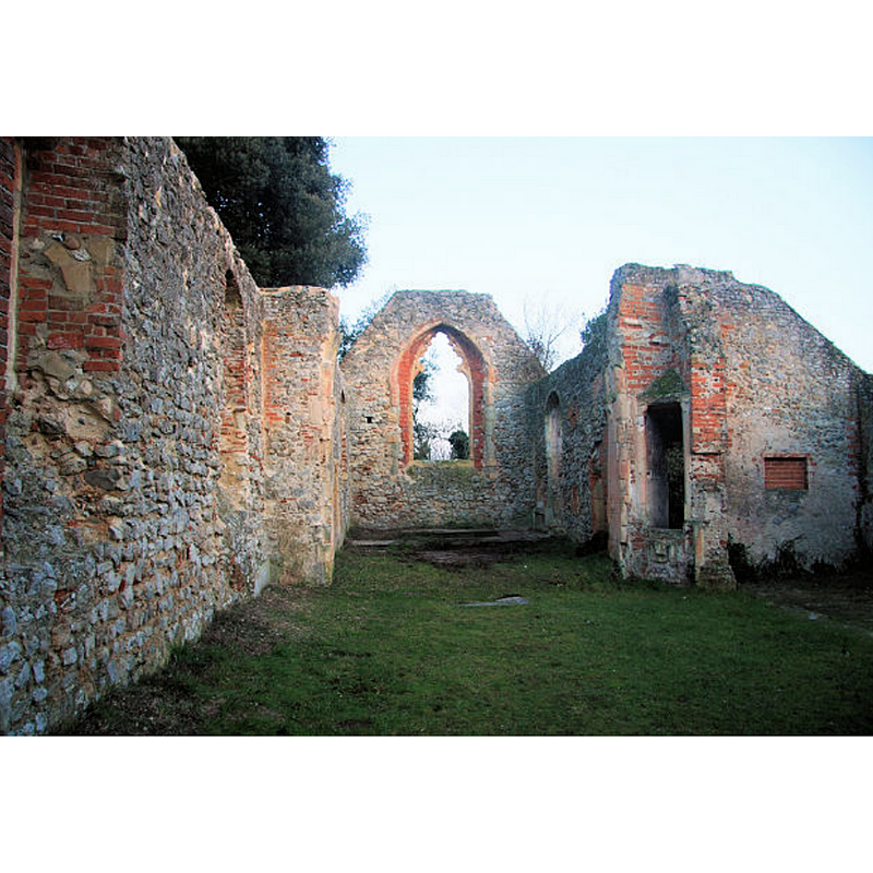
Scene Description: the nave gutted by the 1971 fire
Copyright Statement: Image copyright © Bob Jones, 2009
Image Source: digital photograph taken 21 January 2009 by Bob Jones [www.geograph.org.uk/photo/1143862] [accessed 28 June 2018]
Copyright Instructions: CC-BY-SA-2.0
INFORMATION
Font ID: 16664ALR
Object Type: Baptismal Font1?
Font Century and Period/Style: Medieval
Church / Chapel Name: Parish Church of St. Peter [in ruins]
Font Location in Church: [destroyed]
Church Patron Saint(s): St. Peter
Site Location: Essex, East, England, United Kingdom
Directions to Site: Located off (W) the B1027, 9-10 km SE of Colchester, 40 km NE of Chelmsford
Ecclesiastic Region: Diocese of Chelmsford
Historical Region: Hundred of Tendring
Additional Comments: destroyed font by a fire in 1971
Font Notes:
Click to view
There are four entries for this Alresford [variant spelling] in the Domesday survey [http://opendomesday.org/place/TM0620/alresford/] [accessed 28 June 2018], none of which mentions priest of church in it. Bettley & Pevsner (2007) report the roof-less ruins of the old Church of St. Peter, originally of the 12th- and 13th-century,but partially re-built in the 19th century and destroyed by a fire in 1971. The baptismal font is believed to have been destroyed in that fire.
COORDINATES
UTM: 31U 361895 5745792
Latitude & Longitude (Decimal): 51.84583, 0.99508
Latitude & Longitude (DMS): 51° 50′ 44.99″ N, 0° 59′ 42.29″ E
MEDIUM AND MEASUREMENTS
Material: stone
REFERENCES
- Bettley, James, Essex, New Haven and London: Yale University Press, 2007, p. 88