Welland / Wenland / Wonlond
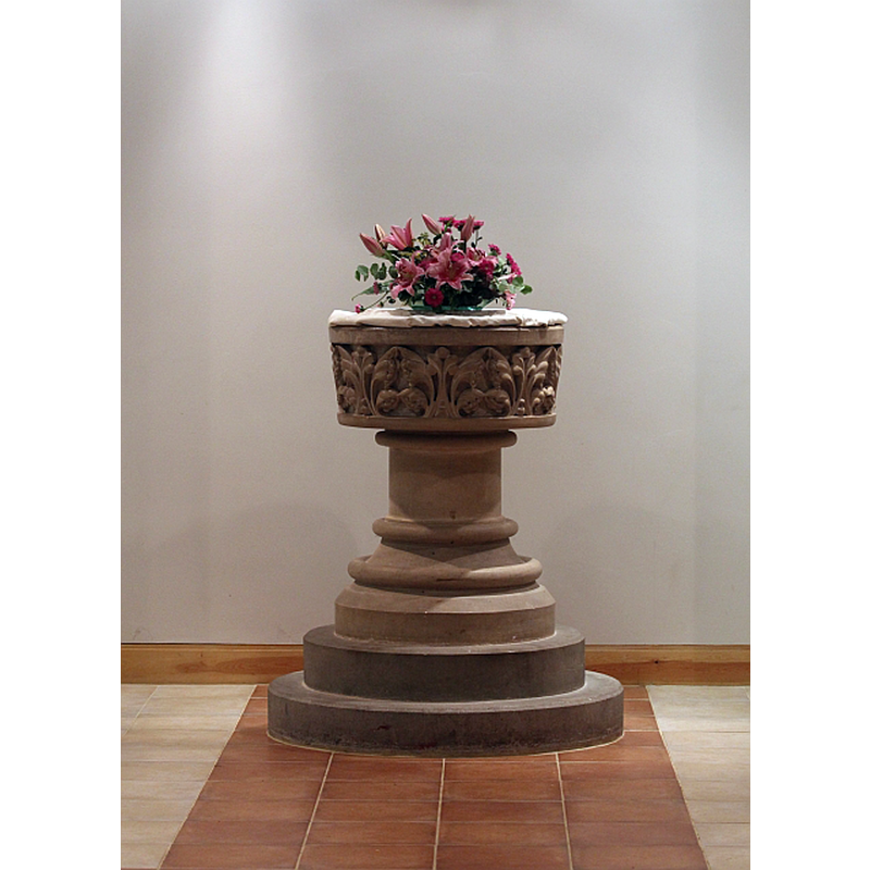
Image copyright © Bob Embleton, 2013
CC-BY-SA-2.0
Results: 2 records
view of font
Scene Description: the 1870s font in the new church
Copyright Statement: Image copyright © Bob Embleton, 2013
Image Source: digital photograph taken 14 September 2013 by Bob Embleton [www.geograph.org.uk/photo/3654579] [accessed 2 October 2014]
Copyright Instructions: CC-BY-SA-2.0
view of church exterior - north view
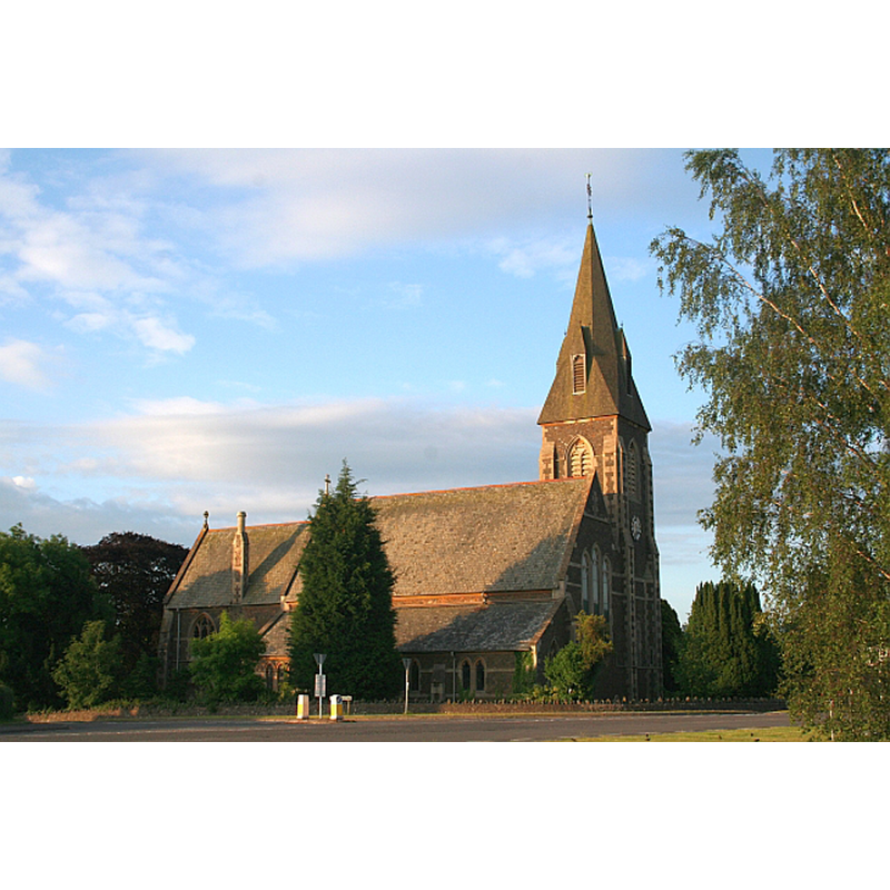
Scene Description: the new church
Copyright Statement: Image copyright © Bob Embleton, 2008
Image Source: digital photograph taken 15 June 2008 by Bob Embleton [www.geograph.org.uk/photo/845016] [accessed 2 October 2014]
Copyright Instructions: CC-BY-SA-2.0
INFORMATION
Font ID: 16657WEL
Object Type: Baptismal Font1
Font Date: ca. 1672?
Font Century and Period/Style: 17th century, Restoration
Workshop/Group/Artisan: portable font
Church / Chapel Name: [New] Parish Church of St. James [from the old church]
Font Location in Church: [cf. FontNotes]
Church Patron Saint(s): St. James
Church Address: Drake Street, Welland, Worcestershire, WR13 6LP [NB: The Old Church was located at the end of Welland Court Lane, off Upton Road, about 2 km from the present church]
Site Location: Worcestershire, West Midlands, England, United Kingdom
Directions to Site: Located 10 km from Malvern, 24 km from Worcester
Ecclesiastic Region: Diocese of Worcester
Historical Region: Hundred of Oswaldslow [in Domesday] -- Hundred of Halfshire
Additional Comments: disappeared font? (the one form ca.1300 church here)
Font Notes:
Click to view
We found no entry for Welland in the Domesday survey. Miller (1890) reports the church "was rebuilt 1762, and a tower added 1738", but the first recorded vicar is noted as "Johannes Clyve", and was in place before 1320; no mention of a font in it. Brooks & Pevsner (2007) report a "round font with deeply cut foliage dating from the 1870s". The Parish website [www.stjameschurchwelland.com/history.html] [accessed 9 June 2010] informs: "There has been a church of Saint James at Welland since 1300. The Old Church was situated at the end of Welland Court Lane [...] Due to an increase in the population of the village in the late 1800s and the deterioration of the Old Church, it was decided to look for another site [...] The work was commenced in 1873 [...] It was consecrated on 2nd April 1875 [...] in the vestry, a small stone travelling font from the 17th century and brought from the Old Church. [NB: we have no information on the font from the medieval church]
COORDINATES
UTM: 30U 547972 5767220
Latitude & Longitude (Decimal): 52.053502, -2.300374
Latitude & Longitude (DMS): 52° 3′ 12.61″ N, 2° 18′ 1.34″ W
REFERENCES
- Victoria County History [online], University of London, 1993-. URL: https://www.british-history.ac.uk.
- Brooks, Alan, Worcestershire, New Haven; London: Yale University Press, 2007, p. 650