Stone nr. Kidderminster / Staines / Stanes
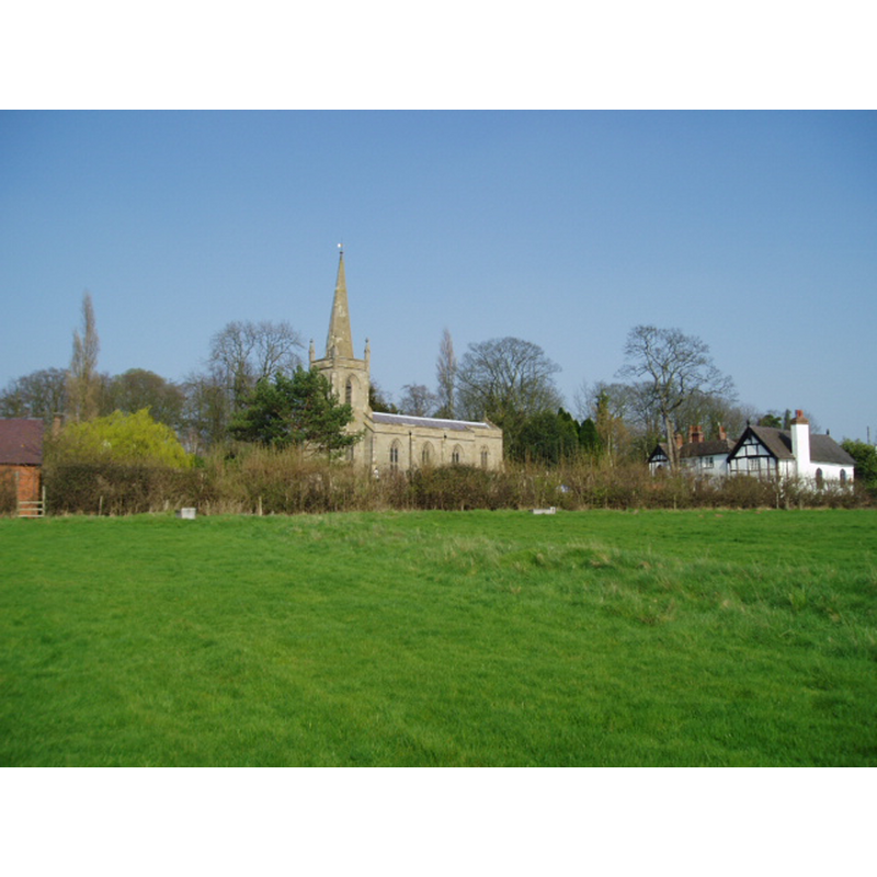
Image copyright © Martin B, 2005
CC-BY-SA-2.0
Results: 1 records
view of church exterior in context - southwest view
Scene Description: Source caption: "Taken from the footpath leading to the A448, to the south-west of the church [...] The school is the white building on the right of the photograph."
Copyright Statement: Image copyright © Martin B, 2005
Image Source: digital photograph taken 2 April 2005 by Martin B [www.geograph.org.uk/photo/1195] [accessed 22 September 2014]
Copyright Instructions: CC-BY-SA-2.0
INFORMATION
Font ID: 16653STO
Object Type: Baptismal Font1?
Font Century and Period/Style: 13th century (mid?), Medieval
Church / Chapel Name: Parish Church of St. Mary the Virgin
Church Patron Saint(s): St. Mary the Virgin
Church Address: Stone Hill, Stone, Worcestershire, DY10 4BE
Site Location: Worcestershire, West Midlands, England, United Kingdom
Directions to Site: Located 3 km SE of Kidderminster
Ecclesiastic Region: Diocese of Worcester
Historical Region: Hundred of Cresslow / Hundred of Halfshire?
Additional Comments: disappeared font?
Font Notes:
Click to view
There is an entry for this Stone [variant spelling] in the Domesday survey [http://domesdaymap.co.uk/place/SO8575/stone/] [accessed 22 September 2014], but it mentions neither cleric nor church in it. Miller (1890) reports a church here "rebuilt 1832 [...] The font is of marble and very small", obviously a modern one, not having retained the one from the medieval church. The Victoria County History (Worcester, vol. 3, 1913) reports: "The chapel of Stone was dedicated in honour of the Virgin Mary by Godfrey Giffard, Bishop of Worcester, in 1269. [...] The whole building is modern, and was built in 1831, when the old church was destroyed", and the furnishings are modern: "The font is of 13th-century design, with a square bowl." The VCH entry (ibid.) further adds that the registers here start in 1601. Brooks & Pevsner (2007) note: "large square font carved by William Forsyth". [NB: we have no information on the font of the medieval church]
COORDINATES
UTM: 30U 554488 5802313
Latitude & Longitude (Decimal): 52.36838, -2.1997
Latitude & Longitude (DMS): 52° 22′ 6.17″ N, 2° 11′ 58.92″ W
REFERENCES
- Victoria County History [online], University of London, 1993-. URL: https://www.british-history.ac.uk.
- Brooks, Alan, Worcestershire, New Haven; London: Yale University Press, 2007, p. 609
- Miller, George [Revd.], The Parishes of the Diocese of Worcester, Birmingham: Hall & English, 1890, vol. 2: 165