Queenhill / Chonhelme / Cumhille / Cvumhille / Queen Hill
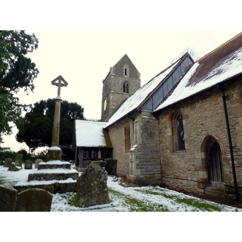
Image copyright © Jonathan Billinger, 2013
CC-BY-SA-2.0
Results: 3 records
view of church exterior - southeast view
Copyright Statement: Image copyright © Jonathan Billinger, 2013
Image Source: digital photograph taken 24 January 2013 by Jonathan Billinger [www.geograph.org.uk/photo/3310936] [accessed 30 September 2014]
Copyright Instructions: CC-BY-SA-2.0
view of church interior - nave - looking east
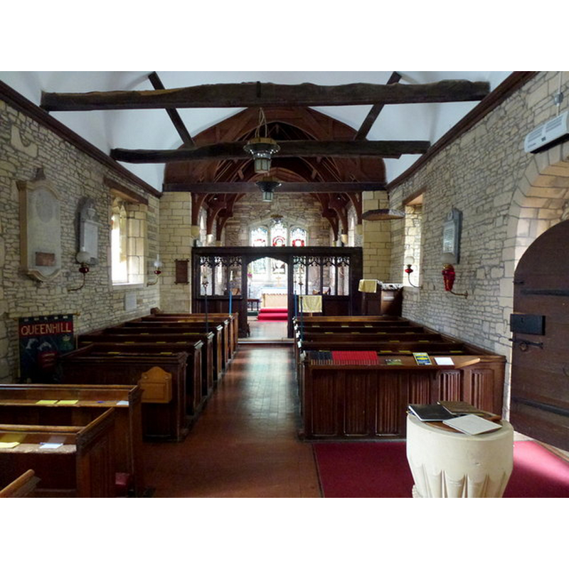
Scene Description: the font visible in the foreground, by the south doorway -- the basin is a modern replacement
Copyright Statement: Image copyright © Jonathan Billinger, 2013
Image Source: digital photograph taken 24 January 2013 by Jonathan Billinger [www.geograph.org.uk/photo/3310942] [accessed 30 September 2014]
Copyright Instructions: CC-BY-SA-2.0
design element - motifs - rope moulding


INFORMATION
Font ID: 16624QUE
Object Type: Baptismal Font1
Font Century and Period/Style: 12th century [base only], Medieval [composite]
Church / Chapel Name: Parish Church of St. Nicholas [aka St. Laurence, Holdfast]
Font Location in Church: Inside the church, at the W end of the nave, S side
Church Patron Saint(s): St. Nicholas [later (?) St. Lawrence]
Church Address: Queenhill, Worcestershire WR8 0RE
Site Location: Worcestershire, West Midlands, England, United Kingdom
Directions to Site: Located off (N) the M50, NW of Tewkesbury [Coordinates: 52.0281, -2.2044] [Diocese of Worcester]
Ecclesiastic Region: Diocese of Worcester
Historical Region: Hundred of Oswaldslow [in Domesday] -- Hundred of Halfshire
Additional Comments: altered font: missing orig. basin
Font Notes:
Click to view
There are two entries for Queenhill [variant spelling] in the Domesday survey [http://domesdaymap.co.uk/place/SO8636/queenhill/] [accessed 30 October 2014], neither of which reports a cleric or church in it. Miller (1890) writes about this church, "till lately a chapelry of Ripple [...] The basement of the font is old, the rest of it is new." The Victoria County History (Worcester, vol. 3, 1913) notes: "The church of St. Laurence, Queenhill, formerly dedicated in honour of St. Nicholas [...] It is probable that a church has stood on this site since the end of the 11th century [...] The church was thoroughly restored and repaired in 1854 [...] The bowl of the font is modern, but the cable-moulded circular base is probably of the 12th century." In Brooks & Pevsner (2007): "Neo-Norman font; C12 base with cable moulding."
COORDINATES
UTM: 30U 554571 5764441
Latitude & Longitude (Decimal): 52.027905, -2.204589
Latitude & Longitude (DMS): 52° 1′ 40.46″ N, 2° 12′ 16.52″ W
MEDIUM AND MEASUREMENTS
Material: stone
REFERENCES
- Victoria County History [online], University of London, 1993-. URL: https://www.british-history.ac.uk.
- Brooks, Alan, Worcestershire, New Haven; London: Yale University Press, 2007, p. 544
- Miller, George [Revd.], The Parishes of the Diocese of Worcester, Birmingham: Hall & English, 1890, vol. 2: 127-128