Ombersley / Ambresl' / Ambreslege / Ambresley / Aumbresleg / Humbresl' / Ombresleya / Ombresleye
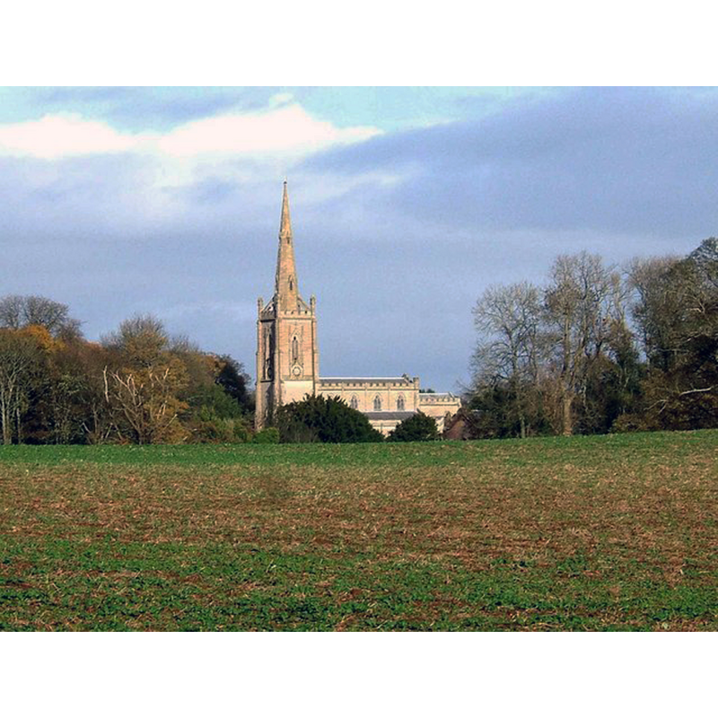
Image copyright © P L Chadwick, 2009
CC-BY-SA-2.0
Results: 2 records
view of church exterior in context
Scene Description: Source caption: "St Andrew's Church in Ombersley is an "estate church" connected with Ombersley Court. Designed by Thomas Rickmans (1776-1841) it remains almost unaltered since it was completed in 1829. The Spire is 160 feet high and rests on top of the Bell Tower. Viewed here from near the Wychavon Way."
Copyright Statement: Image copyright © P L Chadwick, 2009
Image Source: digital photograph taken 15 November 2009 by P L Chadwick [www.geograph.org.uk/photo/1591999] [accessed 29 September 2014]
Copyright Instructions: CC-BY-SA-2.0
view of church exterior in context
![Source caption: "Ombersley churchyard [...] Looking south to the mortuary chapel at the far end of the graveyard. The chapel is all that remains of the original church, which was pulled down in 1825 to make way for the present day St Andrew's church."](/static-50478a99ec6f36a15d6234548c59f63da52304e5/compressed/1141005070_compressed.png)
Scene Description: Source caption: "Ombersley churchyard [...] Looking south to the mortuary chapel at the far end of the graveyard. The chapel is all that remains of the original church, which was pulled down in 1825 to make way for the present day St Andrew's church."
Copyright Statement: Image copyright © Trevor Rickard, 2008
Image Source: digital photograph taken 4 November 2008 by Trevor Rickard [www.geograph.org.uk/photo/1139026] [accessed 29 September 2014]
Copyright Instructions: CC-BY-SA-2.0
INFORMATION
Font ID: 16615OMB
Object Type: Baptismal Font1?
Font Century and Period/Style: 11th century, Pre-Conquest? / Norman
Church / Chapel Name: Sandys Mausoleum [formerly the medieval Parish Church]
Church Address: Church Lane, Ombersley, Worcestershire WR9 0EP
Site Location: Worcestershire, West Midlands, England, United Kingdom
Directions to Site: Located 6 km W of Droitwich
Ecclesiastic Region: Diocese of Worcester
Historical Region: Hundred of Oswaldslow
Additional Comments: disappeared font? (the one from the 11thC church here?) / disused font (the one from 1828)
Font Notes:
Click to view
There is an entry for Ombersley [variant spelling] in the Domesday survey [http://domesdaymap.co.uk/place/SO8463/ombersley/] [accessed 29 September 2014]; it reports two priests in it but mentions no church here, though there probably was one. Miler (1890) reports a new font in the re-built church, "given by Lord Sandys in memory of his mother, Lady Sandys; Miller gives "Tedicius", sine data, as first recorded vicar here, the next one down the list being "Will'us de Chinton ... 1285". The Victoria County History (Worcester, vol. 3, 1913) notes: "It would seem that originally the advowson of the church of Ombersley belonged to the Bishops of Worcester, for in 1207 [...] the bishop agreed to give the church of Ombersley to the abbot" [of Evesham]; of the St. Andrew's Church, itself, the VCH writes: "The remaining portion of the former church [...] is of late 13th-century date with the exception of the east wall, which was probably rebuilt in the 18th century. [...] The stone and marble font is a recent gift replacing the mean font dating from 1828 which now stands in the mortuary chapel." [NB: the "mortuary chapel" is actually the remains of Ombersley's medieval church, which became Sandys Mausoleum -- we have no information on the medieval font of that church]
COORDINATES
UTM: 30U 552522 5791225
Latitude & Longitude (Decimal): 52.268892, -2.230317
Latitude & Longitude (DMS): 52° 16′ 8.01″ N, 2° 13′ 49.14″ W
REFERENCES
- Victoria County History [online], University of London, 1993-. URL: https://www.british-history.ac.uk.
- Miller, George [Revd.], The Parishes of the Diocese of Worcester, Birmingham: Hall & English, 1890, vol. 2: 121-123