Naunton Beauchamp / Dirty Naunton / Newentune / Newynton Beauchamp / Niuuantune
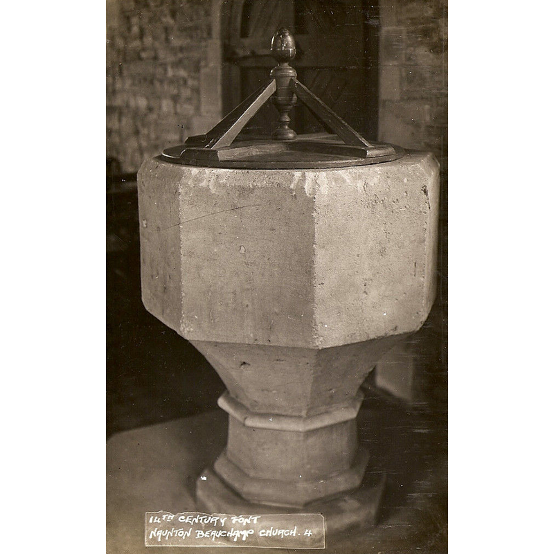
Image copyright © [in the public domain]
No known copyright restriction
Results: 3 records
view of font and cover
Copyright Statement: Image copyright © [in the public domain]
Image Source: undated B&W postcard [for sale on ebay15 October 2014] [http://i.ebayimg.com/00/s/MTAyNFg2MzY=/$(KGrHqF,!lcE5up1ePGMBOb1pwR-kQ~~60_57.JPG] [accessed 15 October 2014]
Copyright Instructions: No known copyright restriction
view of church exterior - southeast view
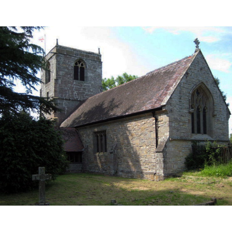
Scene Description: Source caption: "Naunton Beauchamp church is dedicated to St Bartholomew, the tower dates from the 14th century, however, the nave and chancel were restored by Hopkins in 1897."
Copyright Statement: Image copyright © Philip Halling, 2008
Image Source: digital photograph taken 8 June 2008 by Philip Halling [www.geograph.org.uk/photo/847536] [accessed 15 October 2014]
Copyright Instructions: CC-BY-SA-2.0
design element - motifs - moulding
Copyright Statement: Image copyright © Philip Halling, 2008
Image Source: digital photograph taken 8 June 2008 by Philip Halling [www.geograph.org.uk/photo/847536] [accessed 15 October 2014]
Copyright Instructions: CC-BY-SA-2.0
INFORMATION
Font ID: 16612NAU
Object Type: Baptismal Font1
Font Century and Period/Style: 14th century, Decorated
Church / Chapel Name: Parish Church of St. Bartholomew
Font Location in Church: Inside the church
Church Patron Saint(s): St. Bartholomew
Church Address: Seaford Lane, Naunton Beauchamp, Worcestershire WR10 2LQ
Site Location: Worcestershire, West Midlands, England, United Kingdom
Directions to Site: Located off the B4082, S of the A422, 5 km N of Pershore, 15 km E of Worcester
Ecclesiastic Region: Diocese of Worcester
Historical Region: Hundred of Pershore
Additional Comments: disappeared font? (the one of the pre-1269 church here? [cf. FontNotes])
Font Notes:
Click to view
There is an entry for this Naunton [variant spelling] in the Domesday survey [http://domesdaymap.co.uk/place/SO9652/naunton-beauchamp/] [accessed 15 October 2014], but it mentions neither cleric nor church in it. Miller (1890) writes: "The Church of St. Bartholomew was probably rebuilt by Urso, as a bear is carved on the buttresses of the tower [...] The tower is of the 14th century"; Miller does not mention a font in this church, but his list of recorded rectors goes back to "Andreas of Leycester", in 1269, which indicates a church here at the time. The Victoria County History (Worcester, vol. 4, 1924) notes: "The church, with the exception of the 14thcentury tower, was pulled down and rebuilt above the plinths in 1896, but some of the old work was re-used. [...] The font has a massive octagonal bowl and a moulded base." In Brooks & Pevsner (2007): "Massive octagonal bowl, perhaps C14."
COORDINATES
UTM: 30U 564792 5780453
Latitude & Longitude (Decimal): 52.170751, -2.052593
Latitude & Longitude (DMS): 52° 10′ 14.71″ N, 2° 3′ 9.34″ W
MEDIUM AND MEASUREMENTS
Material: stone
Font Shape: octagonal, mounted
Basin Interior Shape: round
Basin Exterior Shape: octagonal
LID INFORMATION
Date: modern?
Material: wood
Apparatus: no
Notes: round platform with four(?) ribs around a central pivot; ball finial; appears modern
REFERENCES
- Victoria County History [online], University of London, 1993-. URL: https://www.british-history.ac.uk.
- Brooks, Alan, Worcestershire, New Haven; London: Yale University Press, 2007, p. 496
- Miller, George [Revd.], The Parishes of the Diocese of Worcester, Birmingham: Hall & English, 1890, vol. 2: 223