Kington nr. Worcester / Chintune / Keynton / Kineton / Kinton / Kyneton / Kynton
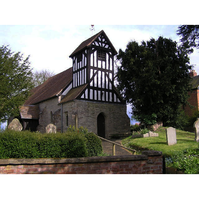
Image copyright © Richard Dunn, 2005
CC-BY-SA-2.0
Results: 2 records
view of church exterior - northwest view
Copyright Statement: Image copyright © Richard Dunn, 2005
Image Source: digital photograph taken 3 May 2005 by Richard Dunn [www.geograph.org.uk/photo/6980] [accessed 18 September 2014]
Copyright Instructions: CC-BY-SA-2.0
view of font and cover

INFORMATION
Font ID: 16605KIN
Object Type: Baptismal Font1
Font Century and Period/Style: 13th century [re-cut?], Early English [altered]
Church / Chapel Name: Parish Church of St. James
Font Location in Church: Inside the church
Church Patron Saint(s): St. James
Church Address: Kington, Worcestershire, WR7 4DQ
Site Location: Worcestershire, West Midlands, England, United Kingdom
Directions to Site: Located off the A422, near Flyford Flavell, 15 km E of Worcester
Ecclesiastic Region: Diocese of Worcester
Historical Region: Hundred of Ash -- Hundred of Halfshire
Additional Comments: altered font (the present one: re-cut) -- disappeared font? (from the original Saxon/Norman church here)
Font Notes:
Click to view
There is an entry for this Kington [variant spelling] in the Domesday survey [http://domesdaymap.co.uk/place/SO9955/kington/] [accessed 18 September 2014], but it mentions neither cleric nor church in it. Miller (1890) mentions a 12th-century window in the north wall of the chancel of this church, and an aperture on the south side that "may be Saxon"; he mentions no font in it. The Victoria County History (Worcester, vol. 3, 1913) notes: "The first mention of the church occurs in 1225 [...] The octagonal bowl of the font has been recut." Brooks & Pevsner (2007) report a "Big plain octagonal bowl, perhaps C13." Noted and illustrated in the Parish website [www.cofe-inkberrow.org.uk/st_james.shtml] [accessed 27 May 2010]: "in the tower is the Early-English font, octagonal shaped, but recut." English Heritage (1965) reports: "The plain octagonal font is on a square base, medieval but not precisely dateable".
COORDINATES
UTM: 30U 567750 5783494
Latitude & Longitude (Decimal): 52.19773, -2.00873
Latitude & Longitude (DMS): 52° 11′ 51.83″ N, 2° 0′ 31.43″ W
MEDIUM AND MEASUREMENTS
Material: stone
Font Shape: octagonal, mounted
Basin Interior Shape: round
Basin Exterior Shape: octagonal
LID INFORMATION
Date: modern?
Material: wood
Apparatus: no
Notes: octagonal and flat, with metal decoration and ring handle
REFERENCES
- Victoria County History [online], University of London, 1993-. URL: https://www.british-history.ac.uk.
- Brooks, Alan, Worcestershire, New Haven; London: Yale University Press, 2007, p. 418
- Miller, George [Revd.], The Parishes of the Diocese of Worcester, Birmingham: Hall & English, 1890, vol. 2: 66-67