Harvington / Hereforda / Herefordtun-juxta-Avene / Herefortune / Herferthun / Herfortune / Hervertun / Hervyngton
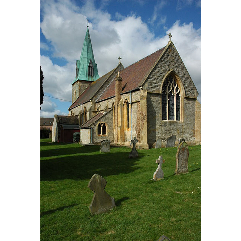
Image copyright © Philip Halling, 2010
CC-BY-SA-2.0
Results: 4 records
view of church exterior - southeast view
Copyright Statement: Image copyright © Philip Halling, 2010
Image Source: digital photograph taken 4 April 2010 by Philip Halling [www.geograph.org.uk/photo/1786463] [accessed 24 September 2014]
Copyright Instructions: CC-BY-SA-2.0
view of church exterior - northwest end
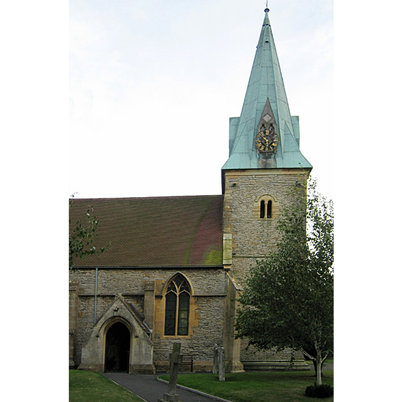
Copyright Statement: Image copyright © Dave Bushell, 2005
Image Source: digital photograph taken 26 September 2005 by Dave Bushell [www.geograph.org.uk/photo/58078] [accessed 24 September 2014]
Copyright Instructions: CC-BY-SA-2.0
view of church interior - nave - looking west
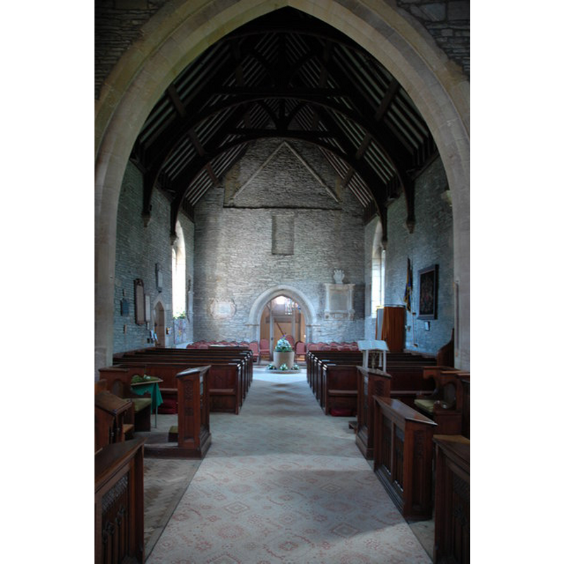
Scene Description: the font at the west end of the nave
Copyright Statement: Image copyright © Philip Halling, 2010
Image Source: digital photograph taken 4 April 2010 by Philip Halling [www.geograph.org.uk/photo/2022034] [accessed 24 September 2014]
Copyright Instructions: CC-BY-SA-2.0
view of font and cover

Copyright Statement: Image copyright © Tudor Barlow, 2014
Image Source: digital photograph taken 22 March 2014 by Tudor Barlow [www.flickr.com/photos/tudorbarlow/13449522365/] [accessed 24 September 2014]
Copyright Instructions: PERMISSION NOT AVAILABLE -- IMAGE NOT FOR PUBLIC USE
INFORMATION
Font ID: 16603HAR
Object Type: Baptismal Font1
Font Century and Period/Style: 11th - 12th century, Medieval
Church / Chapel Name: Parish Church of St. James
Font Location in Church: Inside the church, at the W end of the nave
Church Patron Saint(s): St. James
Church Address: Church Street, Harvington, Worcestershire, WR11 8PB
Site Location: Worcestershire, West Midlands, England, United Kingdom
Directions to Site: Located N of Evesham, near the county border with Warwickshire
Ecclesiastic Region: Diocese of Worcester
Historical Region: Hundred of Oswaldslow [in Domesday] -- Hundred of Halfshire
Additional Comments: disappeared font? (the one from the ca.800 AD church here [cf. FontNotes])
Font Notes:
Click to view
There is an entry for Harvington [variant spelling] in the Domesday survey [folio 173v] [http://domesdaymap.co.uk/place/SP0548/harvington/] [accessed 24 September 2014], but it mentions neither cleric nor church in it. Miller (1890) notes: "The tower is thought to be Saxon", butmentions no font in this church. The Victoria County History (Worcester, vol. 3, 1913) notes: "According to the register of Worcester Priory, Deneberht, Bishop of Worcester, gave the church of Harvington to the priory at the same time as he gave the manor [...] At the beginning of the 9th century [...] The earliest existing remains belong to the 12th century or earlier, and the church at that date was considerably smaller than the present building, the nave being about 16 ft. wide. The extreme height of the early nave, the west wall of which is still clearly visible, would even suggest a pre-Conquest date, but the earliest detail, that of the tower (which has been rebuilt in recent years), is of the first quarter of the 12th century. [...] The circular tub-font at the west end of the nave is of doubtful date." Brooks & Pevsner (2007) date It Norman.
COORDINATES
UTM: 30U 574062 5776870
Latitude & Longitude (Decimal): 52.137379, -1.917841
Latitude & Longitude (DMS): 52° 8′ 14.56″ N, 1° 55′ 4.23″ W
MEDIUM AND MEASUREMENTS
Material: stone
Font Shape: tub-shaped
Basin Interior Shape: round
Basin Exterior Shape: round
LID INFORMATION
Date: 19th century?
Material: wood
Apparatus: no
Notes: round and flat, with metal decoration; appears Victorian
REFERENCES
- Victoria County History [online], University of London, 1993-. URL: https://www.british-history.ac.uk.
- Brooks, Alan, Worcestershire, New Haven; London: Yale University Press, 2007, p. 370
- Miller, George [Revd.], The Parishes of the Diocese of Worcester, Birmingham: Hall & English, 1890, vol. 2:190