Grimley / Grimanleag / Grimanlege / Grimanleh / Grimele / Grimell
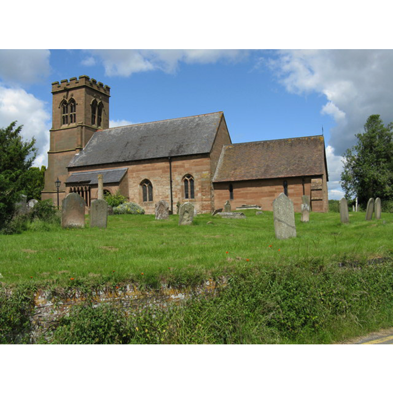
Image copyright © Peter Whatley, 2008
CC-BY-SA-2.0
Results: 3 records
view of church exterior - southeast view
Copyright Statement: Image copyright © Peter Whatley, 2008
Image Source: digital photograph taken 19 June 2008 by Peter Whatley [www.geograph.org.uk/photo/850810] [accessed 24 September 2014]
Copyright Instructions: CC-BY-SA-2.0
view of church exterior - south portal
Copyright Statement: Image copyright © Peter Whatley, 2008
Image Source: digital photograph taken 19 June 2008 by Peter Whatley [www.geograph.org.uk/photo/850810] [accessed 24 September 2014]
Copyright Instructions: CC-BY-SA-2.0
design element - motifs - moulding


INFORMATION
Font ID: 16598GRI
Object Type: Baptismal Font1
Font Century and Period/Style: 11th - 12th century [basin only] [altered?], Medieval / composite
Church / Chapel Name: Parish Church of St. Bartholomew
Font Location in Church: Inside the church
Church Patron Saint(s): St. Bartholomew
Church Address: Grimley, Worcester WR2 6LT
Site Location: Worcestershire, West Midlands, England, United Kingdom
Directions to Site: Located 7 km NNW of Worcester
Ecclesiastic Region: Diocese of Worcester
Historical Region: Hundred of Oswaldslow
Additional Comments: altered font? (basin re-cut; missing base -- cf. FontNotes])
Font Notes:
Click to view
There is an entry for Grimley [variant spelling] in the Domesday book [http://domesdaymap.co.uk/place/SO8360/grimley/] [accessed 24 September 2014], but ir mentions neither cleric nor church in it. Miller (1890) reports a plain Norman doorway and an octagonal font on a circular base in this church. The Victoria County History (Worcester, vol. 3, 1913) notes: "In 1238 there was a free chapel at Grimley. [...] The advowson belonged to the Priors of Worcester [...] until the monastery was dissolved. It was appropriated to the priory in 1268 under the title of 'church,' and to it was attached the chapelry of Hallow. [...] The only remains of the 12th-century church are the south doorway and the lower part of the south wall of the nave. [...] The font is apparently an old one recut. It is octagonal in plan, with a moulding of 15th-century character on the lower ridge of the bowl; the base is new." English Heritage [Listing NGR: SO8363060682] (1959) reports an "Octagonal font, probably recut Romanesque original on new base." In Brooks & Pevsner (2007) with "C14-C15" date. [NB: we have no information on the font of the early church here].
COORDINATES
UTM: 30U 551682 5788273
Latitude & Longitude (Decimal): 52.242435, -2.243068
Latitude & Longitude (DMS): 52° 14′ 32.77″ N, 2° 14′ 35.05″ W
MEDIUM AND MEASUREMENTS
Material: stone
Font Shape: octagonal, mounted
Basin Interior Shape: round
Basin Exterior Shape: octagonal
REFERENCES
- Victoria County History [online], University of London, 1993-. URL: https://www.british-history.ac.uk.
- Brooks, Alan, Worcestershire, New Haven; London: Yale University Press, 2007, p. 330
- Miller, George [Revd.], The Parishes of the Diocese of Worcester, Birmingham: Hall & English, 1890, vol. 2: 106-107