Earl's Croome / Cromb Simon / Croumbe Adam / Croumbe Simond / Crumba / Crumbe / Earles Croome / Earley Crome / Ellyscrove / Erles Crombe / Erles Crowme / Irliscroome / Jefferry Crombe / Jeffrey Croombe / Symondescrombe / Yrlyscrome
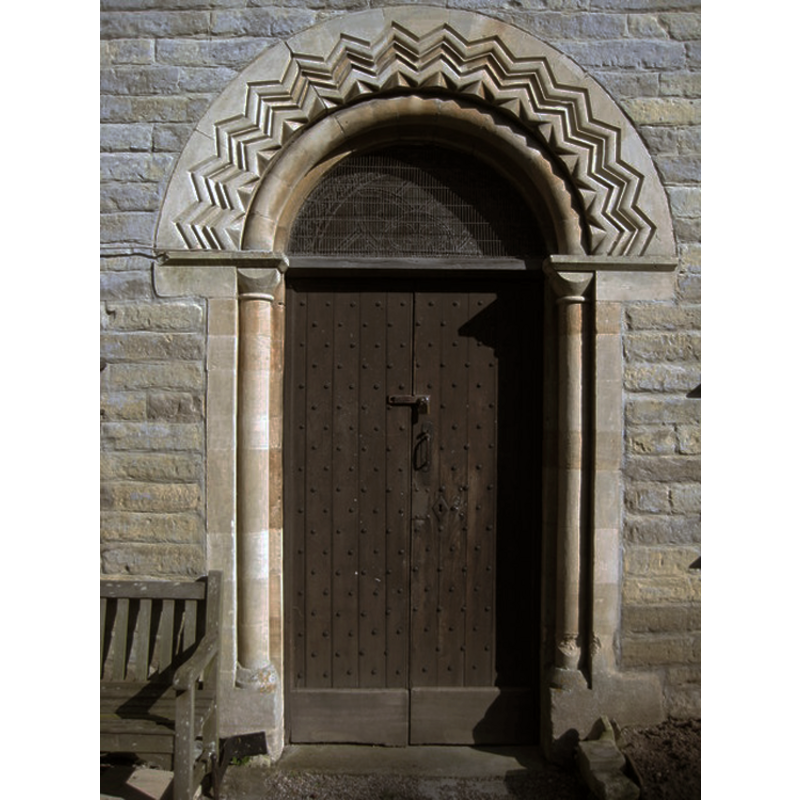
Image copyright © Philip Halling, 2008
CC-BY-SA-2.0
Results: 8 records
view of church exterior - west portal
Copyright Statement: Image copyright © Philip Halling, 2008
Image Source: digital photograph taken 26 September 2008 by Philip Halling [www.geograph.org.uk/photo/1048597] [accessed 23 September 2014]
Copyright Instructions: CC-BY-SA-2.0
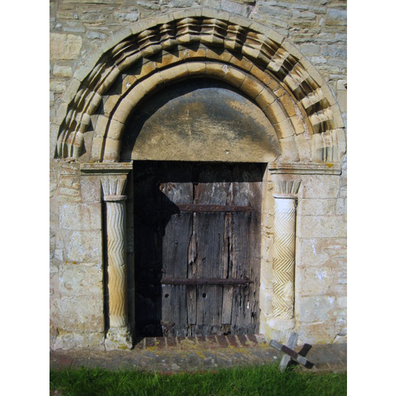
view of church exterior - south portal - tympanum

Copyright Statement: Image copyright © Philip Halling, 2008
Image Source: digital photograph taken 26 September 2008 by Philip Halling [www.geograph.org.uk/photo/1027031] [accessed 23 September 2014]
Copyright Instructions: CC-BY-SA-2.0
view of church exterior - south portal
Copyright Statement: Image copyright © Philip Halling, 2008
Image Source: digital photograph taken 26 September 2008 by Philip Halling [www.geograph.org.uk/photo/1027010] [accessed 23 September 2014]
Copyright Instructions: CC-BY-SA-2.0
view of church exterior - window
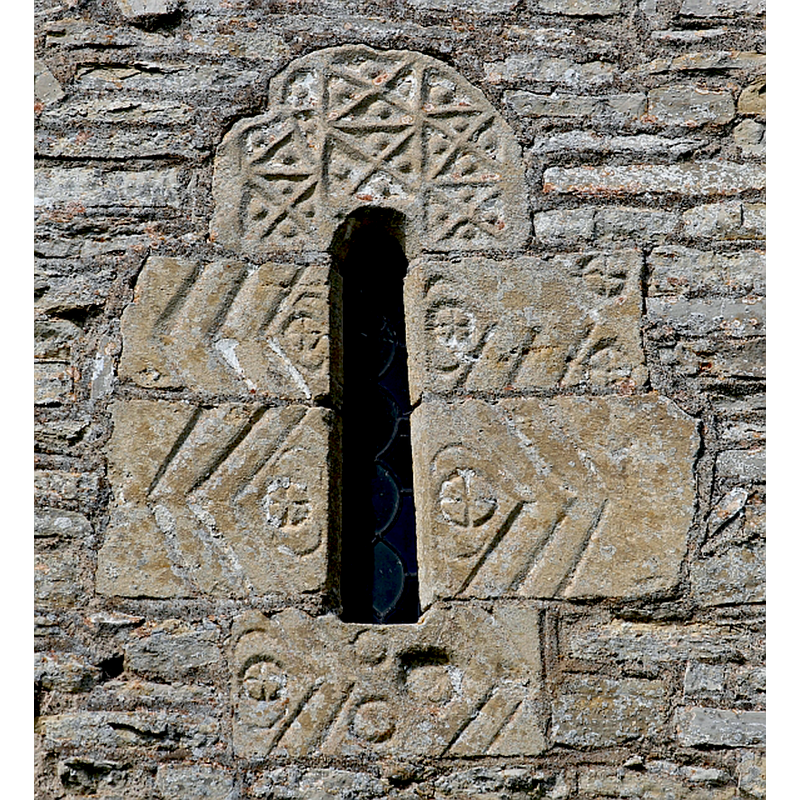
Scene Description: exterior window on the east wall of the chancel
Copyright Statement: Image copyright © Bob Embleton, 2013
Image Source: digital photograph taken 7 August 2013 by Bob Embleton [www.geograph.org.uk/photo/3588418] [accessed 23 September 2014]
Copyright Instructions: CC-BY-SA-2.0
view of church exterior - north view
Copyright Statement: Image copyright © Bob Embleton, 2013
Image Source: digital photograph taken 7 August 2013 by Bob Embleton [www.geograph.org.uk/photo/3587921] [accessed 23 September 2014]
Copyright Instructions: CC-BY-SA-2.0
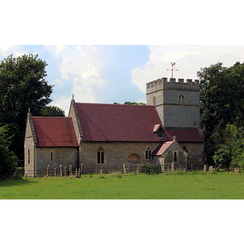
view of church exterior - southwest view
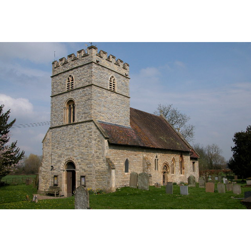
Copyright Statement: Image copyright © Philip Halling, 2005
Image Source: digital photograph taken 3 April 2005 by Philip Halling [www.geograph.org.uk/photo/59470] [accessed 23 September 2014]
Copyright Instructions: CC-BY-SA-2.0
view of church interior - nave - looking east
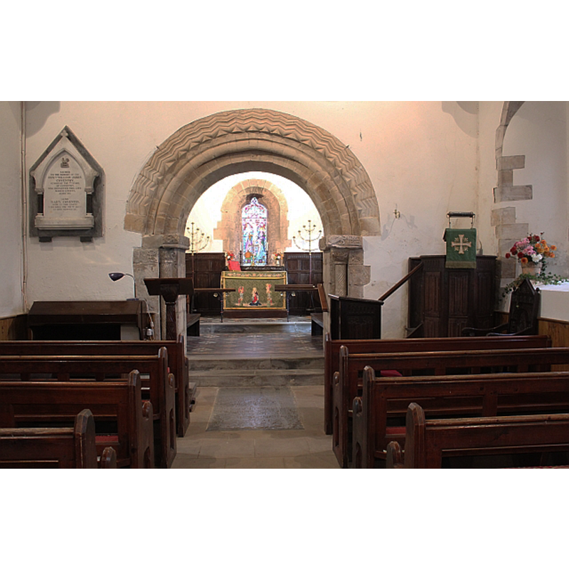
Scene Description: the Romanesque chancel arch
Copyright Statement: Image copyright © Bob Embleton, 2013
Image Source: digital photograph taken 14 September 2013 by Bob Embleton [www.geograph.org.uk/photo/3655907] [accessed 23 September 2014]
Copyright Instructions: CC-BY-SA-2.0
view of font and cover

Scene Description: the modern font of 1869
Copyright Statement: Image copyright © Tudor Barlow, 2013
Image Source: digital photograph taken 15 September 2013 by Tudor Barlow [www.flickr.com/photos/82854217@N00/10926895226] [accessed 23 September 2014]
Copyright Instructions: PERMISSION NOT AVAILABLE -- IMAGE NOT FOR PUBLIC USE
INFORMATION
Font ID: 16589EAR
Object Type: Baptismal Font1?
Font Century and Period/Style: 12th century, Medieval
Church / Chapel Name: Parish Church of St. Nicholas
Church Patron Saint(s): St. Nicholas of Myra
Church Address: Church Lane, Earl's Croome, Worcestershire, WR8 9DE
Site Location: Worcestershire, West Midlands, England, United Kingdom
Directions to Site: Loated 3 km NE of Upton-upon-Severn, 10 km from Tewkesbury
Ecclesiastic Region: Diocese of Worcester
Historical Region: Hundred of Oswaldslow
Additional Comments: disappeared font? (the one from the 12thC church here)
Font Notes:
Click to view
There are two entries for Croome [Croome d'Abitot and Earls Croome] [variant spelling] in the Domesday survey [http://domesdaymap.co.uk/place/XX0000/croome-dabitot-and-earls-croome/] [accessed 23 September 2014]; neither of which mentions a cleric or a church in it. Miller *1890) notes a "church chiefly of modern architecture, and of an early date [...] The font, of Caen stone, is modern." The Victoria County History (Worcester, vol. 3, 1913) notes: "The nave and chancel are those of a 12th-century church, which remained practically untouched till the first half of the 19th century", but does not mention a font in it; the interior plan of the church, however, shows a font -probably the 19th-century one- beneath the western gallery, on the south side. Brooks & Pevsner (2007) confirm that the font and pews are from 1869. The font consists of a cylindrical basin with a band of vine decoration towards the bottom, mounted on a cluster of columns with mouldings; a Victorian version of an Early English font. [NB: we have no information on the medieval font]
COORDINATES
UTM: 30U 555497 5769824
Latitude & Longitude (Decimal): 52.076208, -2.190219
Latitude & Longitude (DMS): 52° 4′ 34.35″ N, 2° 11′ 24.79″ W
REFERENCES
- Victoria County History [online], University of London, 1993-. URL: https://www.british-history.ac.uk.
- Brooks, Alan, Worcestershire, New Haven; London: Yale University Press, 2007, p. 275
- Miller, George [Revd.], The Parishes of the Diocese of Worcester, Birmingham: Hall & English, 1890, vol. 2: 103