Cropthorne / Cropetorn / Croppanhorne / Croppethorne / Cropponthorne / Cropporne
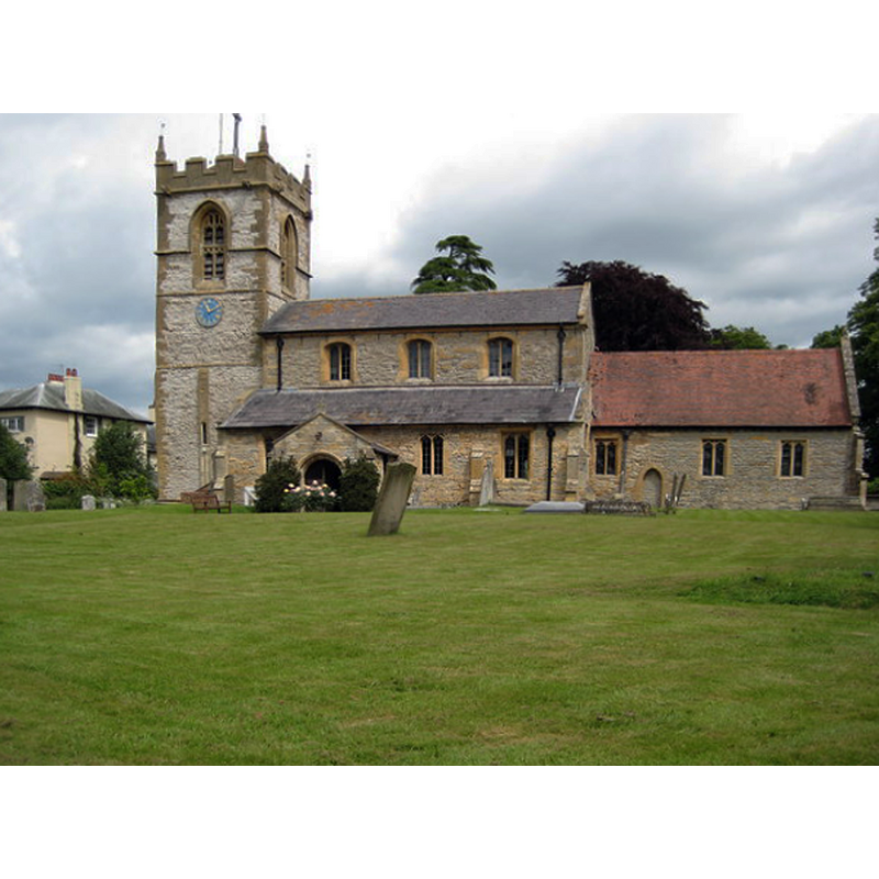
Image copyright © Philip Halling, 2008
CC-BY-SA-2.0
Results: 2 records
view of church exterior - southeast view
Copyright Statement: Image copyright © Philip Halling, 2008
Image Source: digital photograph taken 15 June 2008 by Philip Halling [www.geograph.org.uk/photo/850142] [accessed 23 September 2014]
Copyright Instructions: CC-BY-SA-2.0
view of font and cover in context

Copyright Statement: Image copyright © Tudor Barlow, 2009
Image Source: digital photograph taken 20 February 2009 by Tudor Barlow [http://www.flickr.com/photos/tudorbarlow/3315932132/] [accessed 25 May 2010]
Copyright Instructions: PERMISSION NOT AVAILABLE -- IMAGE NOT FOR PUBLIC USE
INFORMATION
Font ID: 16575CRO
Object Type: Baptismal Font1?
Font Date: ca. 1100?
Font Century and Period/Style: 11th - 12th century, Medieval
Church / Chapel Name: Parish Church of St. Michael
Church Patron Saint(s): St. Michael
Church Address: Main Street, Cropthorne, Worcestershire, WR10 3LU
Site Location: Worcestershire, West Midlands, England, United Kingdom
Directions to Site: Located off (N) the B4084, S of the A44, 5 km SE of Pershore, NW of Evesham
Ecclesiastic Region: Diocese of Worcester
Historical Region: Hundred of Oswaldslow
Additional Comments: disappeared font? (the one from the likely Domesday-time church here)
Font Notes:
Click to view
There is an entry for Cropthorne [variant spelling] in the Domesday survey [http://domesdaymap.co.uk/place/SO9944/cropthorne/] [accessed 23 September 2014]; it reports a priest but does not mention a church, though there probably was one here. Miller (1890) notes "the chancel arch was formerly Norman", but mentions no font in this church. The Victoria County History (Worcester, vol. 3, 1913) notes an early church: "The earliest portion of the present building was begun about the year 1100, and appears to have been a rebuilding of an earlier structure", but reports a modern font in it. Noted in Brooks & Pevsner (2007): "Perp[endicular]-style, c. 1850." The modern font is of the popular Perpendicular design with carved panels on the octagonal basin, raised on an octagonal pedestal base; flat wooden cover probably of the same period. [NB: we have no information on the medieval font(s)]
COORDINATES
UTM: 30U 568181 5772806
Latitude & Longitude (Decimal): 52.1045, -2.0012
LID INFORMATION
Date: modern
Material: wood
Apparatus: no
Notes: [cf. FontNotes]
REFERENCES
- Victoria County History [online], University of London, 1993-. URL: https://www.british-history.ac.uk.
- Brooks, Alan, Worcestershire, New Haven; London: Yale University Press, 2007, p. 248
- Miller, George [Revd.], The Parishes of the Diocese of Worcester, Birmingham: Hall & English, 1890, vol. 2: 181