Hagley / Hageleia / Haggelegh
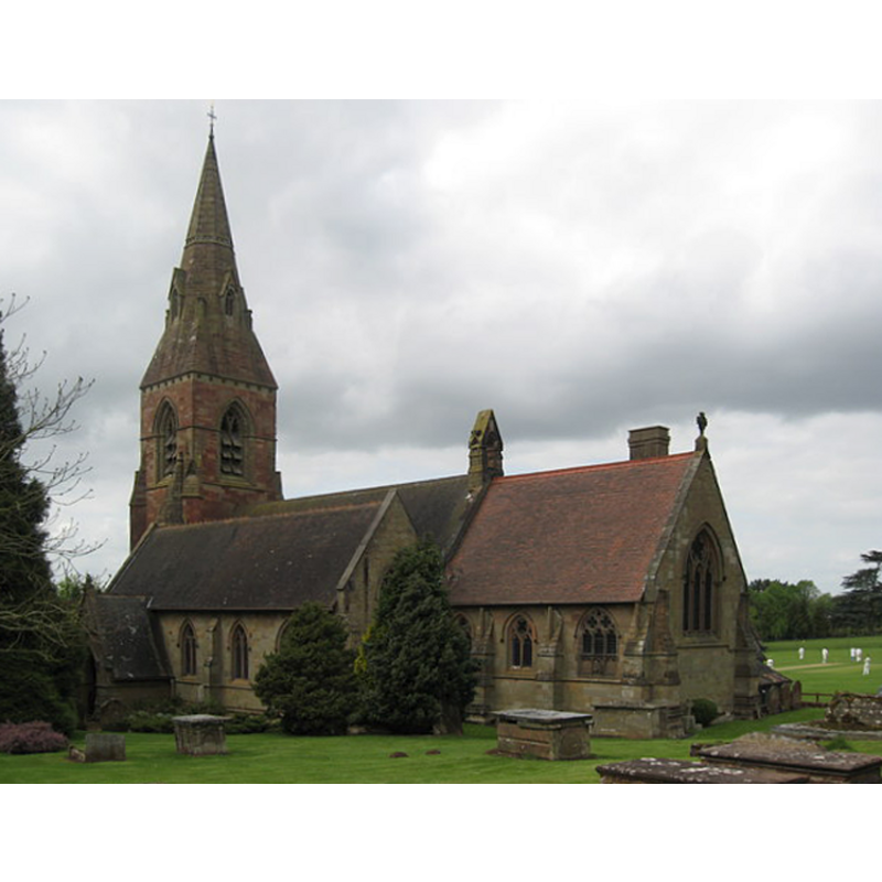
Image copyright © Richard Rogerson, 2009
CC-BY-SA-2.0
Results: 1 records
view of church exterior - southeast view
Copyright Statement: Image copyright © Richard Rogerson, 2009
Image Source: digital photograph taken 2 May 2009 by Richard Rogerson [www.geograph.org.uk/photo/1291066] [accessed 17 September 2014]
Copyright Instructions: CC-BY-SA-2.0
INFORMATION
Font ID: 16557HAG
Object Type: Baptismal Font1?
Font Century and Period/Style: 11th century (?), Norman
Church / Chapel Name: Parish Church of St. John the Baptist
Church Patron Saint(s): St. John the Baptist
Church Address: Hall Dr, Hagley, Worcestershire DY9 9LG
Site Location: Worcestershire, West Midlands, England, United Kingdom
Directions to Site: Located on the A456-A491 junction, SSE of Stourbridge
Ecclesiastic Region: Diocese of Worcester
Historical Region: Hundred of Clent
Additional Comments: disappeared font? (the one from the early church here)
Font Notes:
Click to view
There is an entry for Hagley [variant spelling] in the Domesday survey [http://domesdaymap.co.uk/place/SO9180/hagley/] [accessed 17 September 2014]; a priest is repported in the entry but there is no mention of a church in it. Noakes (1852) notes: "At the west end of the nave is a handsome font octagonal with lancet arches and trefoils and recesses on the faces." Miller (1890) report the church here "entirely rebuilt", the font not being among the retained remains of the old church. The Victoria County History (Worcester, vol. 3, 1913) notes: "From the fact that a priest is mentioned in the Domesday Survey at Hagley [...] it is probable that there was a church here in 1086. The first record of a presentation to the church occurs in 1286 [...] The church was almost completely rebuilt and considerably enlarged in 1860"; no font is mentioned in the VCH entry. Brooks & Pevsner (2007) note a font by G. E. Street, octagonal and panelled. English Heritage [Listing NGR: SO9207580769] (1967) reports an "Octagonal stone font with arcaded stem and cusped frieze around basin." [NB: this font must have been installed just prior to Noakes' visit, in the mid-19th century renovation of this church -- We have no information on the font of the medieval church]
COORDINATES
UTM: 30U 559962 5808639
Latitude & Longitude (Decimal): 52.424677, -2.118189
Latitude & Longitude (DMS): 52° 25′ 28.84″ N, 2° 7′ 5.48″ W
LID INFORMATION
Material: wood, oak
Notes: pyramidal cover with crocketed arrises
REFERENCES
- Victoria County History [online], University of London, 1993-. URL: https://www.british-history.ac.uk.
- Brooks, Alan, Worcestershire, New Haven; London: Yale University Press, 2007, p. 334
- Miller, George [Revd.], The Parishes of the Diocese of Worcester, Birmingham: Hall & English, 1890, vol. 2: 155
- Noake, John, The rambler in Worcestershire, or, Stray notes on churches and congregations, Worcester: Published and sold by all booksellers, 1848, p. 206