Martley No. 1 / Mardelega / Marklegh / Martele / Martelei / Mercelei / Merlea / Merlega / Merlei / Merlie / Mertelai / Mertelega / Mertelu
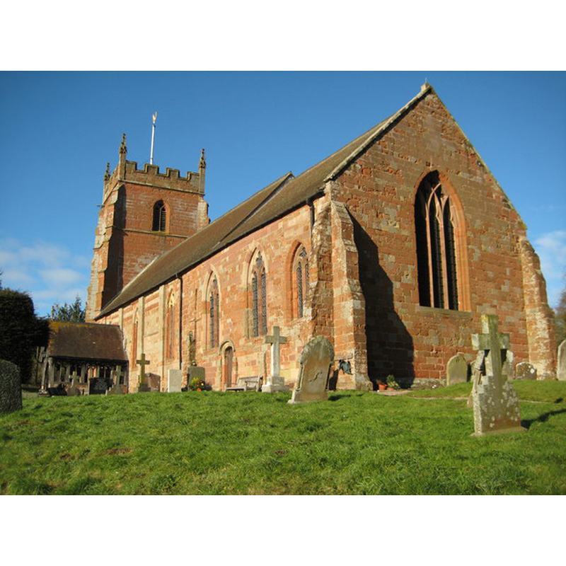
Image copyright © Philip Halling, 2010
CC-BY-SA-2.0
Results: 2 records
view of church exterior - southeast view
Scene Description: Source caption: "Martley church is dedicated to St Peter, here it is viewed from the south-east. The church dates from the 12th century and the perpendicular tower dates from the 15th century."
Copyright Statement: Image copyright © Philip Halling, 2010
Image Source: digital photograph taken 30 January 2010 by Philip Halling [www.geograph.org.uk/photo/1685445] [accessed 27 October 2014]
Copyright Instructions: CC-BY-SA-2.0
view of church exterior in context
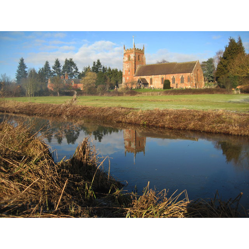
Copyright Statement: Image copyright © Philip Halling, 2010
Image Source: digital photograph taken 30 January 2010 by Philip Halling [www.geograph.org.uk/photo/1685437] [accessed 27 October 2014]
Copyright Instructions: CC-BY-SA-2.0
INFORMATION
Font ID: 16555MAR
Object Type: Baptismal Font1?
Font Century and Period/Style: 11th century, Pre-Conquest? / Norman
Church / Chapel Name: Parish Church of St. Peter
Church Patron Saint(s): St. Peter
Church Address: Martley, Worcestershire, WR6 6QA
Site Location: Worcestershire, West Midlands, England, United Kingdom
Directions to Site: Located 15 km NW of Worcester
Ecclesiastic Region: Diocese of Worcester
Historical Region: Hundred of Doddingtree
Additional Comments: disappeared font? (the one from the Domesday-time church here)
Font Notes:
Click to view
There are four entries for Martley [variant spelling] in the Domesday survey [http://domesdaymap.co.uk/place/SO7559/martley/] [accessed 24 October 2014], one of which reports a church in it. Noake (1848) reports of his visit to this church: "I saw no font; there is a wooden pedestal in front of the clerk's desk, and I suppose they make this available to put a basin on." Miller (1890) writes: "There is a fine Norman doorway to the nave, near to which is the stoop [i.e., stoup] [...] The font is modern." The Victoria County History (Worcester, vol. 4, 1924) notes: "The tithes of Martley apparently belonged originally to the church of St. Helen, Worcester, [...] but in the Domesday Survey it is stated that the church [...] of Martley with the land appurtenant, and with its tithe and two villeins, with 2 virgates of land, were given by William Fitz Osbern Earl of Hereford to St. Mary of Cormeilles [...] The [present] church dates from the early years of the 12th century, and the walls of the nave are of that period", but the VCH adds that the font and pulpit are modern, from the 1870s restoration; the VCH shows an interior plan with the [modern?] font at the west end of the nave. Brooks & Pevsner (2007) report an octagonal font of 1875. [NB: we have no information on the medieval font]
COORDINATES
UTM: 30U 543833 5787415
Latitude & Longitude (Decimal): 52.235399, -2.358124
Latitude & Longitude (DMS): 52° 14′ 7.43″ N, 2° 21′ 29.24″ W
REFERENCES
- Victoria County History [online], University of London, 1993-. URL: https://www.british-history.ac.uk.
- Brooks, Alan, Worcestershire, New Haven; London: Yale University Press, 2007, p. 490
- Miller, George [Revd.], The Parishes of the Diocese of Worcester, Birmingham: Hall & English, 1890, vol. 2: 29
- Noake, John, The rambler in Worcestershire, or, Stray notes on churches and congregations, Worcester: Published and sold by all booksellers, 1848, p. 147